Atlas
The maps of the wars
Theatres, campaigns and battlefields: the volumes' own atlas, then the maps and battle plans of the four compendia. Select a map to see it whole.
Reconstructions The empire whole
Modern maps drawn for this project from published references; borders, sites and routes are approximate.
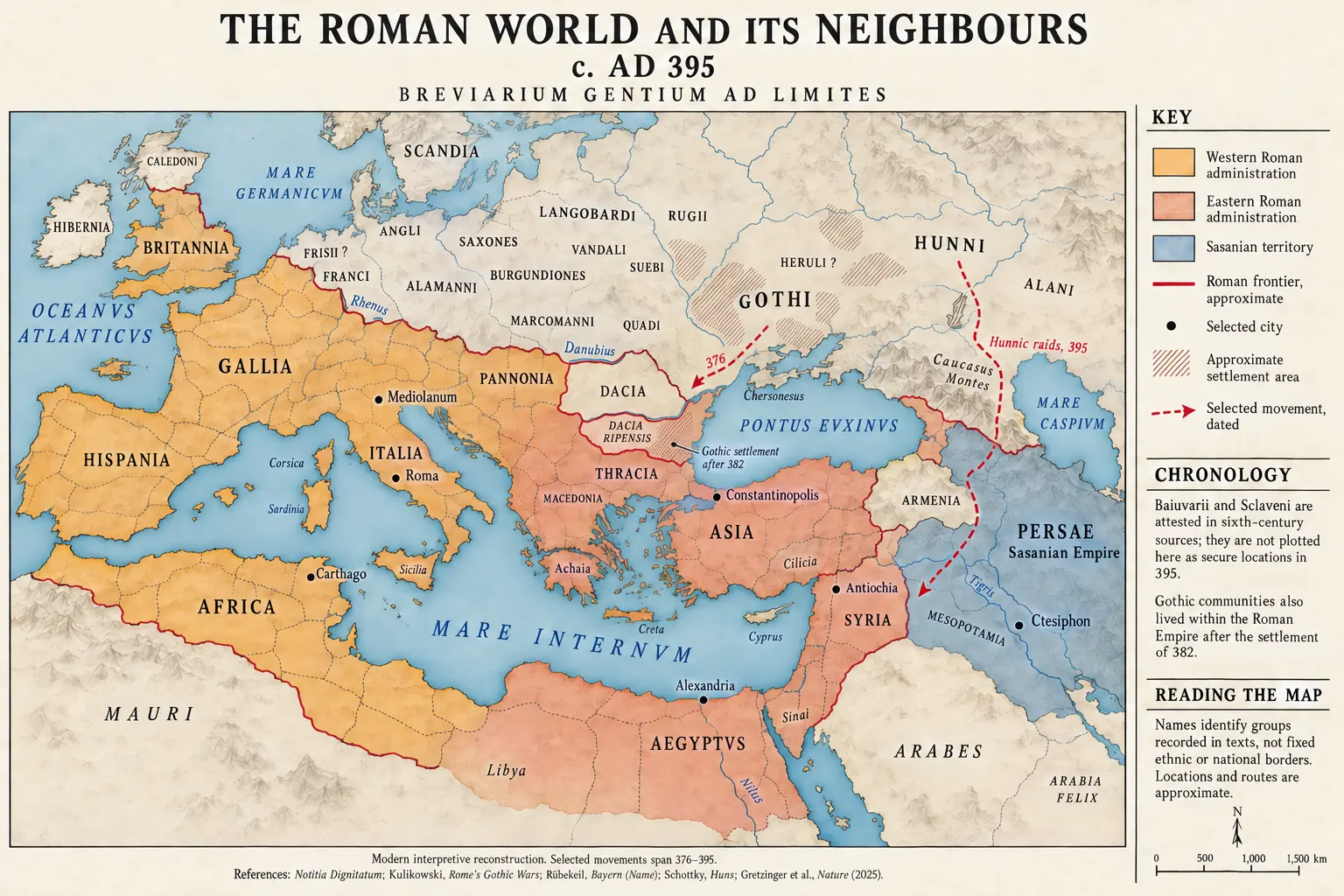 The Roman World and Its Neighbours, c. AD 395 In Book VIII · Proem
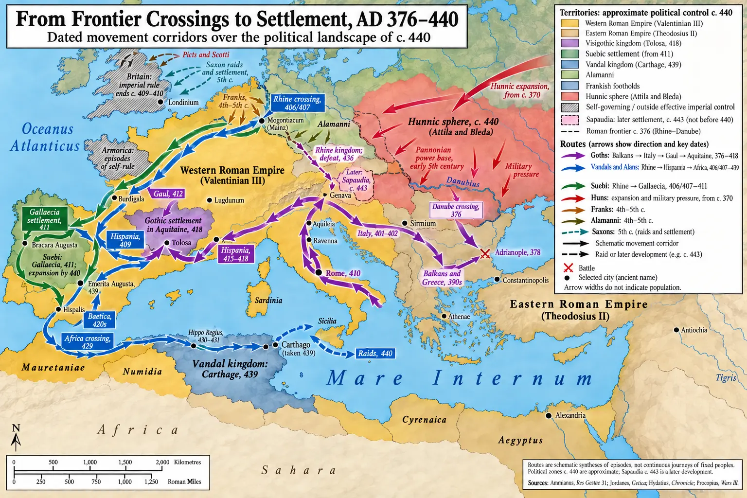 From Frontier Crossings to Settlement, AD 376–440 In Book VIII · Chapter 4: Stilicho, the Rhine Crossing, and the Sack of Rome
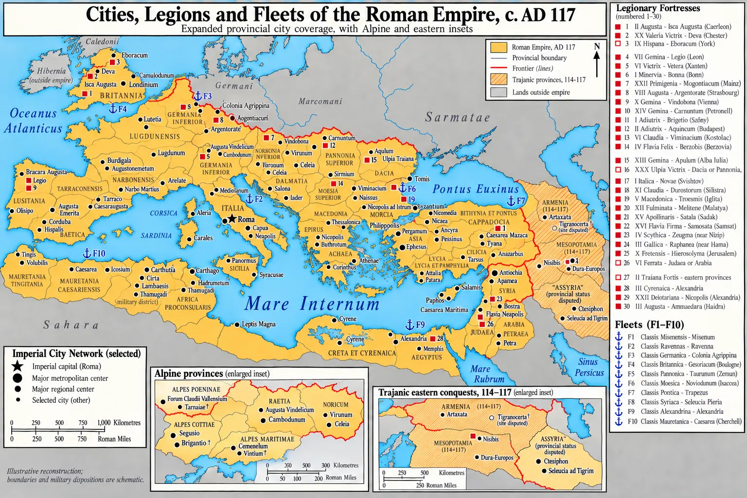 Cities, Legions and Fleets of the Roman Empire, c. AD 117 In Book VII · Proem
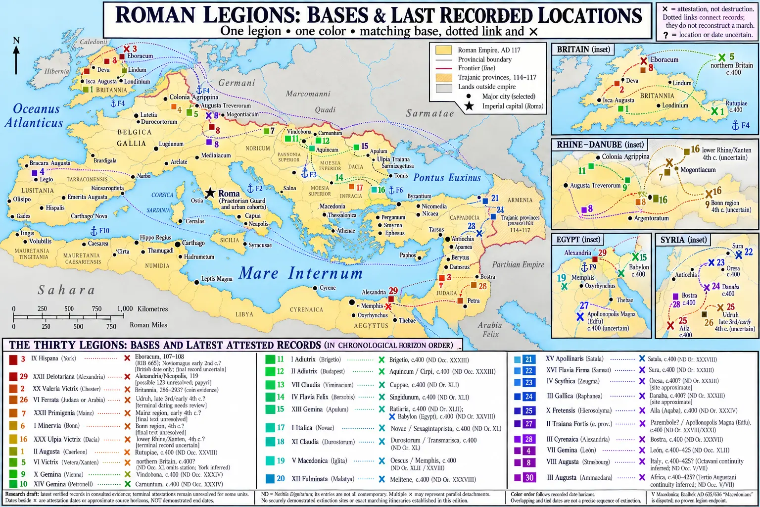 The Thirty Legions: Bases and Last Recorded Locations In Book VI · Epilogue: The World-State at 96
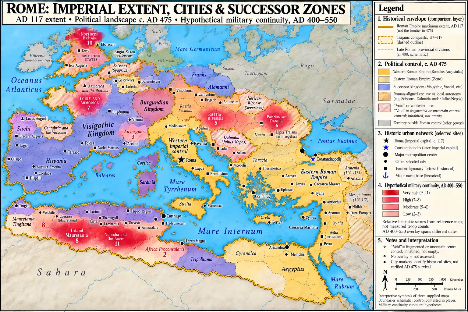 Rome: Imperial Extent, Cities and Successor Zones In Book VIII · Epilogue: The Audit of the Eight Hundred Years
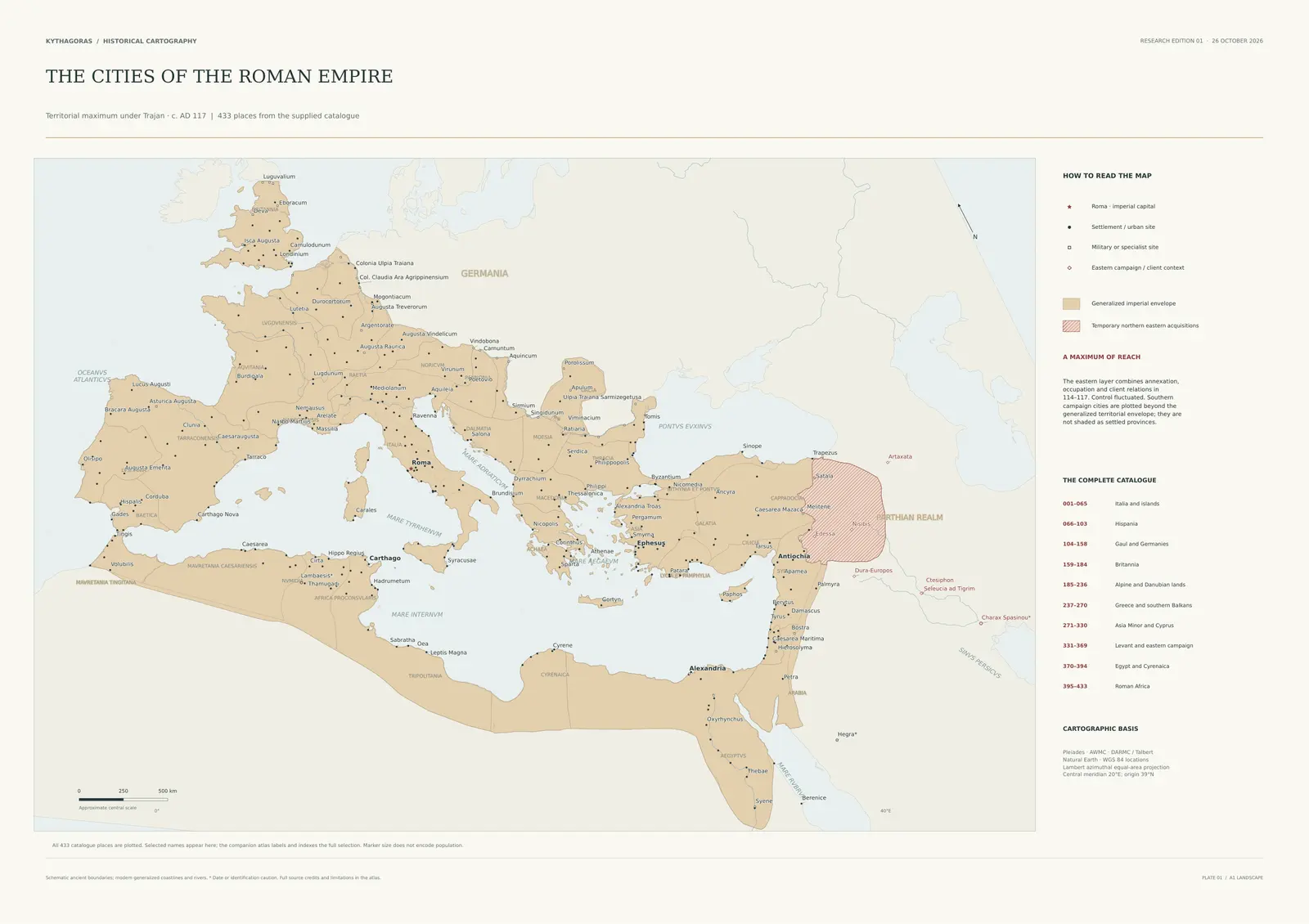 The Cities of the Roman Empire, c. AD 117 In Book VII · Chapter 4: The Antonine Noon and Its Wars
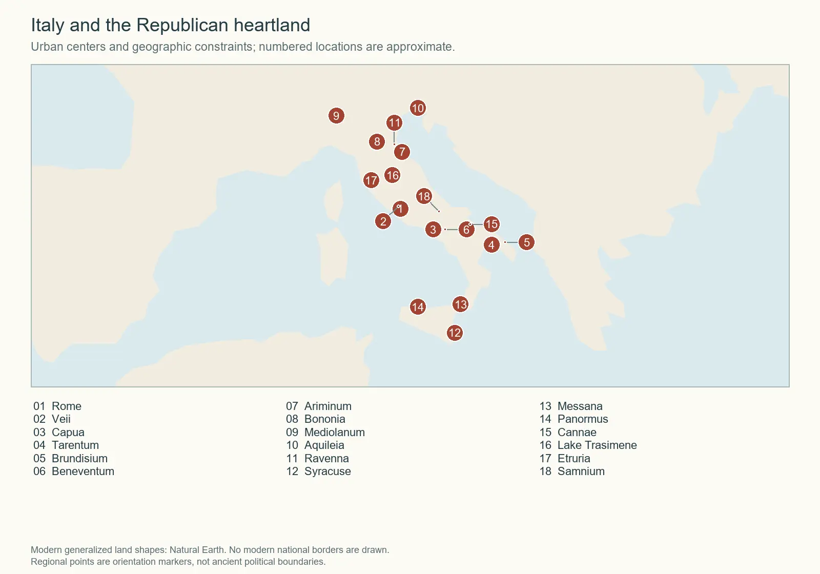 Italy and the Republican Heartland In Book I · Chapter 6: The Consolidation of Italy
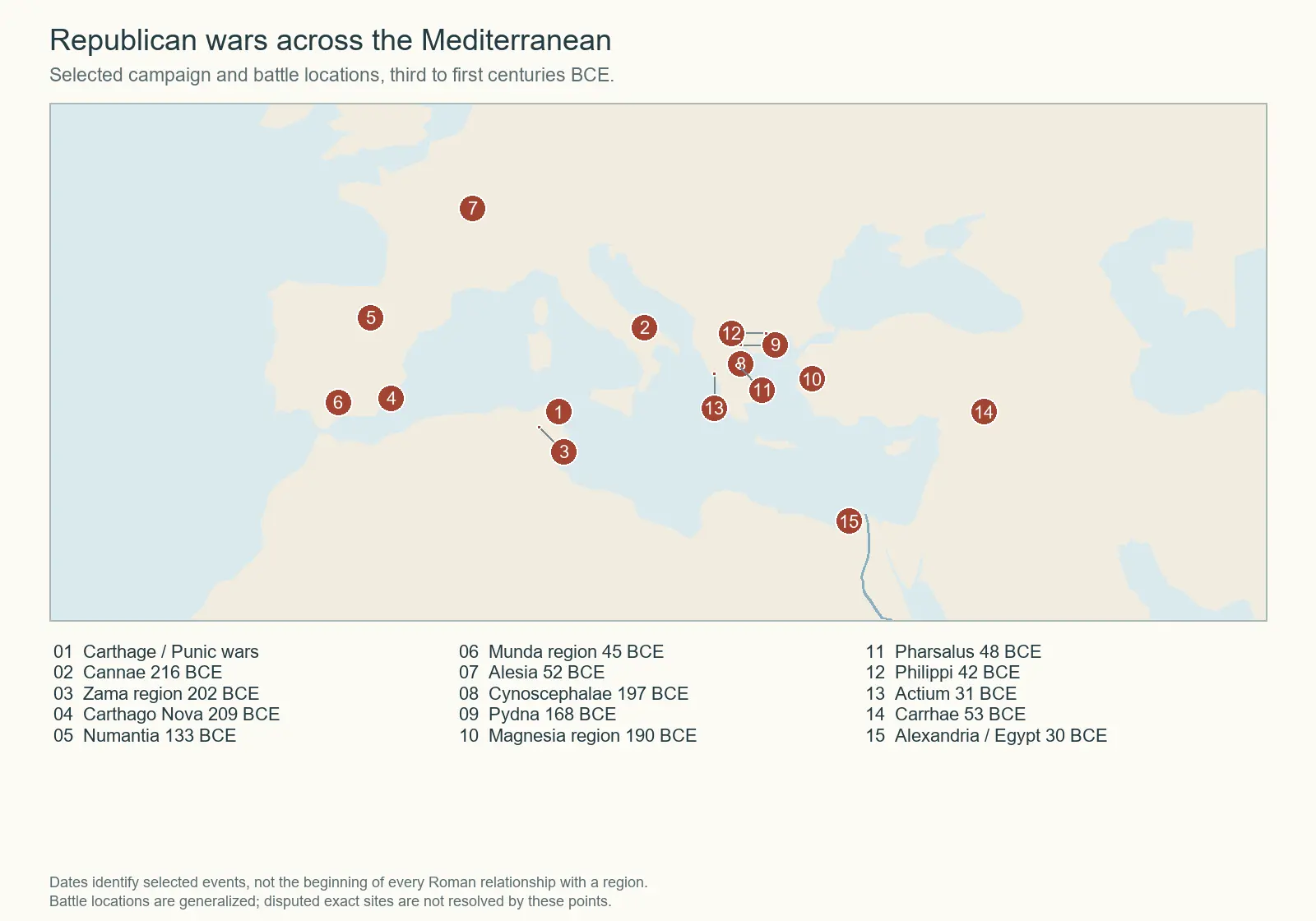 Republican Wars across the Mediterranean In Book IV · Proem
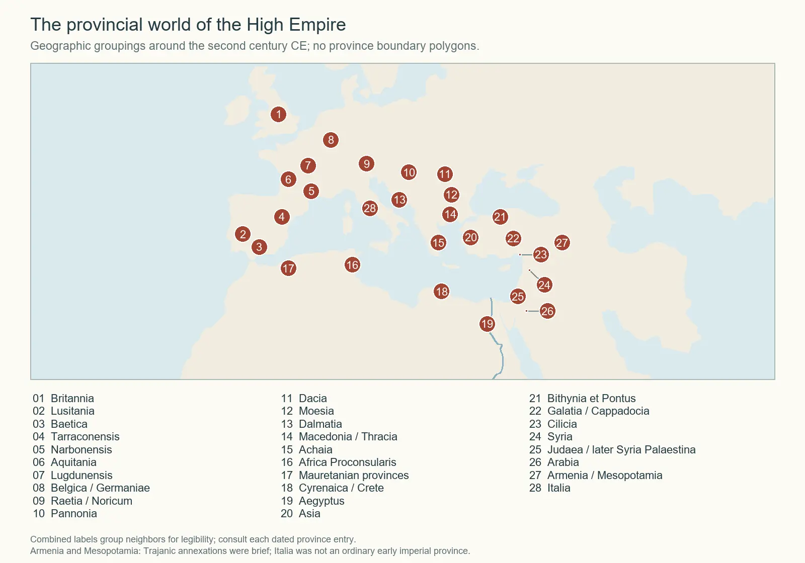 The Provincial World of the High Empire In Book VII · Epilogue: The World-State at 284
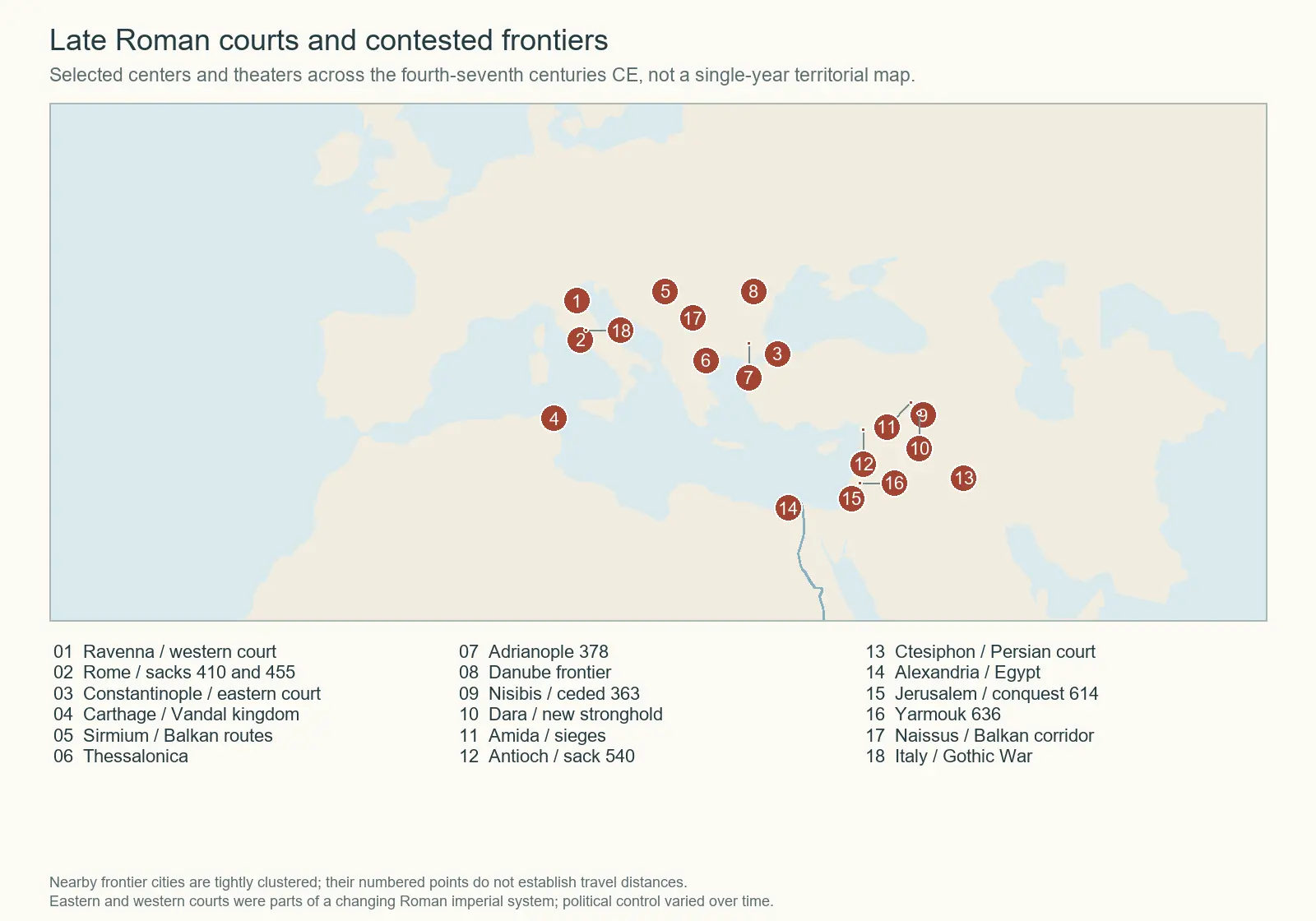 Late Roman Courts and Contested Frontiers In Book VIII · Chapter 6: The Dissolution
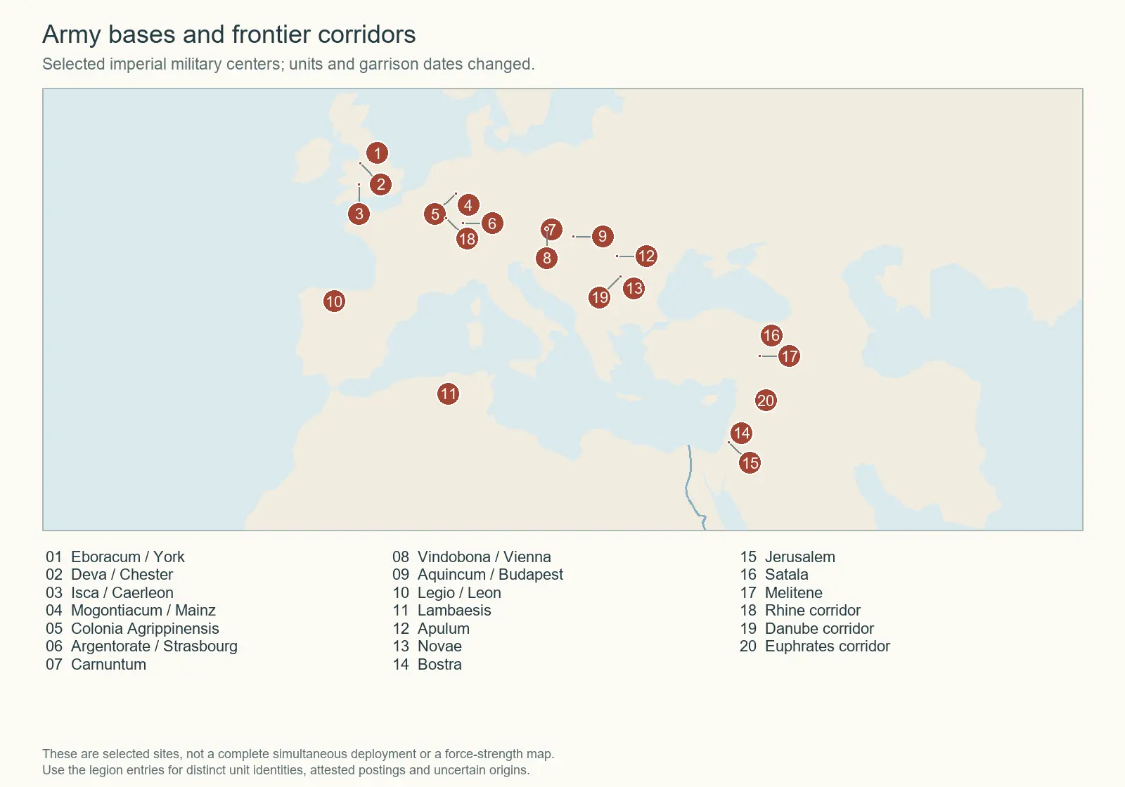 Army Bases and Frontier Corridors In Book VI · Chapter 8: The Flavian Consolidation and the Wars of Domitian
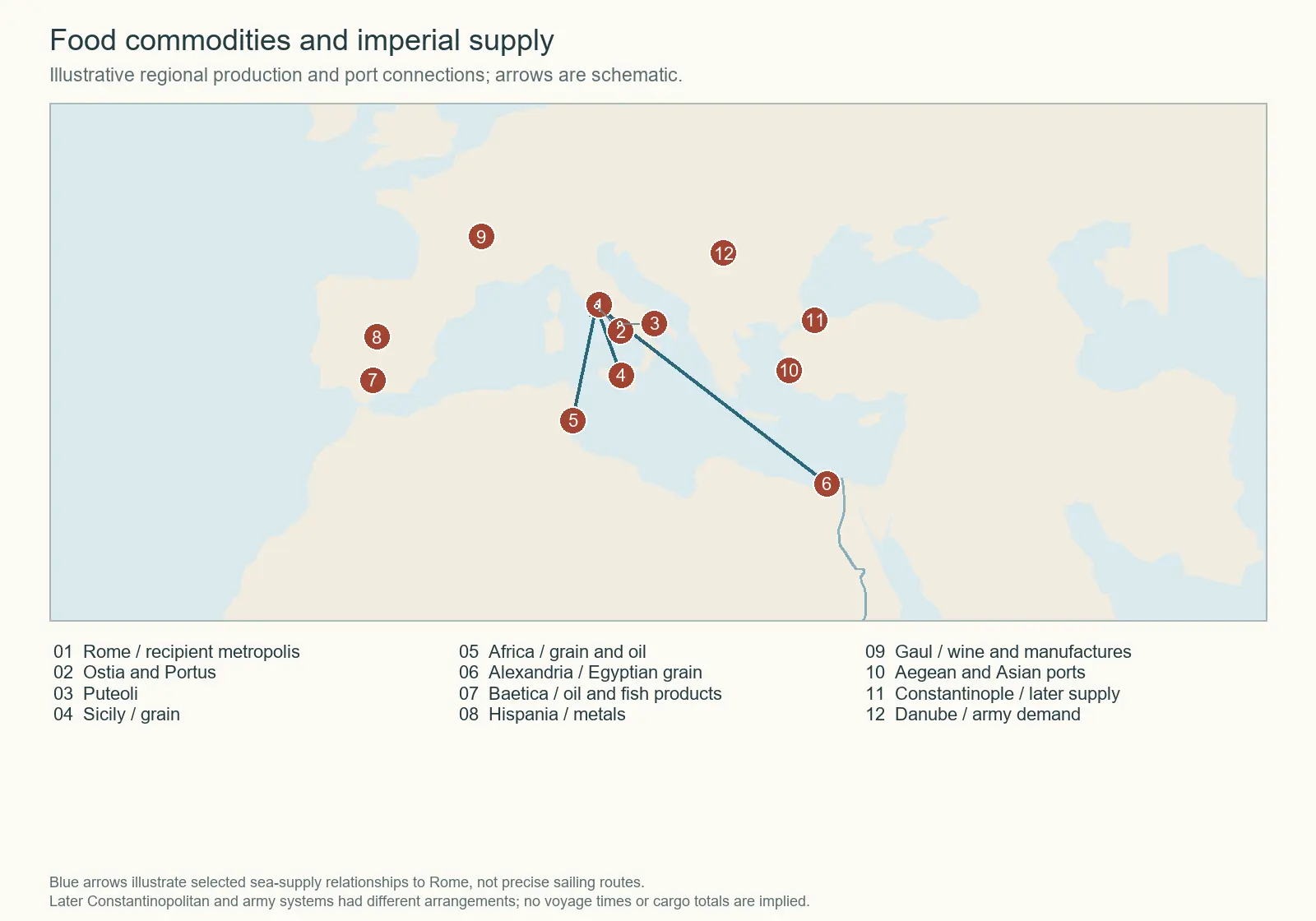 Food Commodities and Imperial Supply In Book VIII · Chapter 5: Aetius, Africa, and Attila
Book I The Republic in Italy
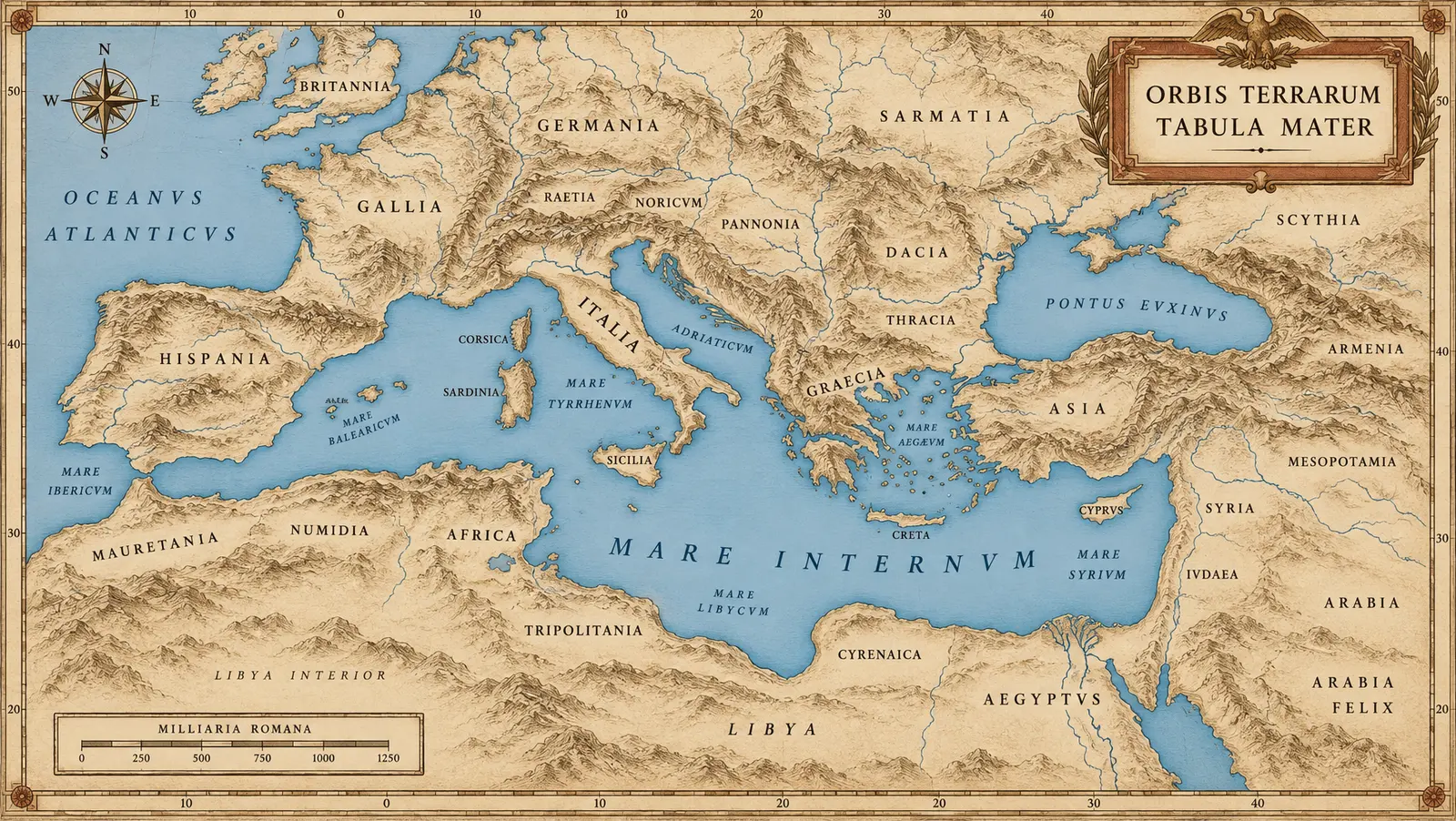 SER-C01 MARE INTERNUM — The Master Reference
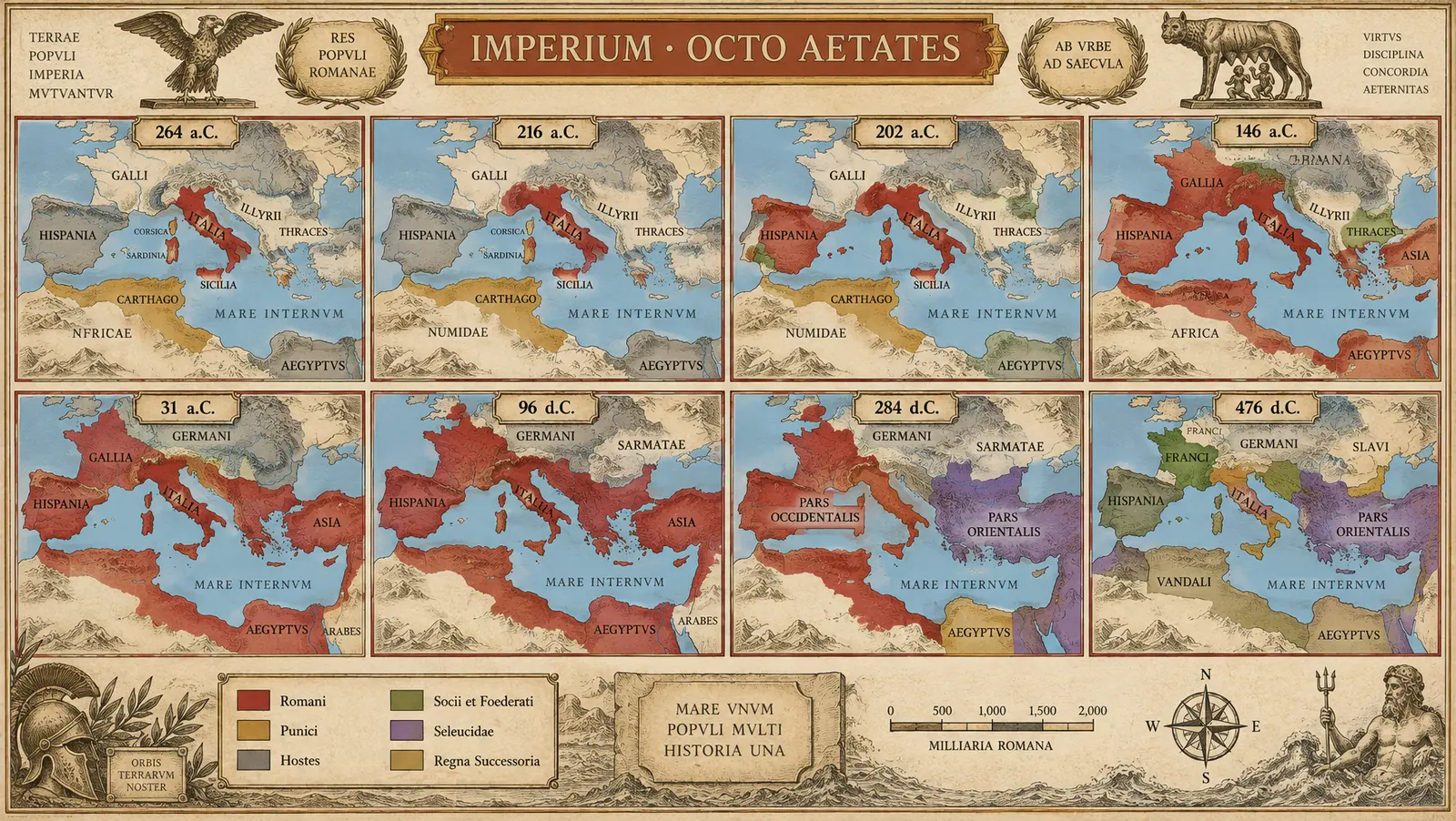 SER-C02 THE GROWTH SEQUENCE
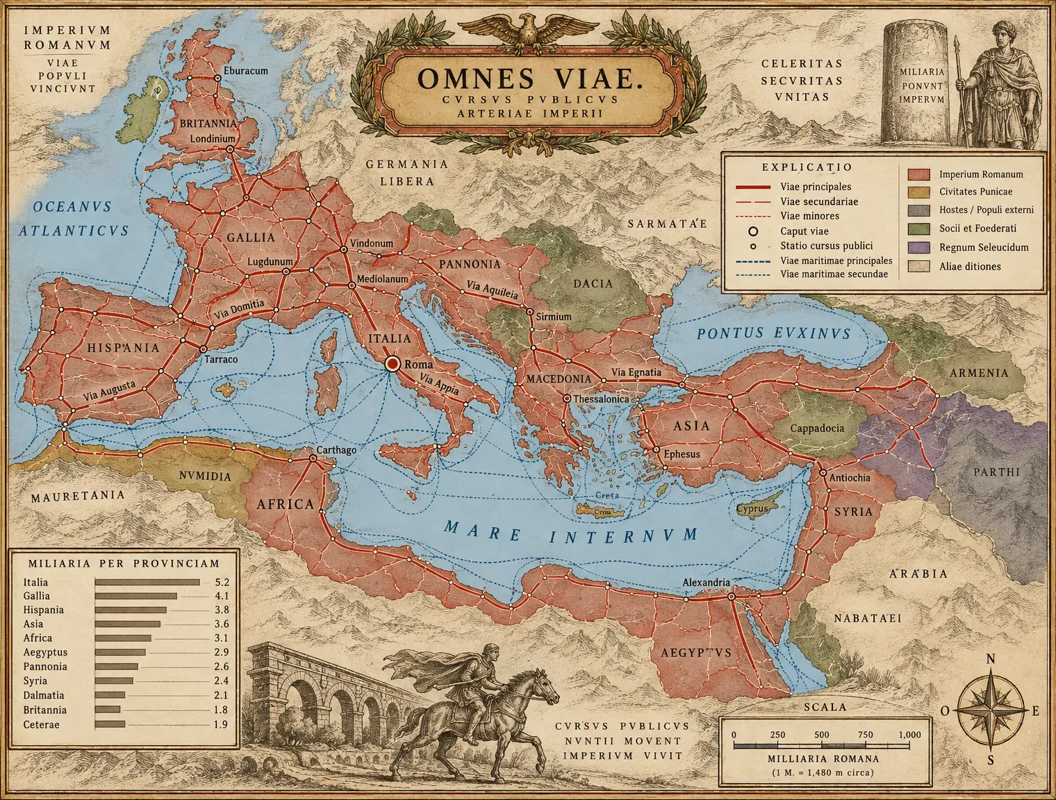 SER-C03 VIAE IMPERII
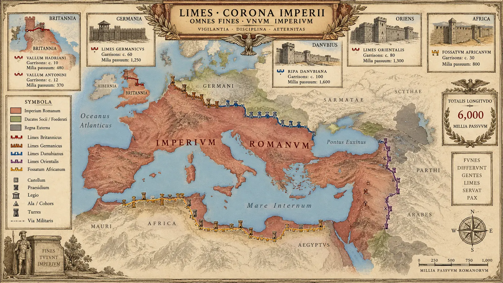 SER-C04 THE FRONTIER ATLAS
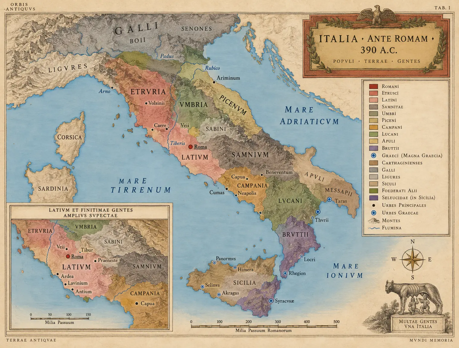 I-C01 ITALIA 390 — The Peoples' Map
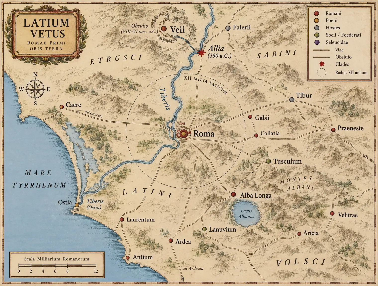 I-C02 LATIUM AND THE ALLIA — The Early War-Country
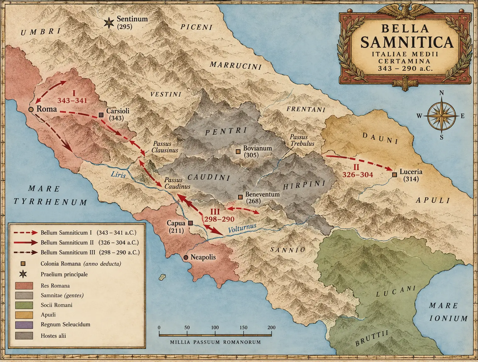 I-C03 THE SAMNITE WARS THEATER
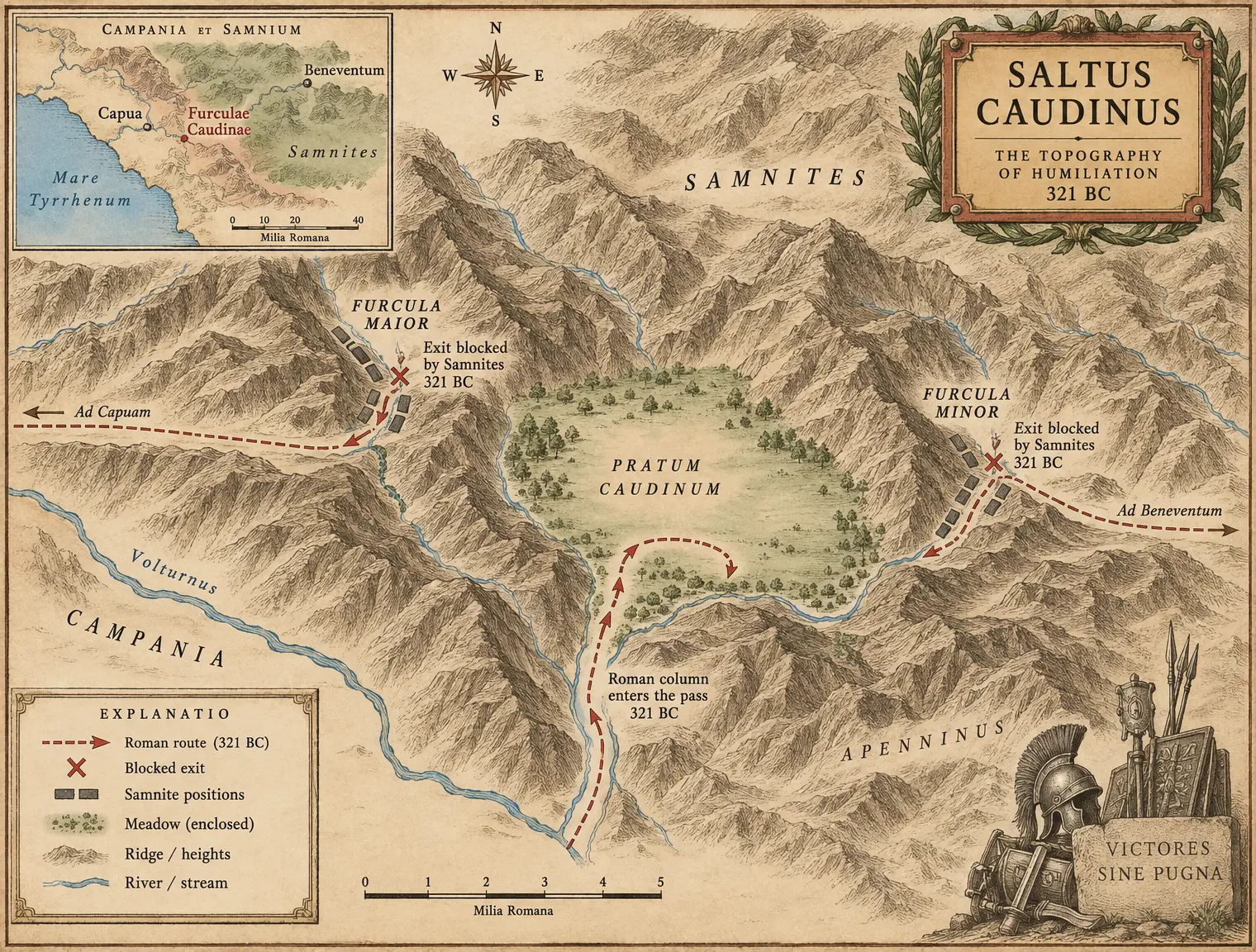 I-C04 FURCULAE CAUDINAE — The Pass
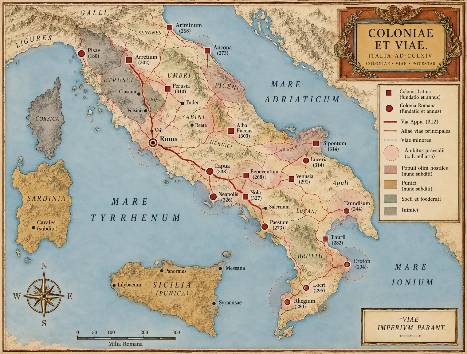 I-C05 THE LATTICE — Colonies and Roads to 264
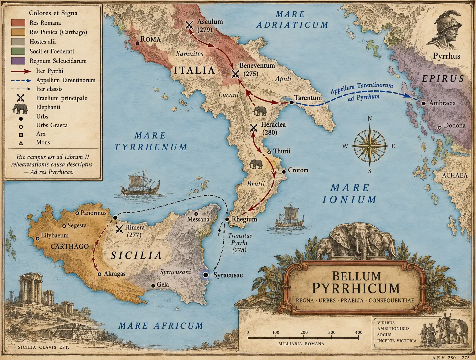 I-C06 THE PYRRHIC THEATER
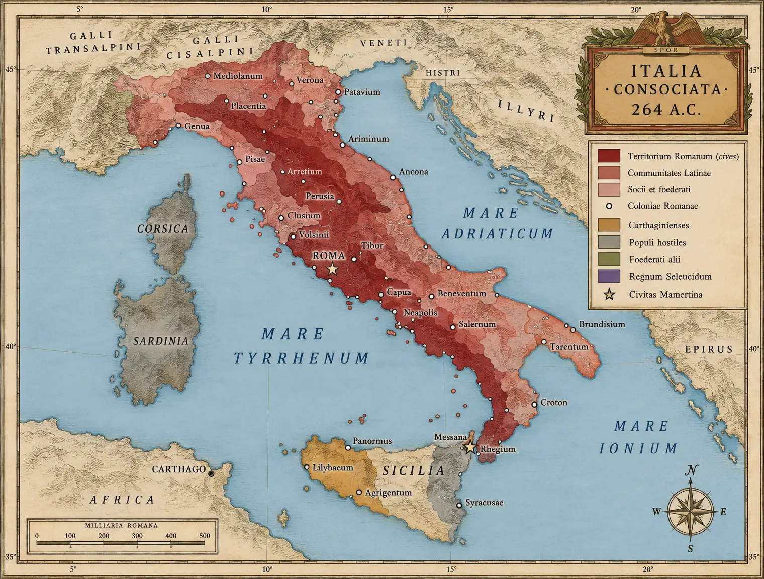 I-C07 ITALIA 264 — The Confederation
Book II The Mediterranean Wars
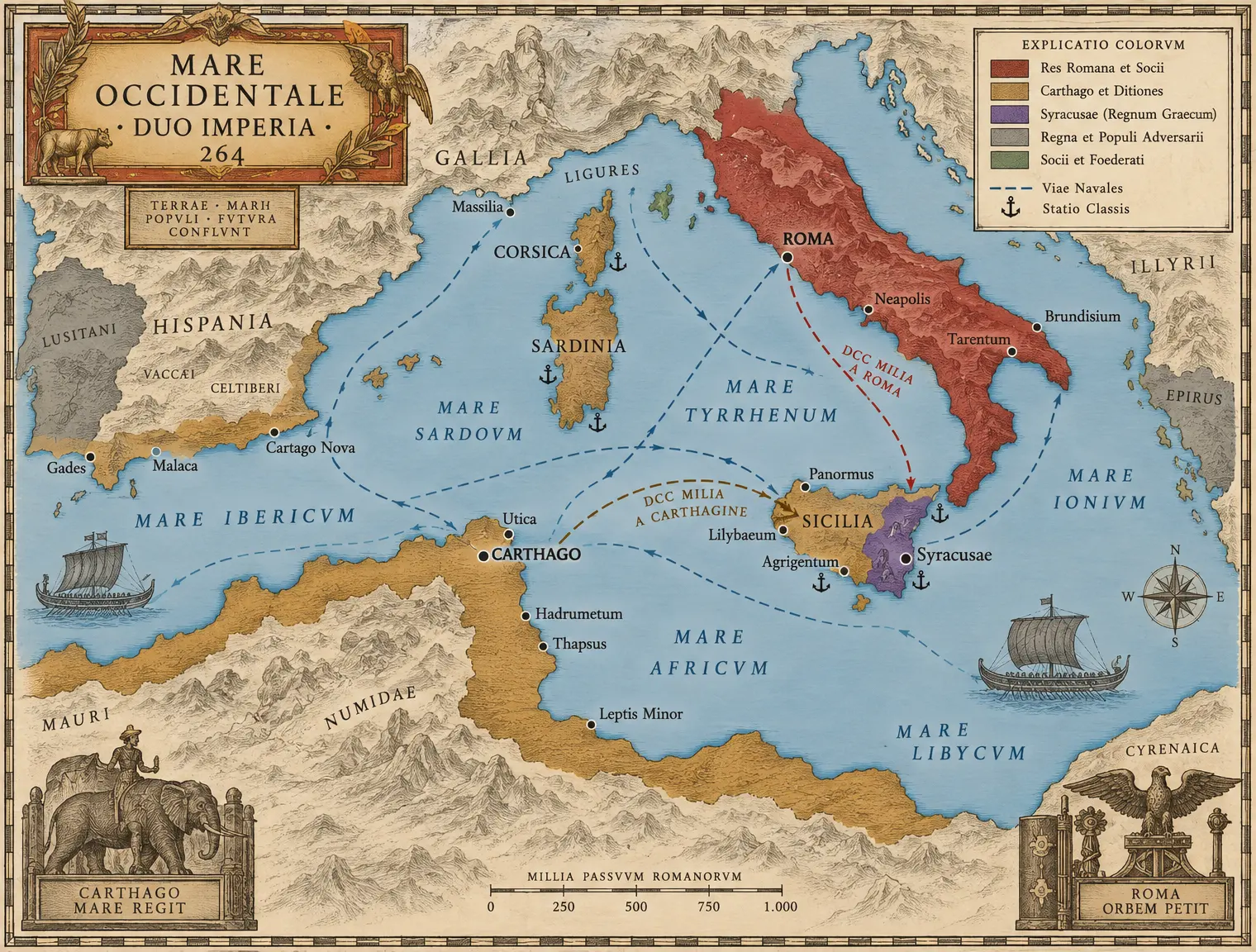 II-C01 THE WESTERN MEDITERRANEAN 264
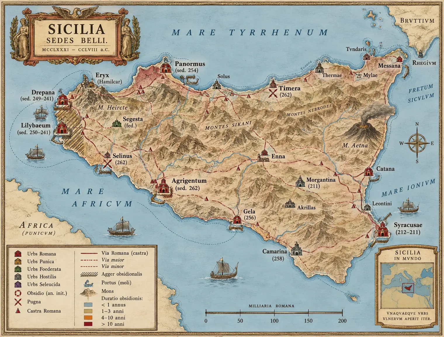 II-C02 SICILIA — The Island War
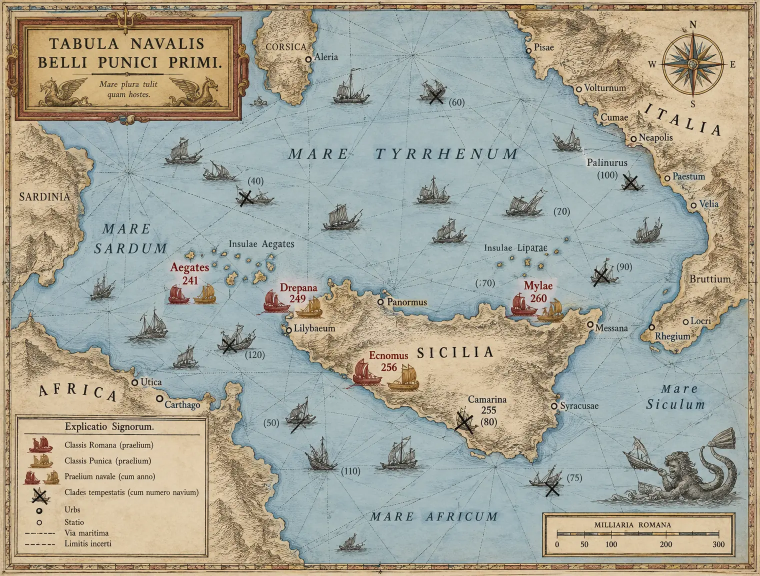 II-C03 THE NAVAL CHART
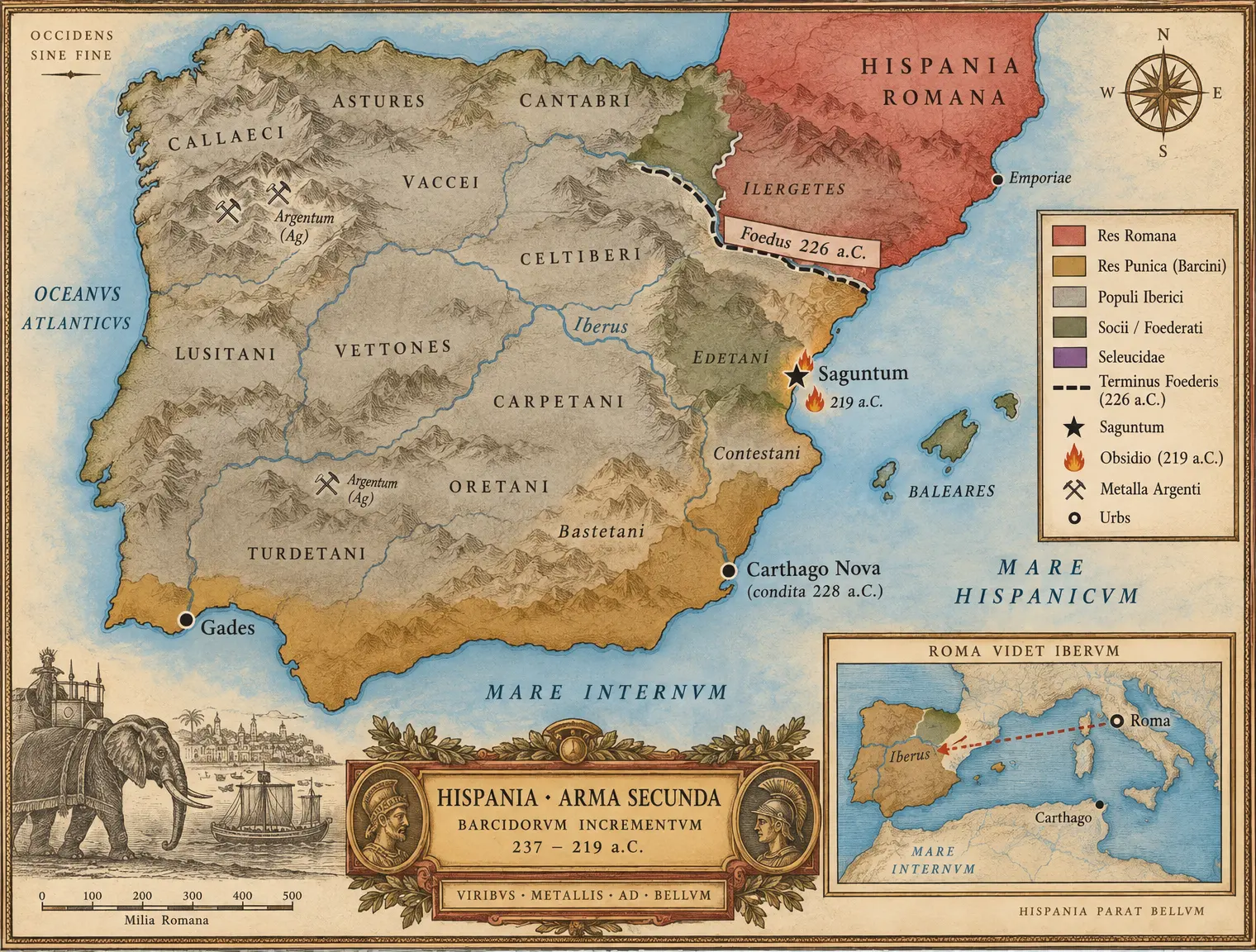 II-C04 HISPANIA BARCINA
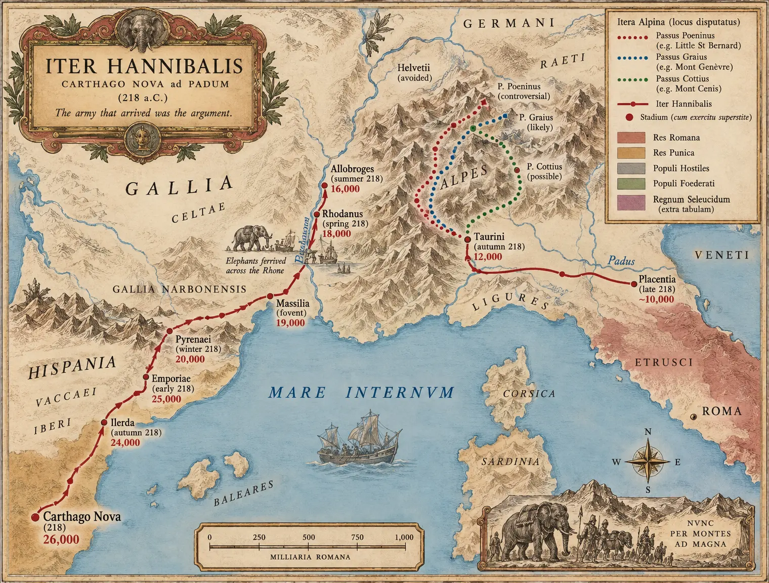 II-C05 THE MARCH
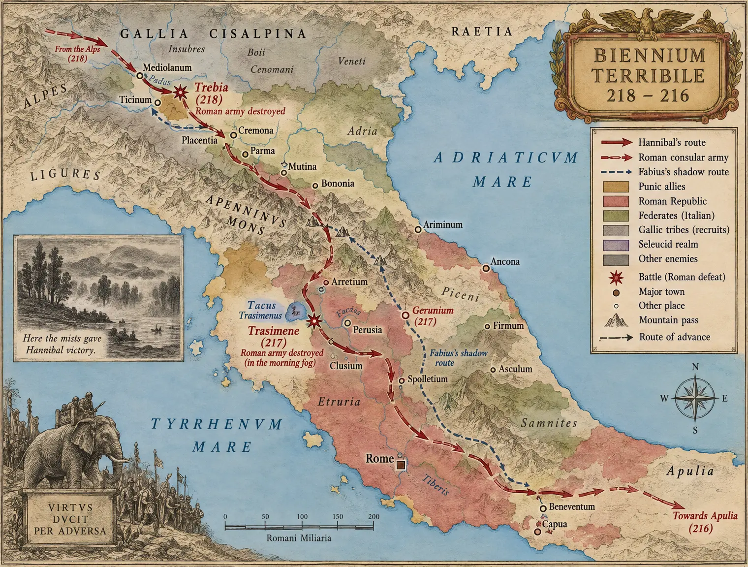 II-C06 THE WAR-COUNTRY 218–216
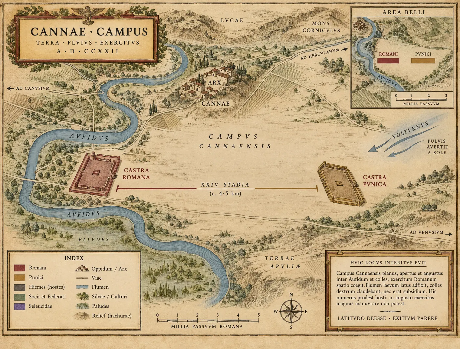 II-C07 CANNAE — The Ground
Book III The Long War
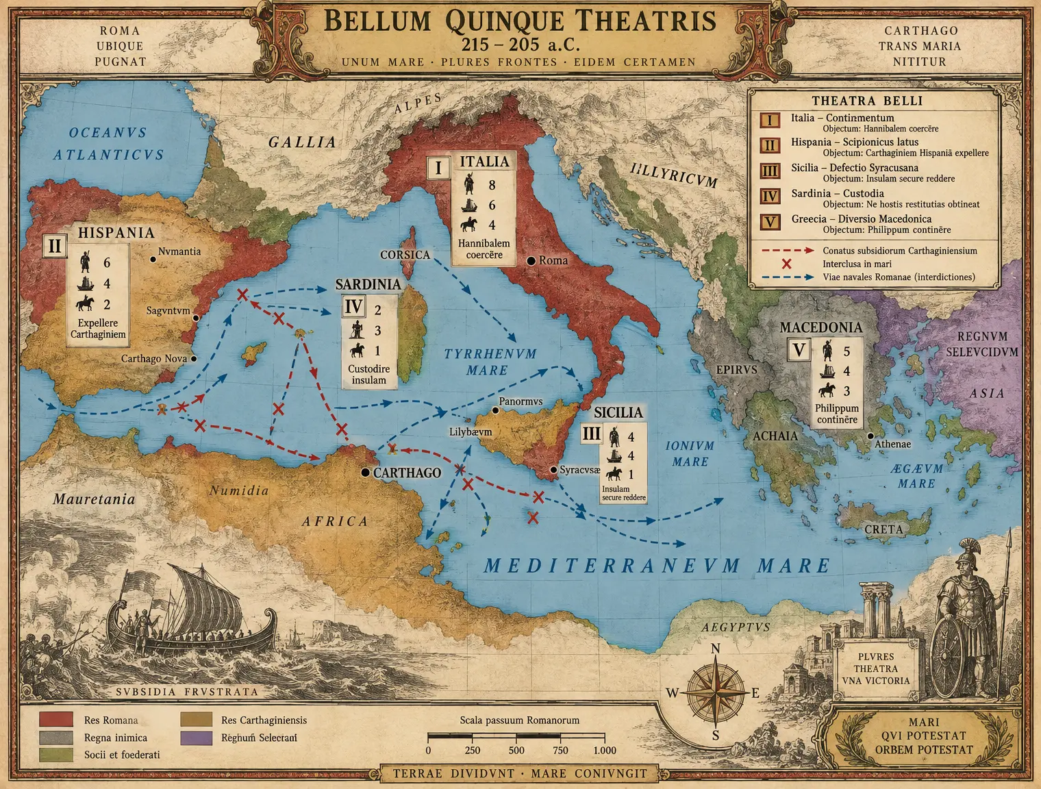 III-C01 THE FIVE-THEATER WAR
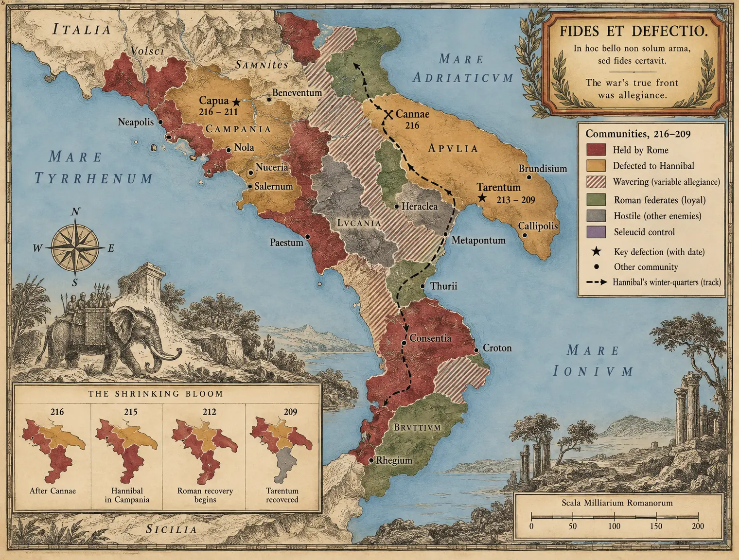 III-C02 THE DEFECTION MAP
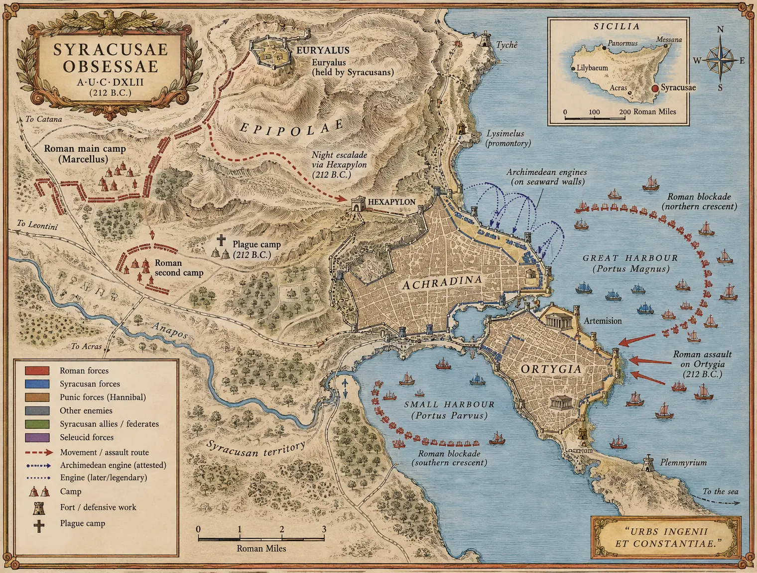 III-C03 SYRACUSAE — The Siege Plan
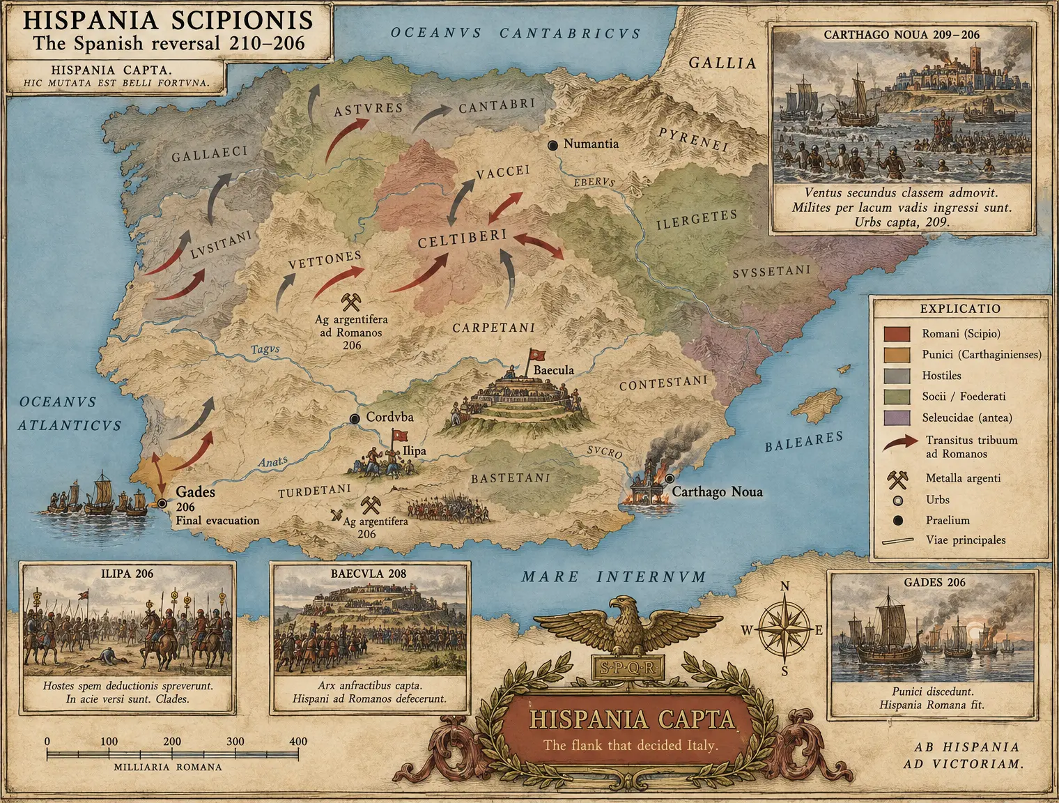 III-C04 HISPANIA SCIPIONIS
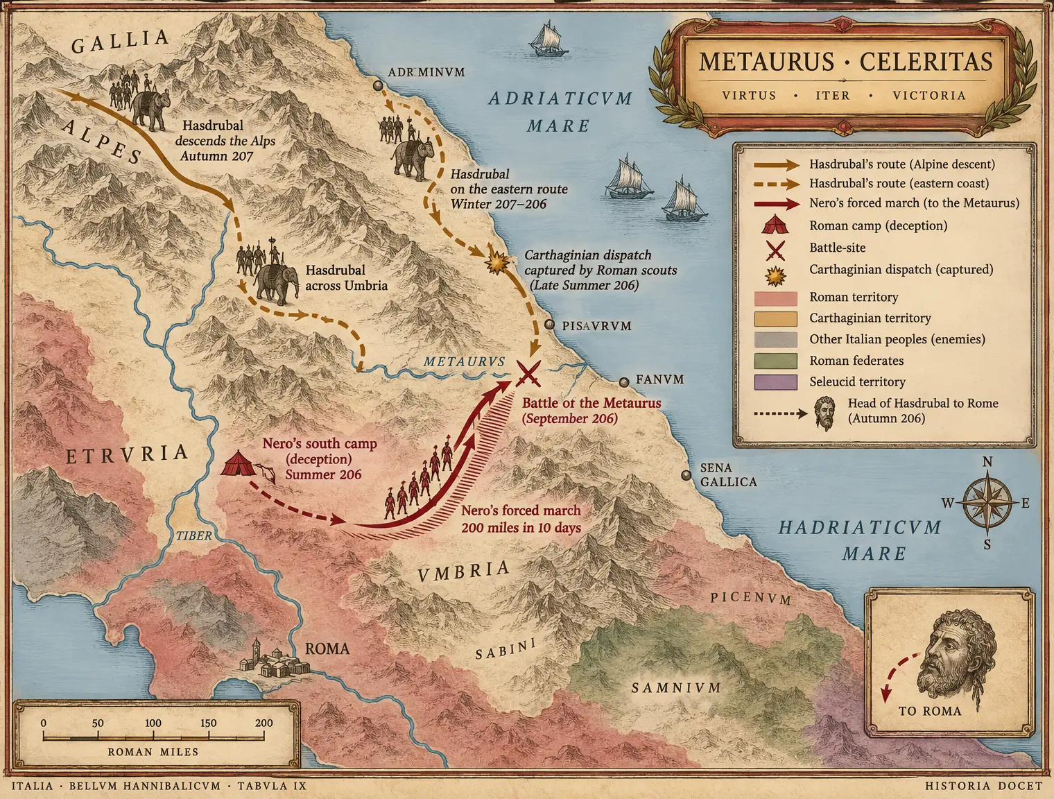 III-C05 THE METAURUS INTERCEPTION
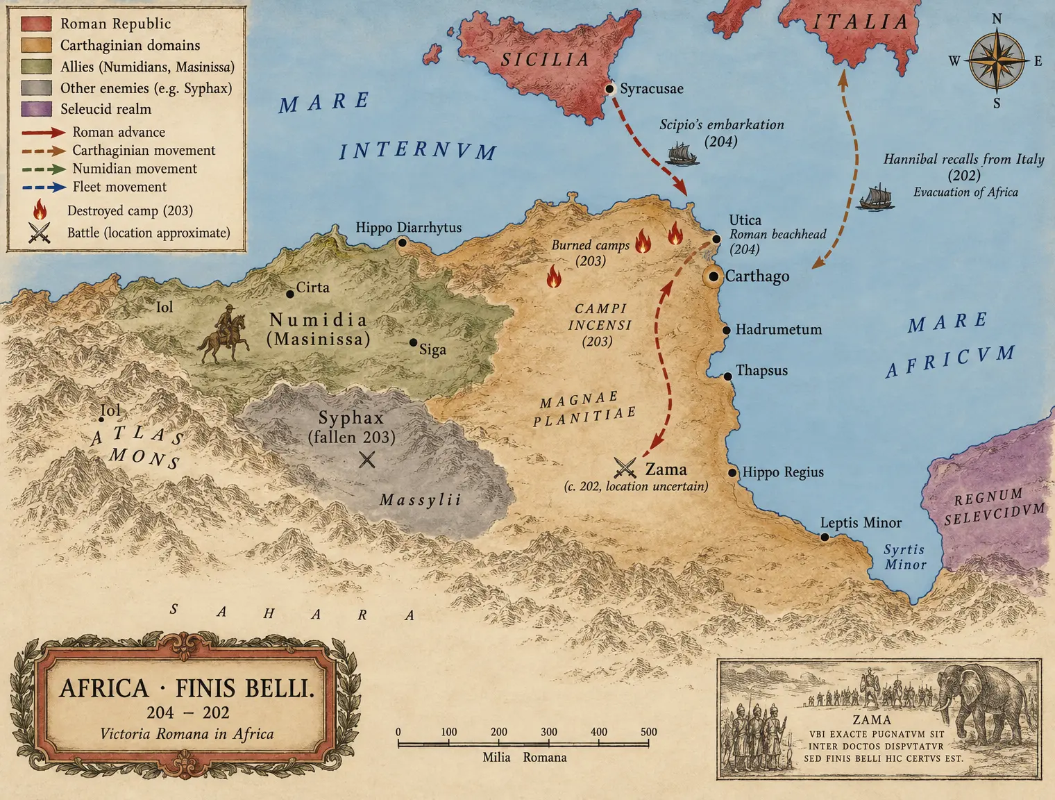 III-C06 AFRICA 204–202
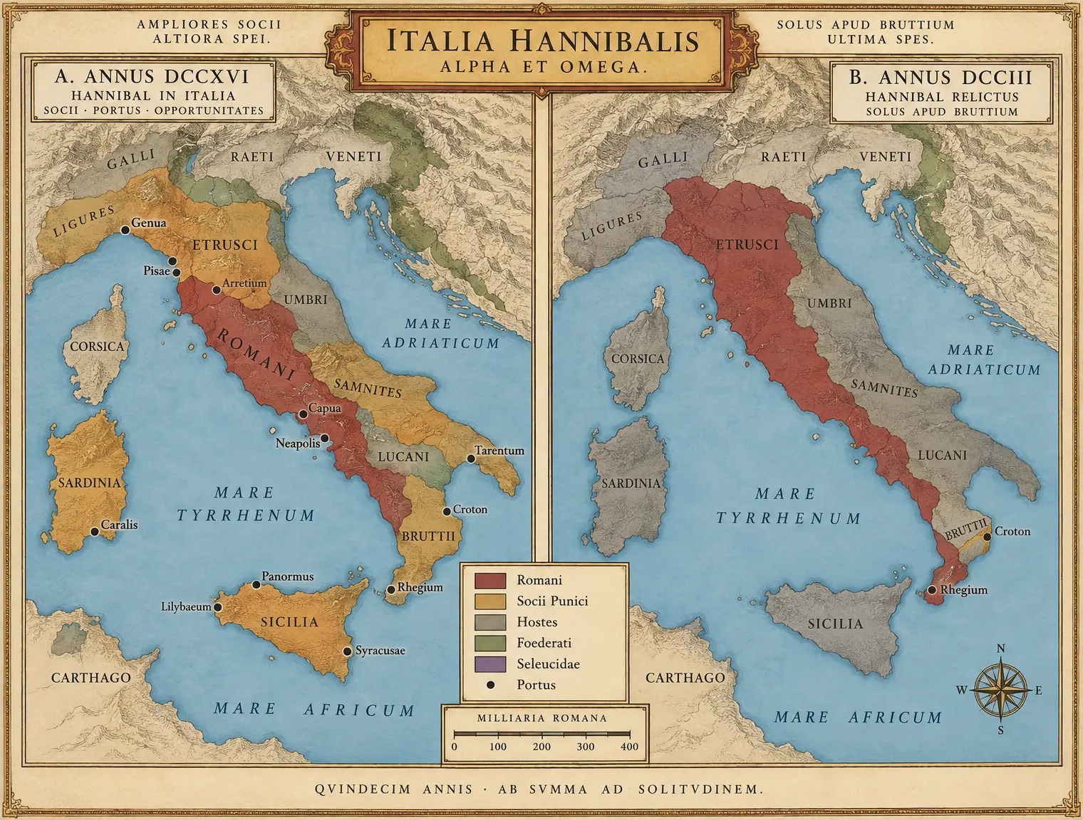 III-C07 THE SHRINKING MAP
Book IV The Wars of Mediterranean Hegemony
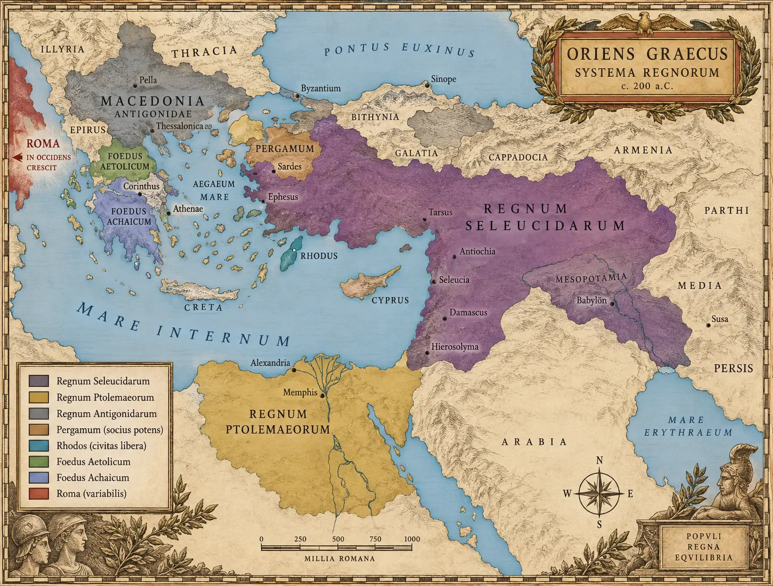 IV-C01 THE HELLENISTIC EAST 200
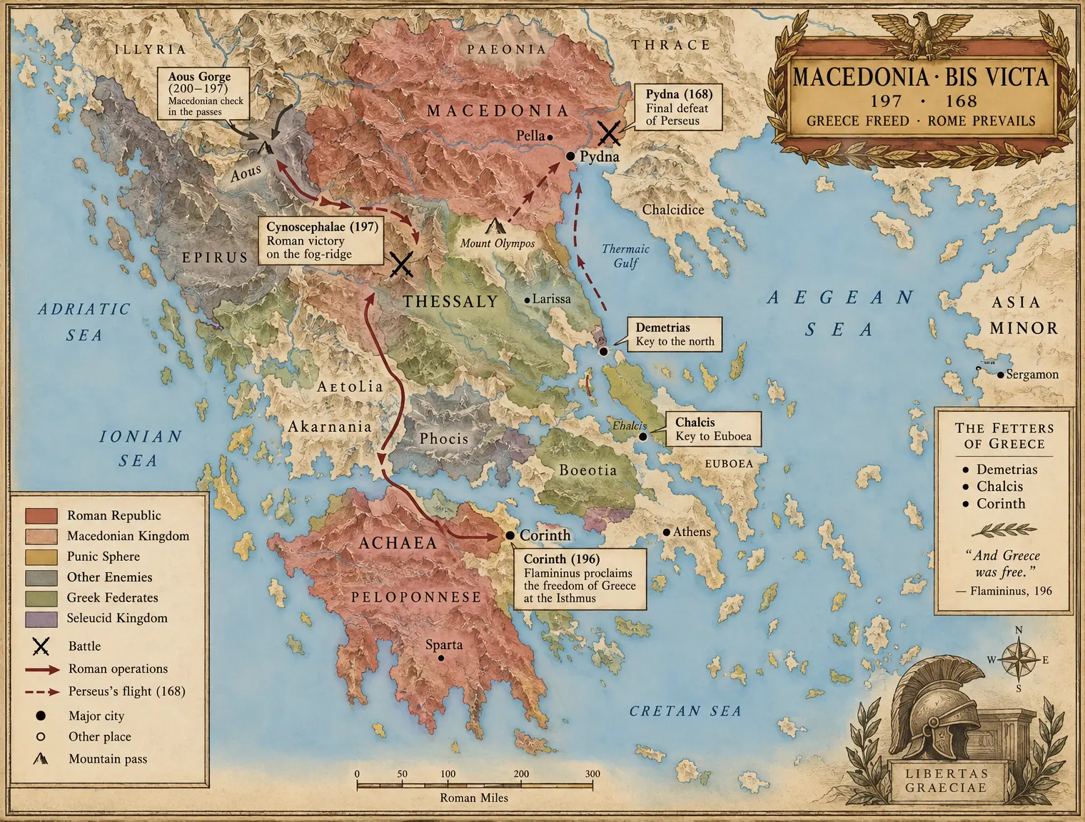 IV-C02 THE MACEDONIAN WARS THEATER
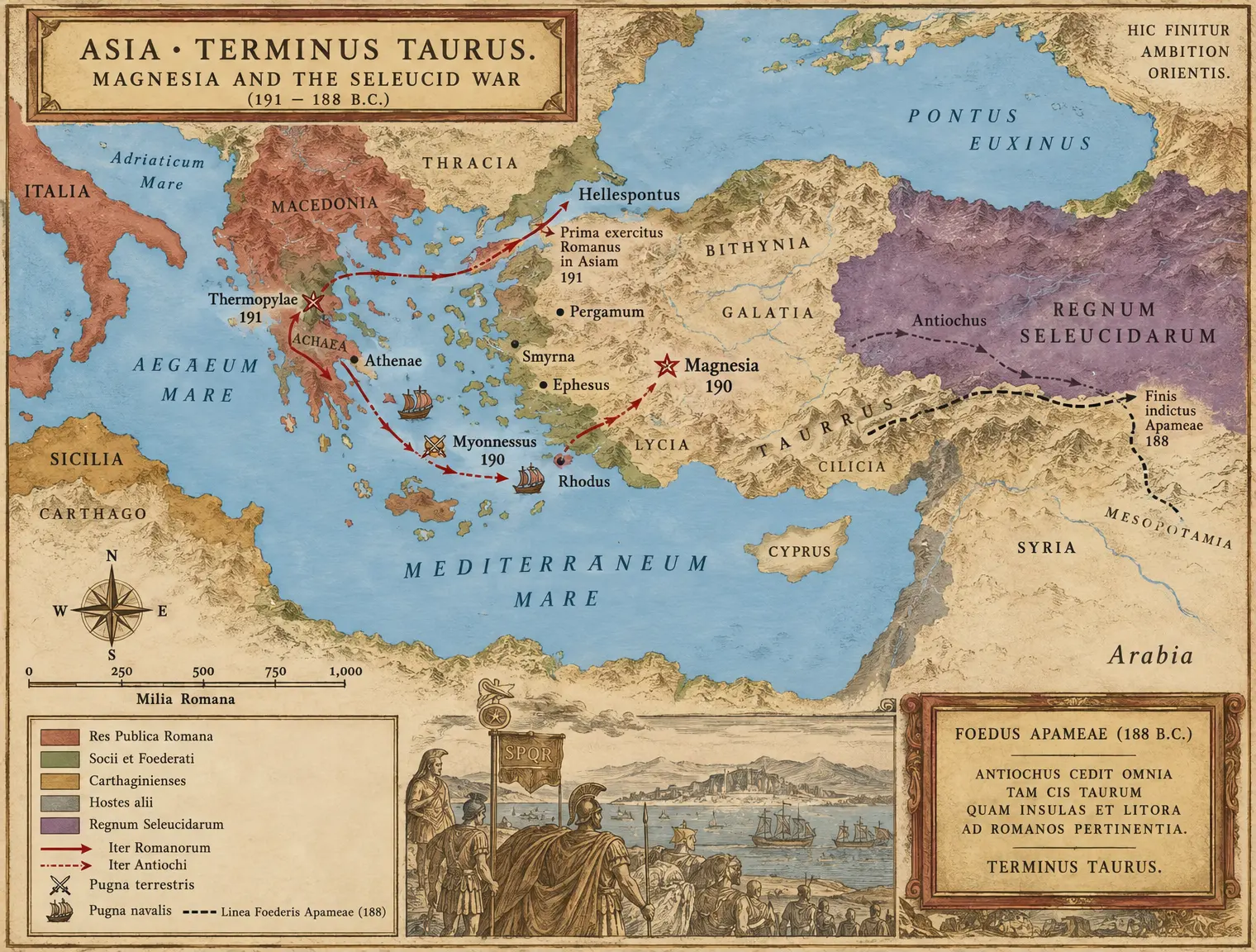 IV-C03 MAGNESIA AND THE SELEUCID WAR
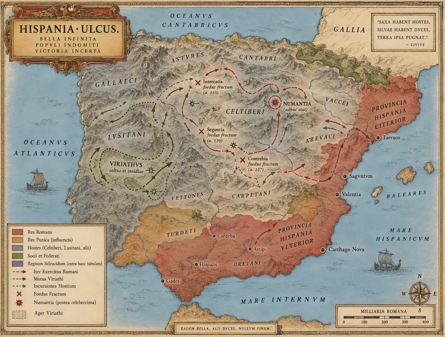 IV-C04 THE SPANISH ULCER
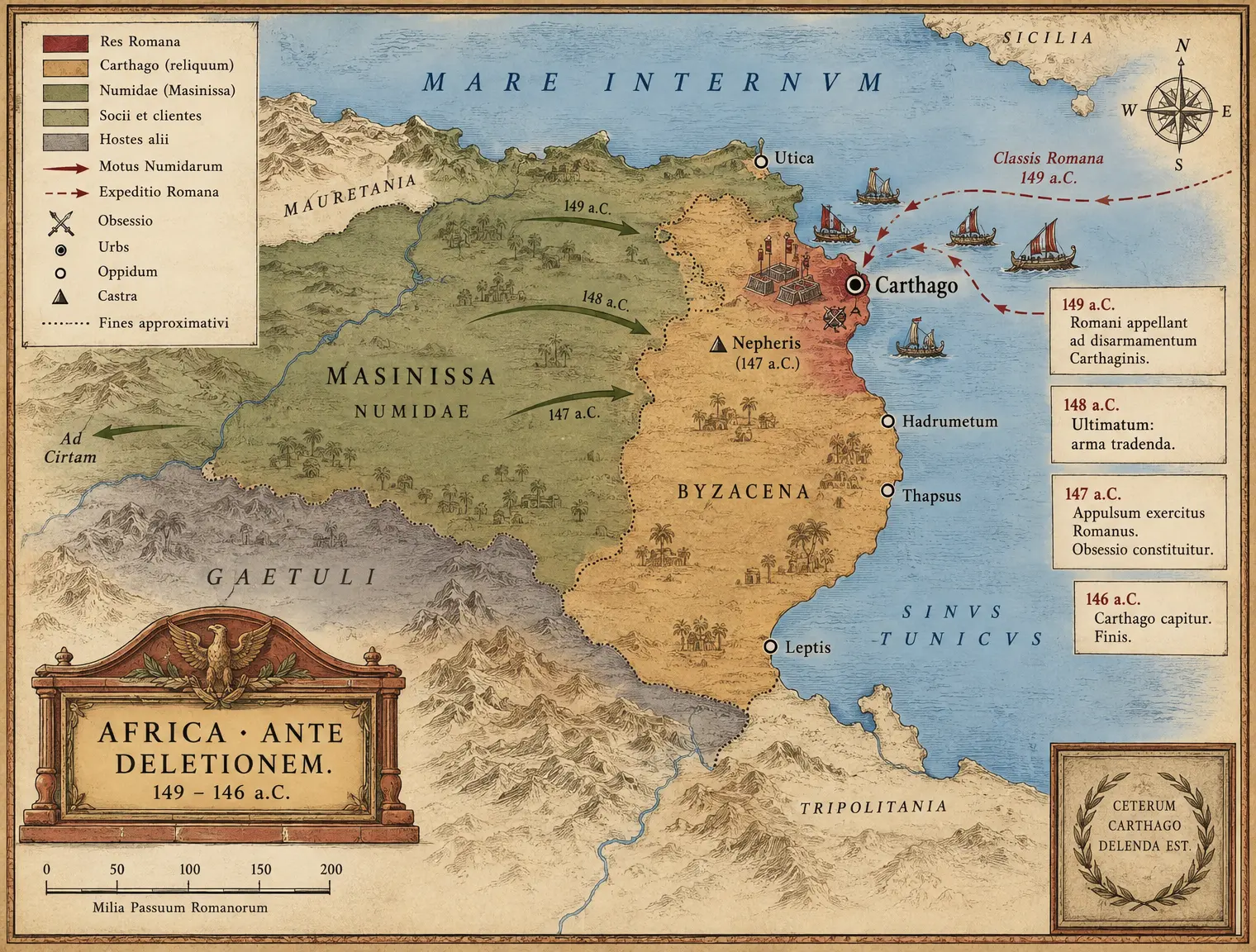 IV-C05 AFRICA 149–146 — The Last Territory
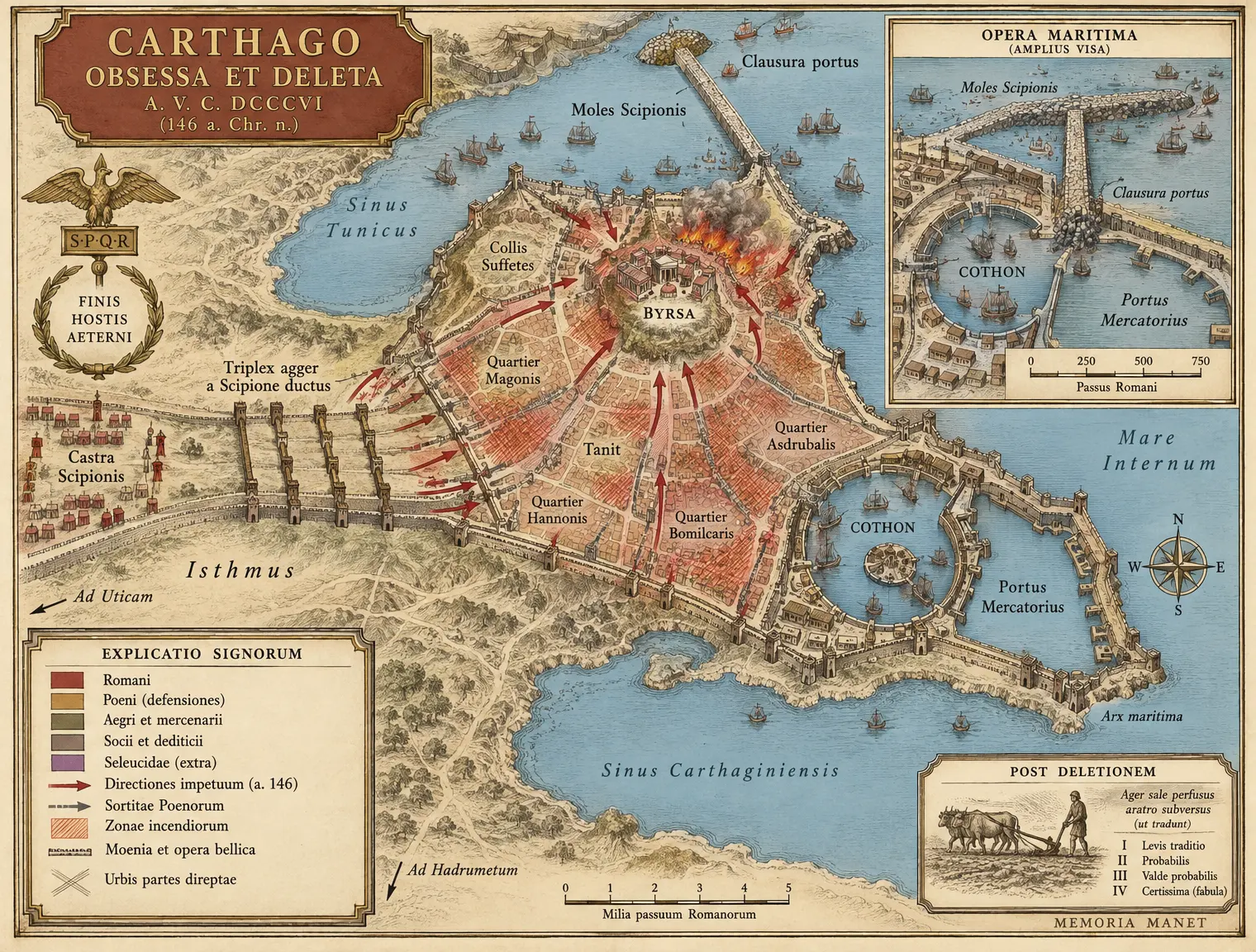 IV-C06 CARTHAGO — The Siege Plan
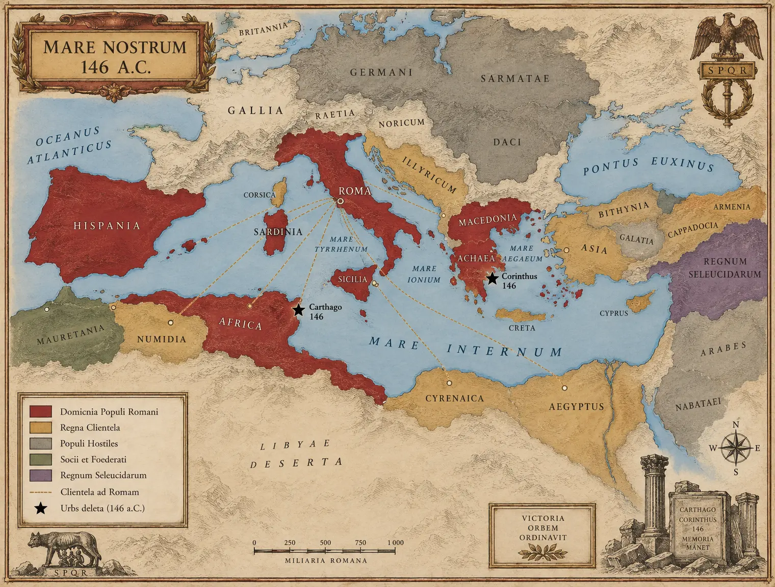 IV-C07 MARE NOSTRUM 146
Book V The Crisis of the Republic
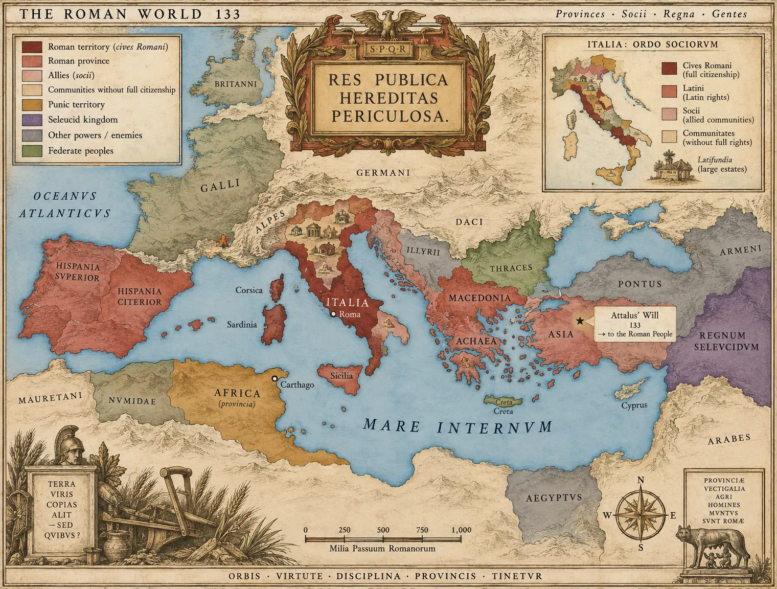 V-C01 THE ROMAN WORLD 133
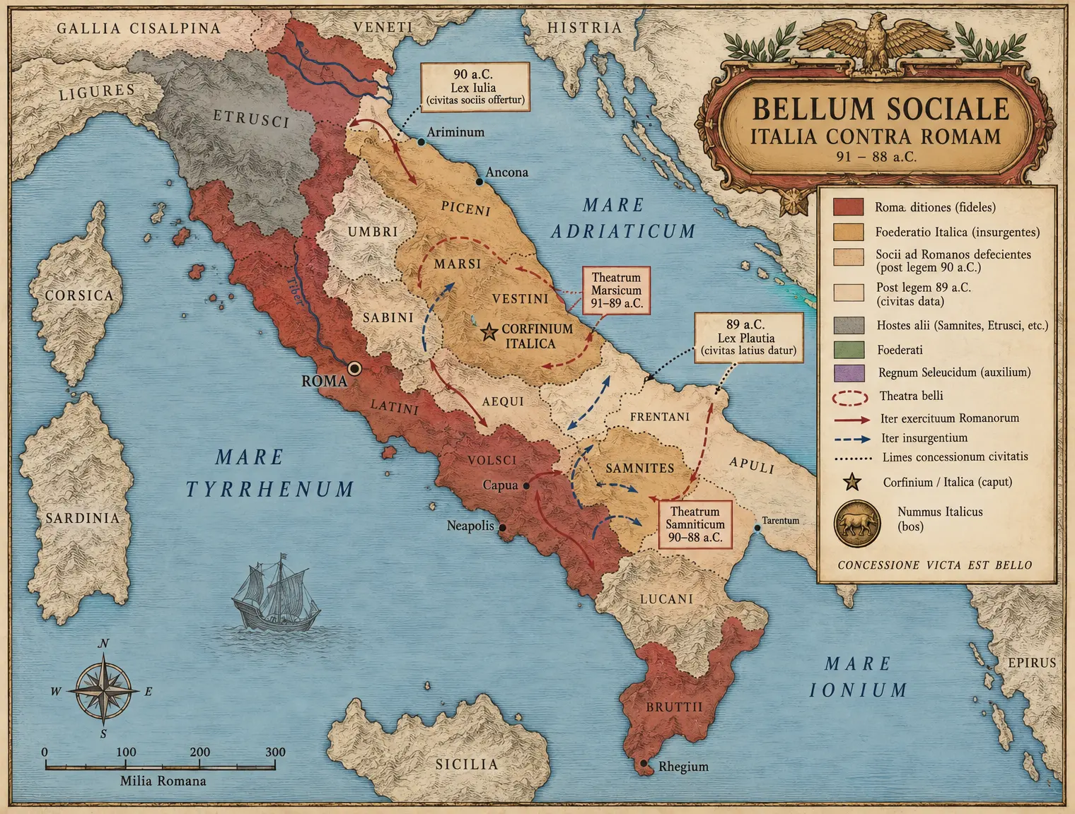 V-C02 THE SOCIAL WAR
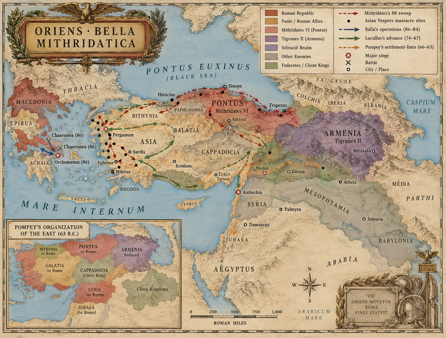 V-C03 THE MITHRIDATIC EAST
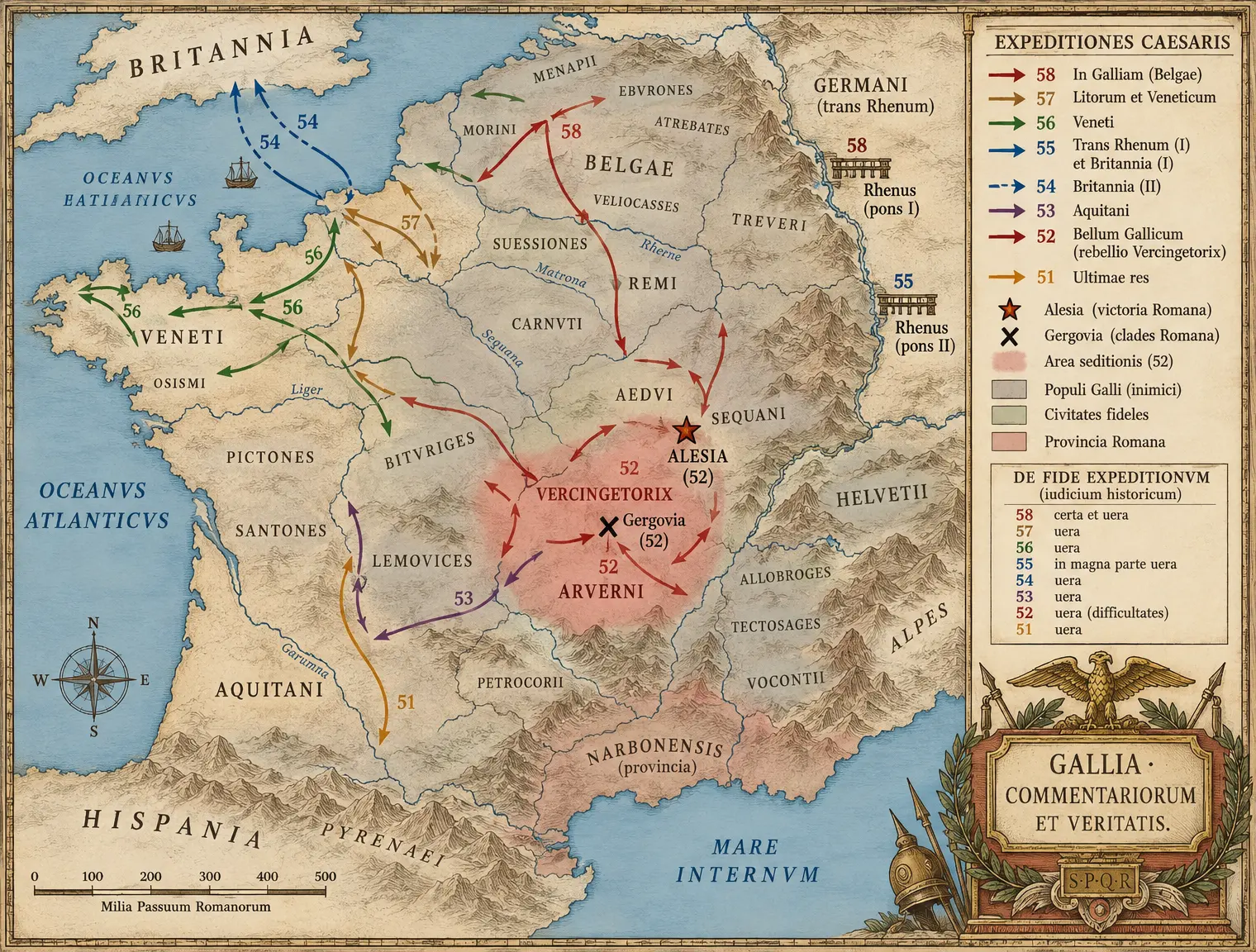 V-C04 GALLIA CAESARIS
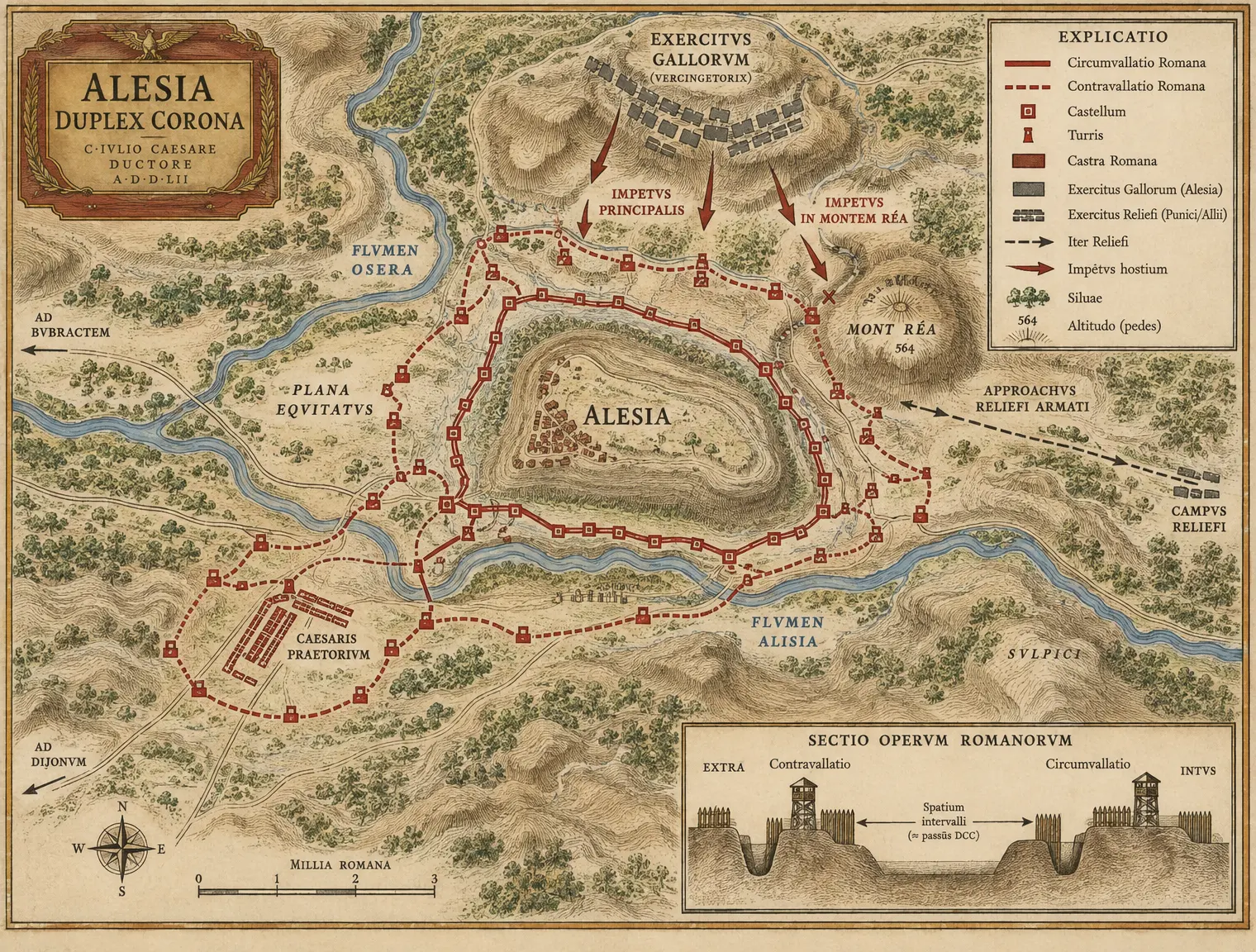 V-C05 ALESIA — The Ground
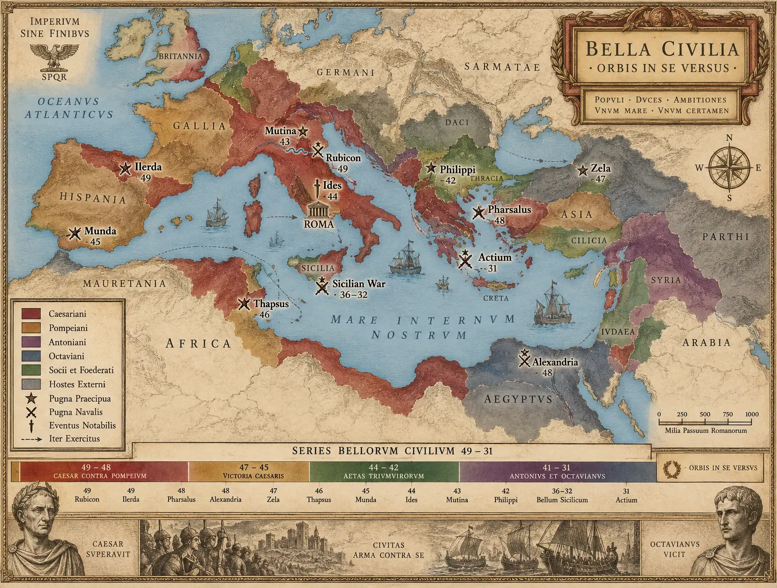 V-C06 THE CIVIL WARS MASTER MAP 49–31
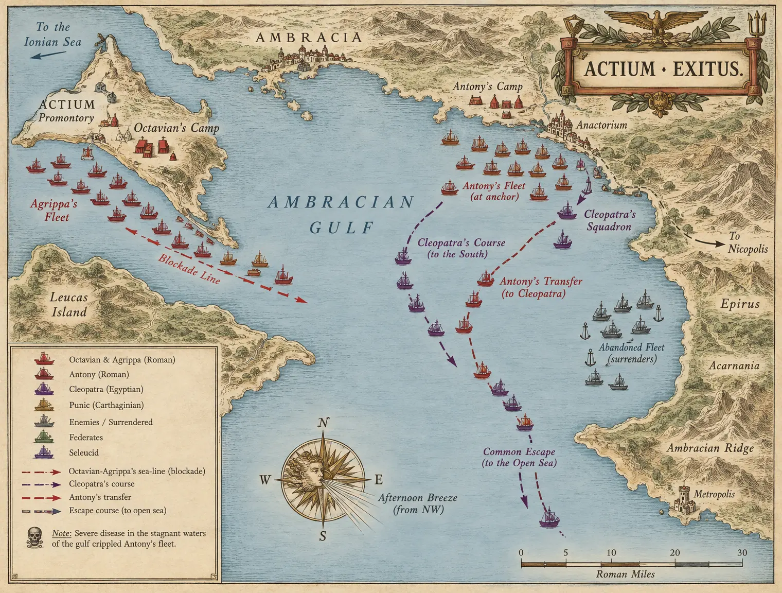 V-C07 ACTIUM — The Gulf Chart
Book VI The Wars of the Early Principate
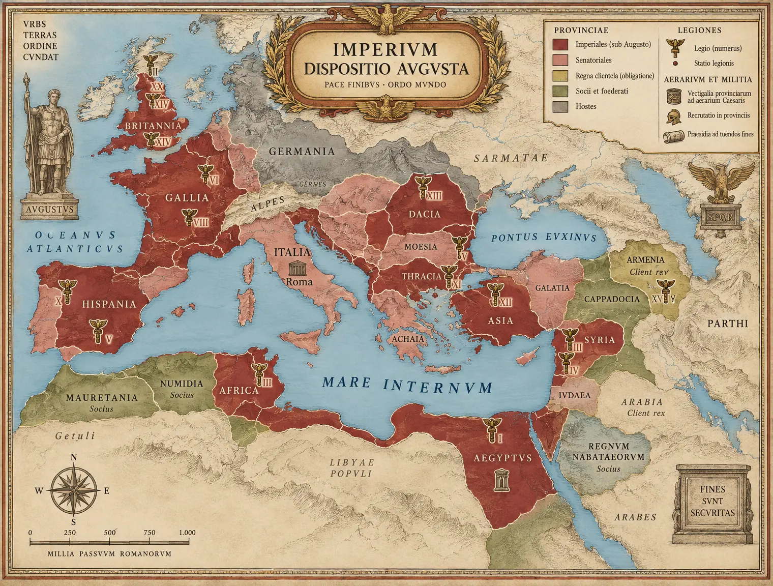 VI-C01 THE AUGUSTAN EMPIRE
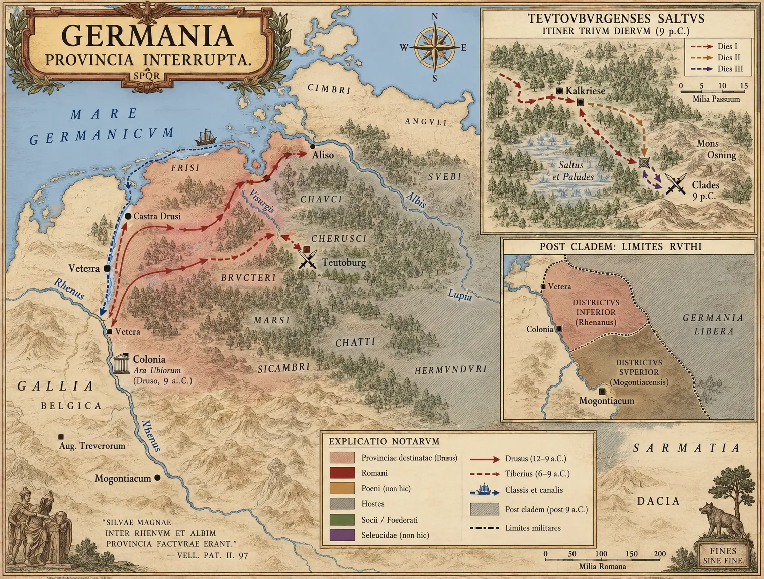 VI-C02 GERMANIA — The Project and the Forest
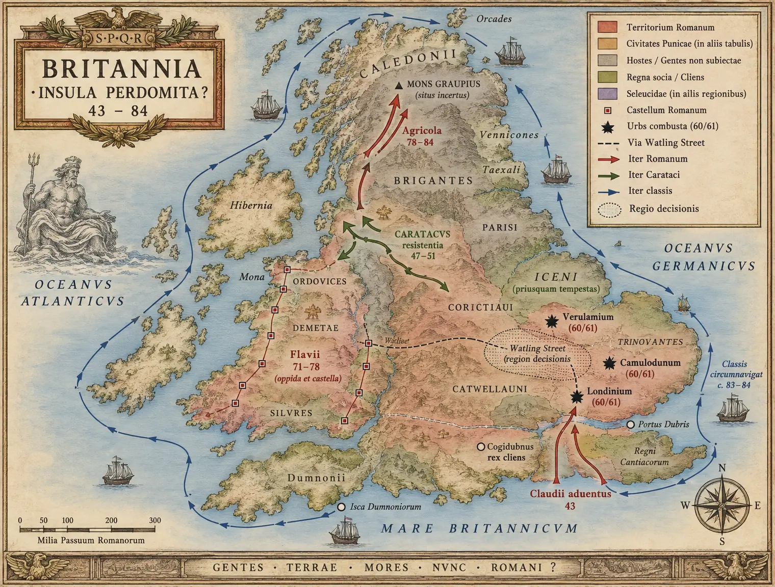 VI-C03 BRITANNIA 43–84
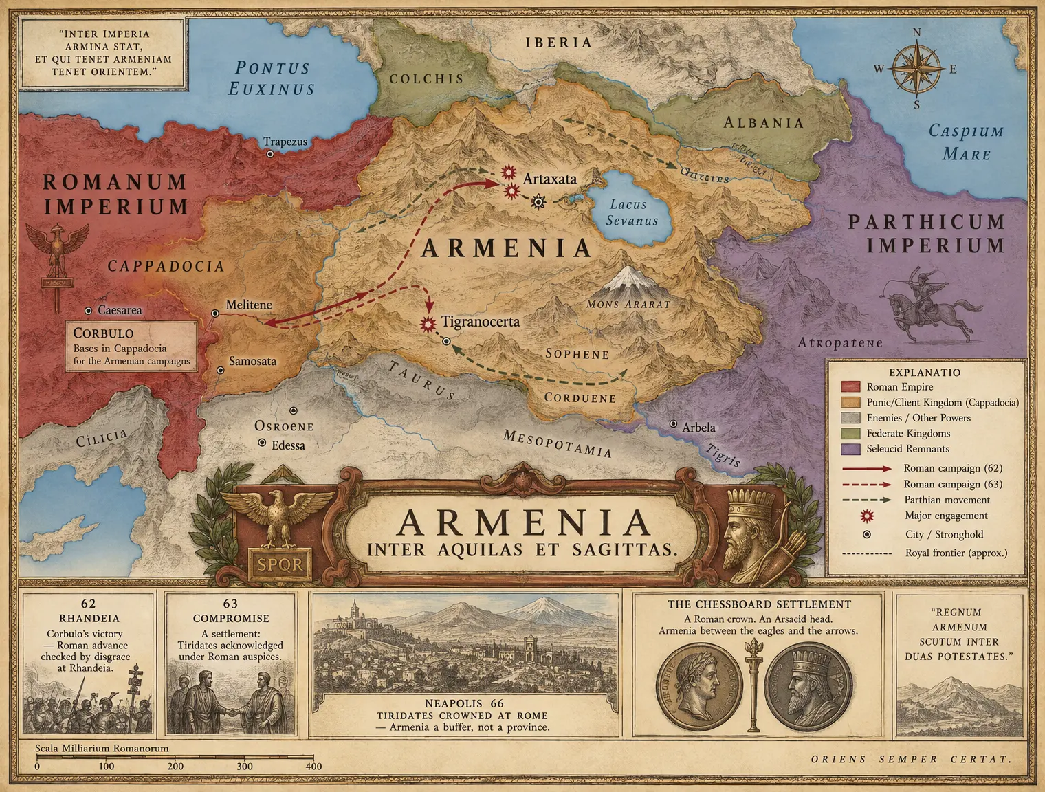 VI-C04 THE ARMENIAN CHESSBOARD
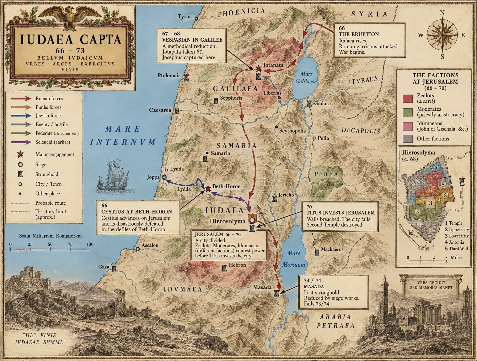 VI-C05 IUDAEA 66–73
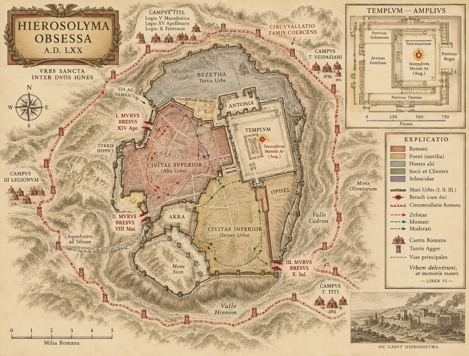 VI-C06 HIEROSOLYMA 70 — The Siege Plan
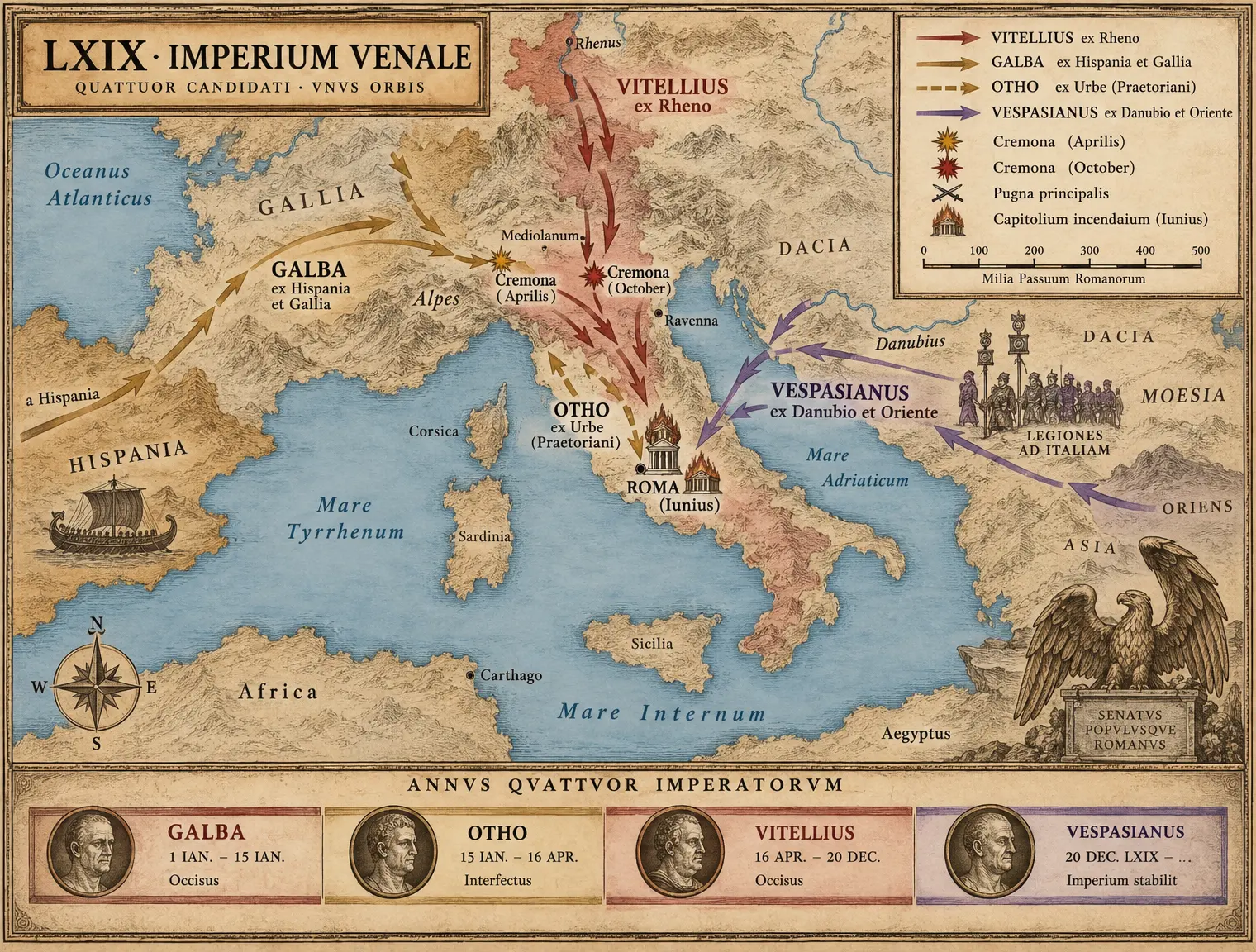 VI-C07 ANNUS QUATTUOR IMPERATORUM
Book VII The High Empire and the Long Crisis
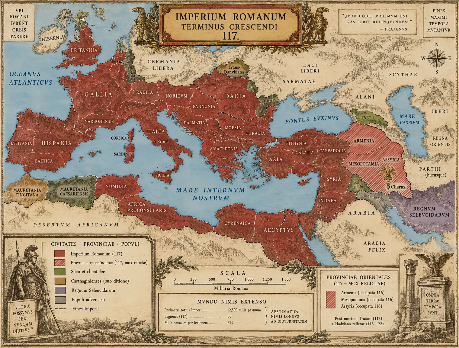 VII-C01 IMPERIUM MAXIMUM 117
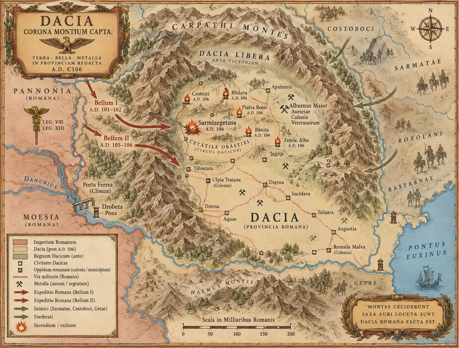 VII-C02 DACIA — The Carpathian Atlas
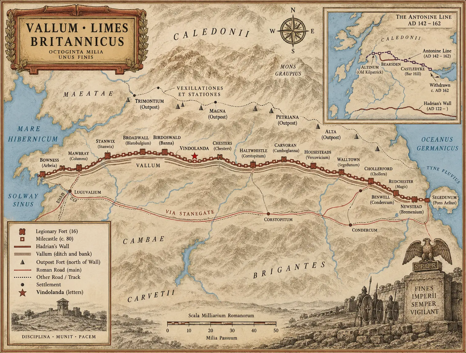 VII-C03 VALLUM HADRIANI — The Wall Corridor
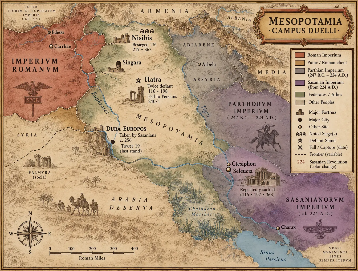 VII-C04 THE MESOPOTAMIAN DUEL
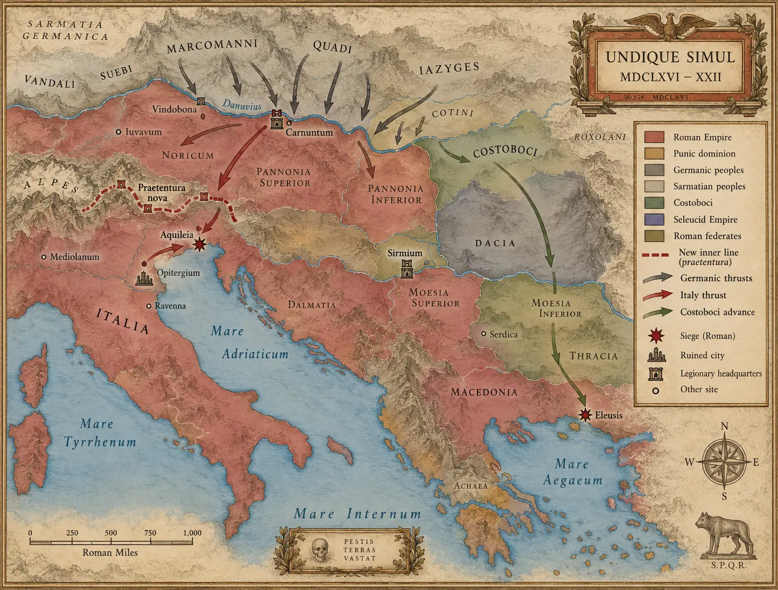 VII-C05 THE MARCOMANNIC EMERGENCY
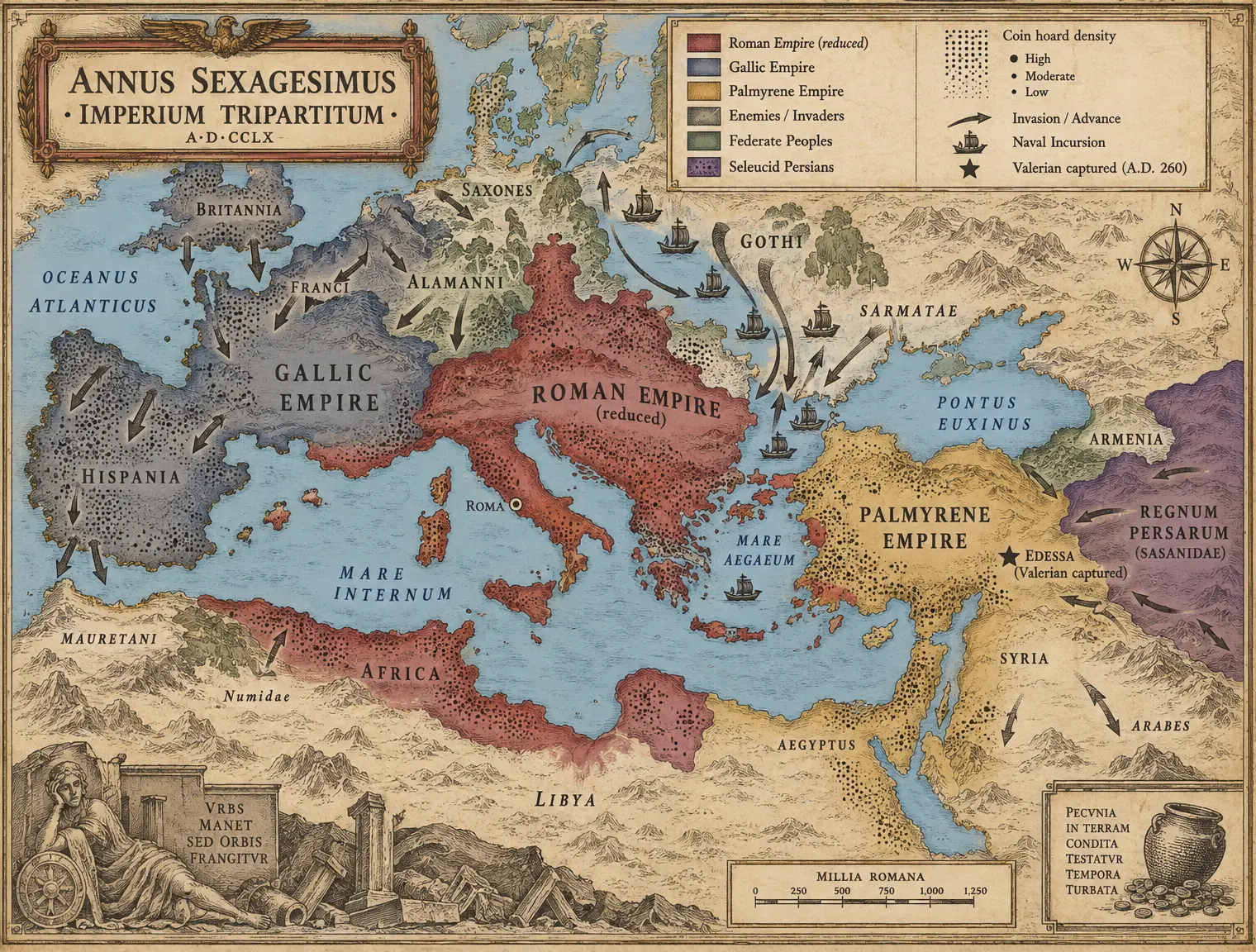 VII-C06 THE BROKEN EMPIRE 260
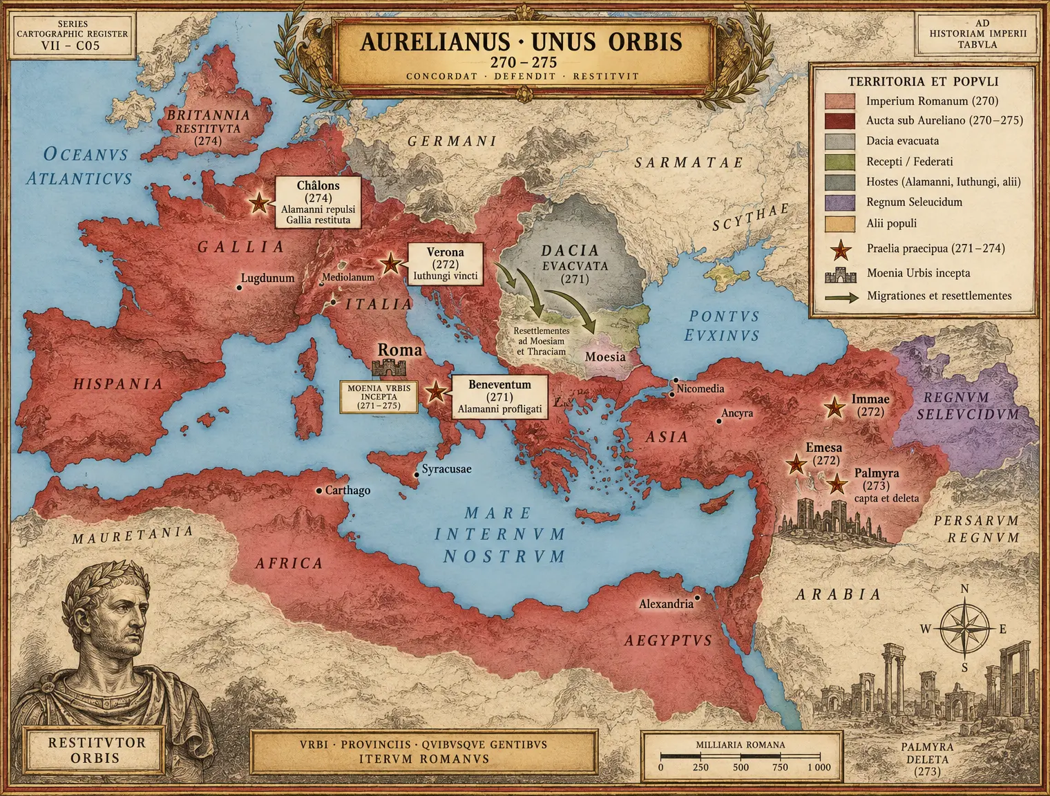 VII-C07 RESTITUTOR ORBIS
Book VIII The Last Age of the West
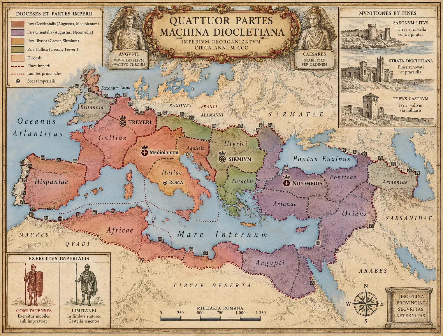 VIII-C01 THE TETRARCHIC ORDER
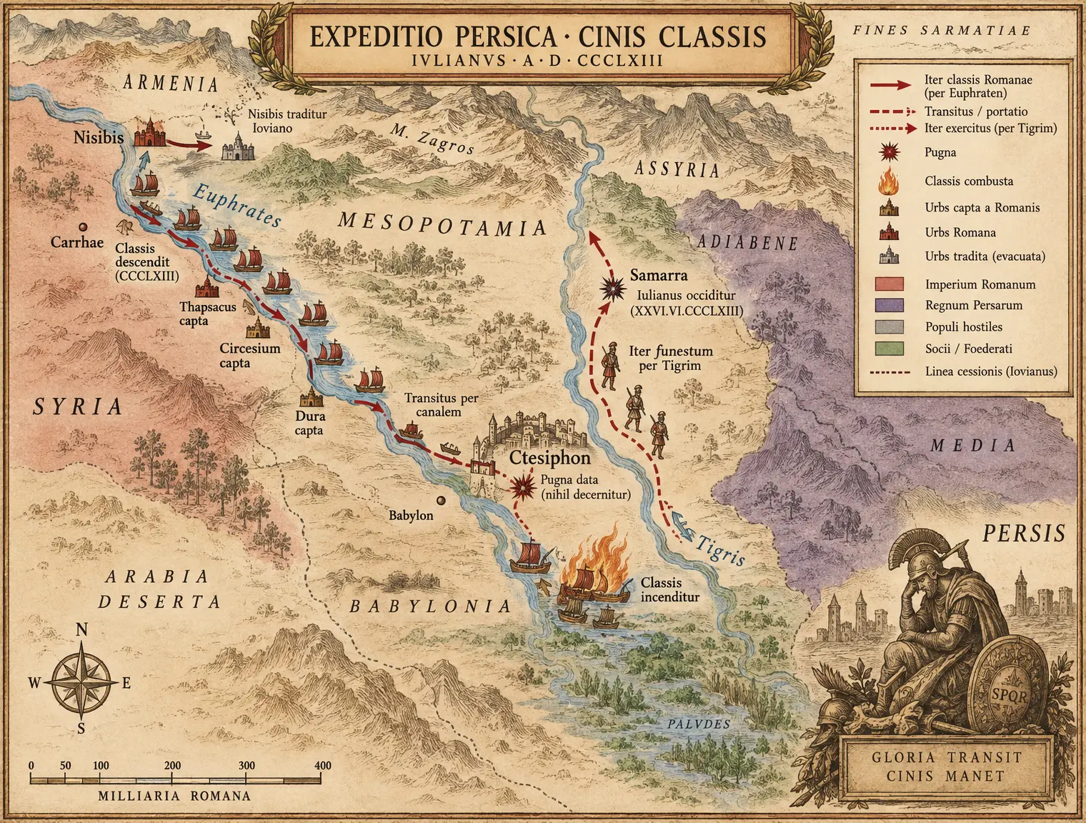 VIII-C02 JULIAN'S RIVER WAR 363
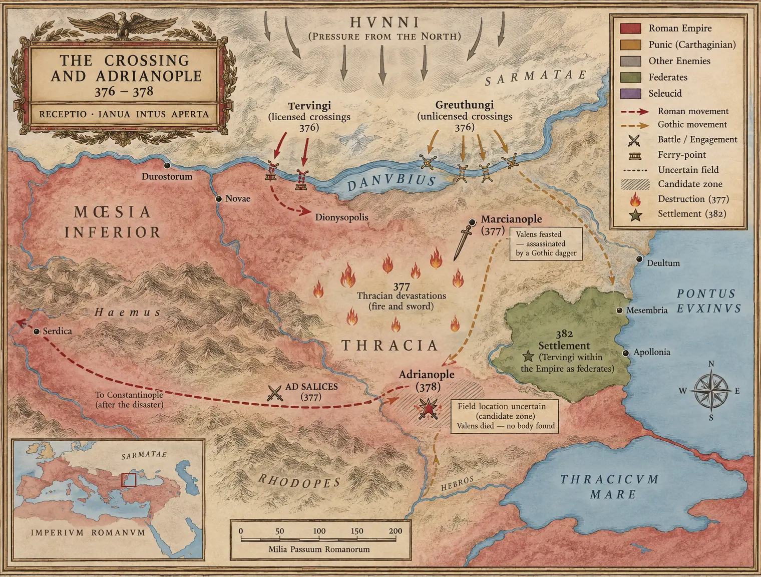 VIII-C03 THE CROSSING AND ADRIANOPLE 376–378
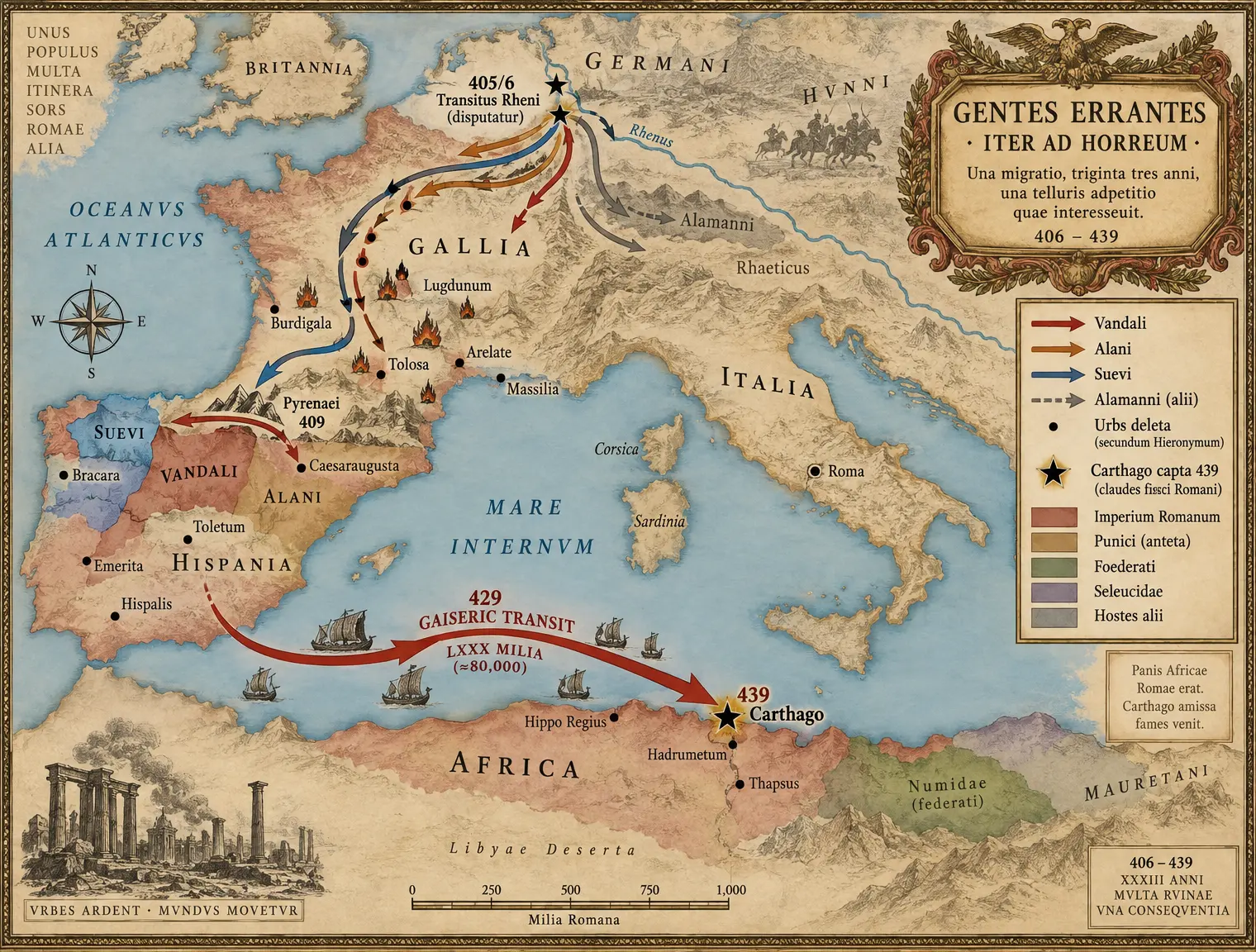 VIII-C04 THE WANDERING PEOPLES 406–439
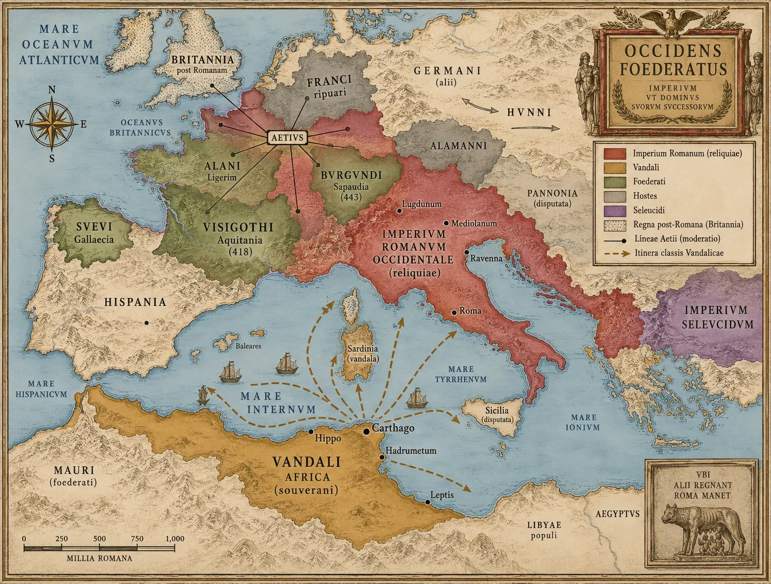 VIII-C05 THE SETTLED WEST c.450
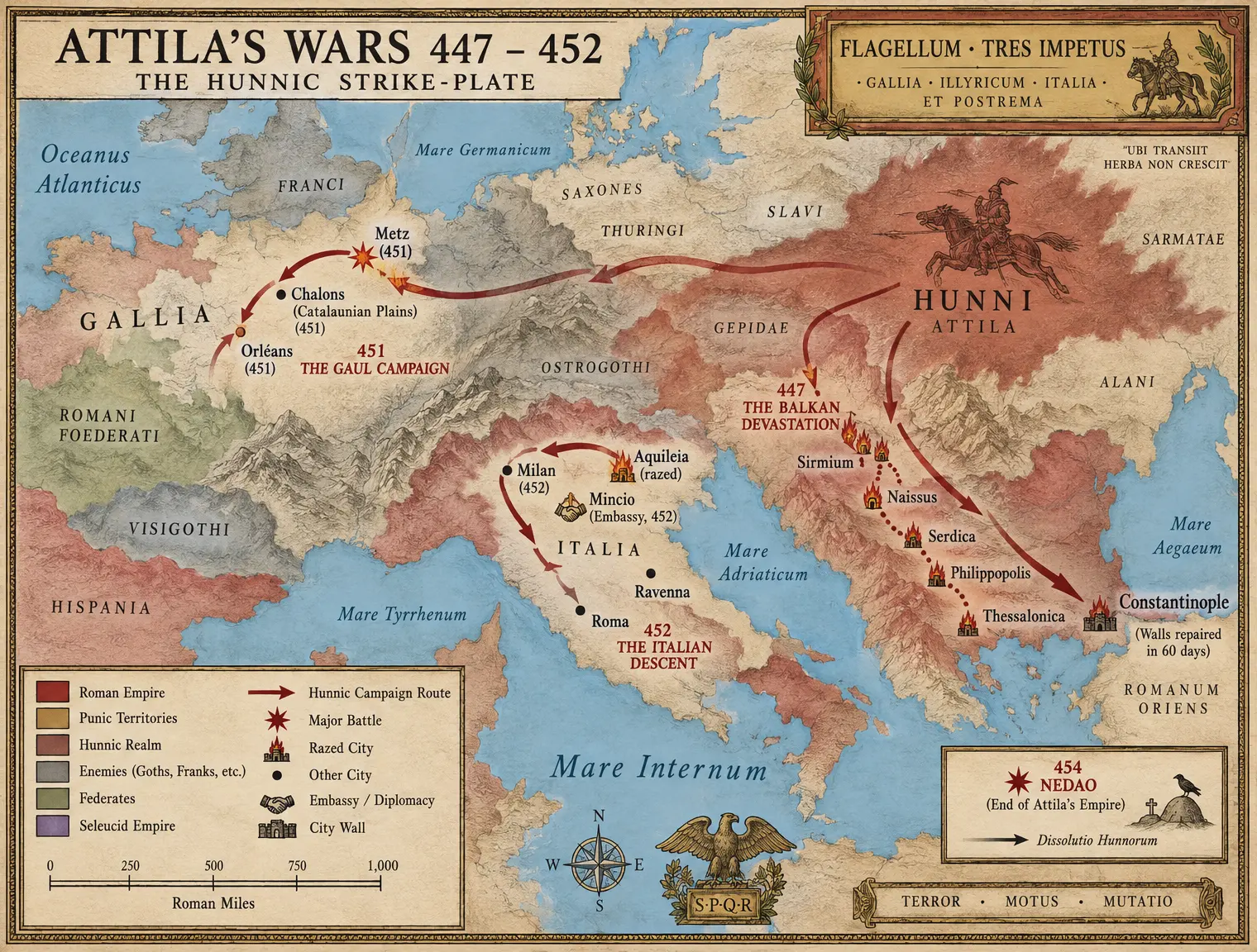 VIII-C06 ATTILA'S WARS 447–452
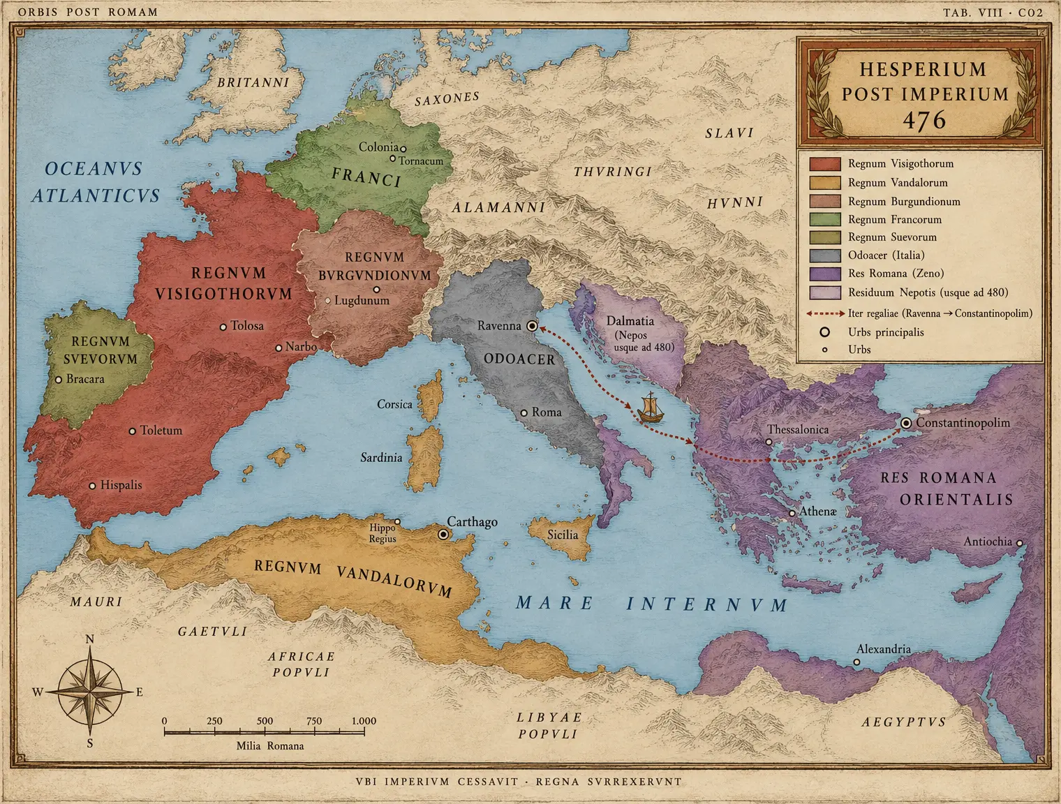 VIII-C07 POST ROMAM — The West 476
Figures From the figures compendium
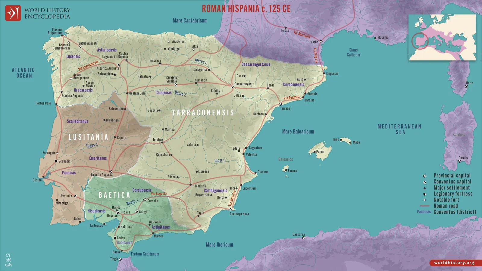 Regional orientation map showing an early imperial arrangement around 125 CE. The earlier wars of Scipio… In Geography and theaters
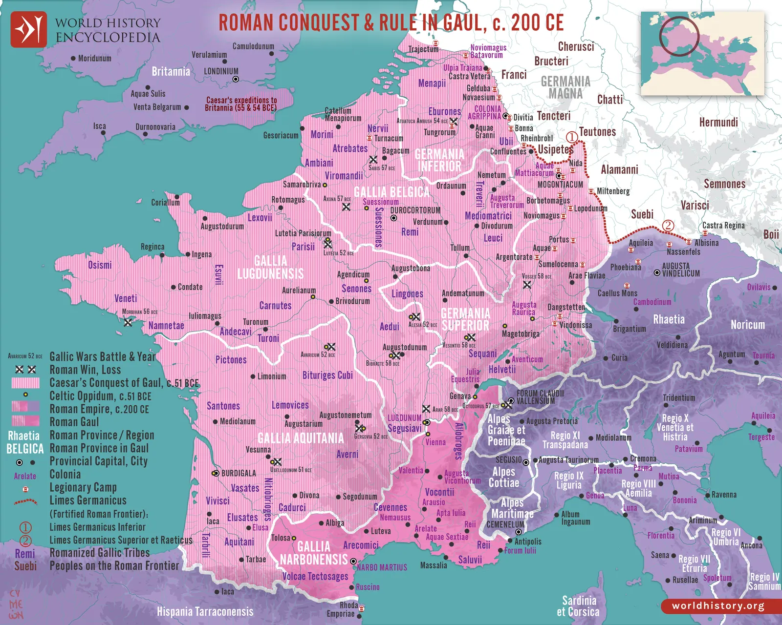 Regional orientation map combining campaigns with a provincial arrangement around 200 CE. It must not be read… In Geography and theaters
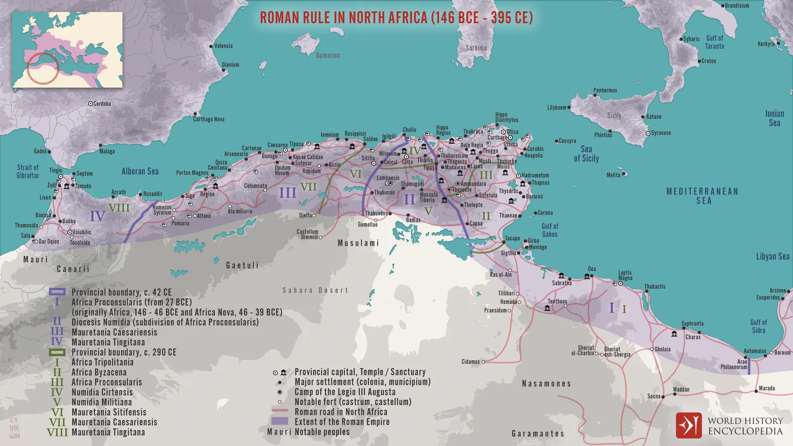 Regional orientation map combining several administrative periods. It locates connected theaters but does not… In Geography and theaters
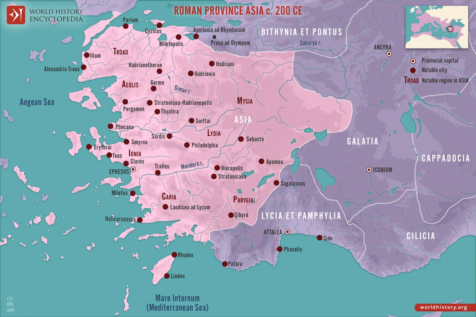 Regional orientation around 200 CE. Asia here means the Roman province in western Anatolia, not the modern… In Geography and theaters
Wars From the wars compendium
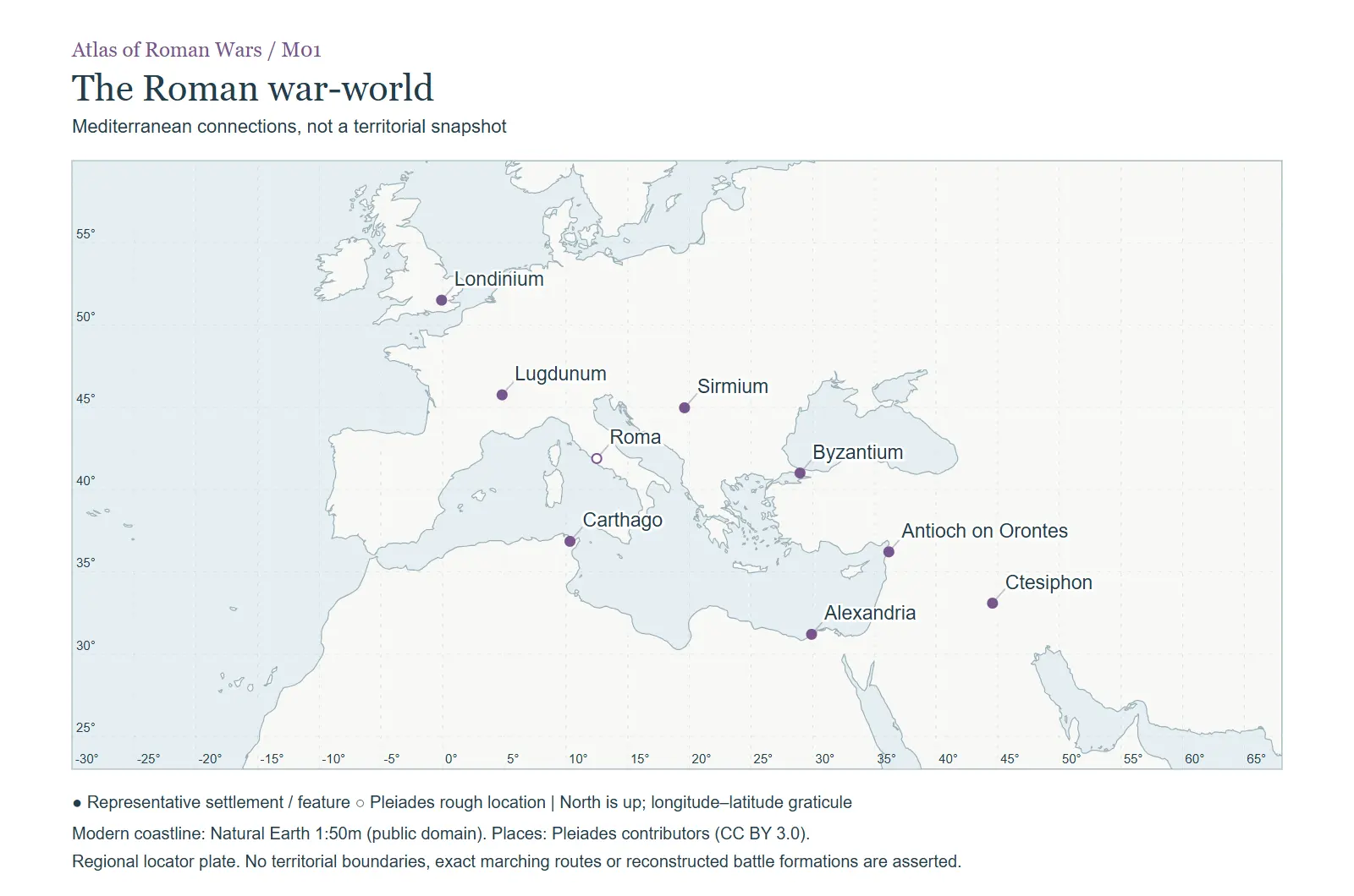 Mediterranean connections, not a territorial snapshot. In The regional atlas
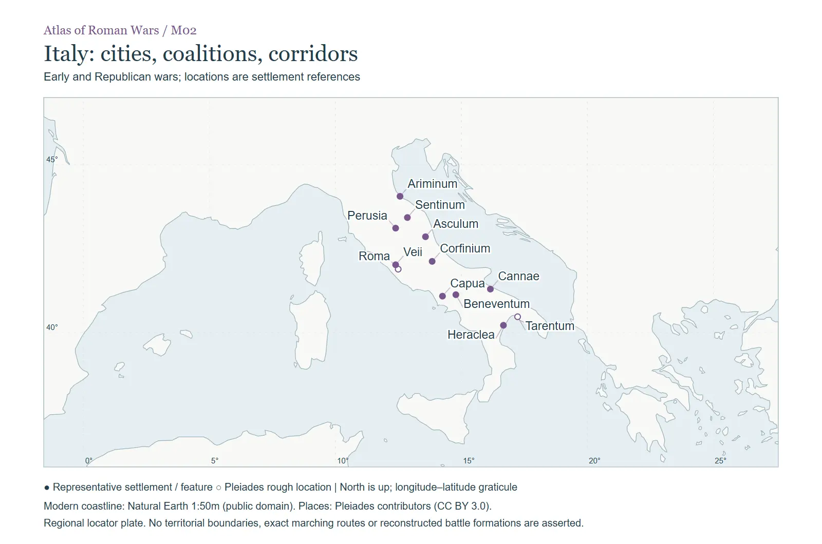 Early and Republican wars; locations are settlement references. In The regional atlas
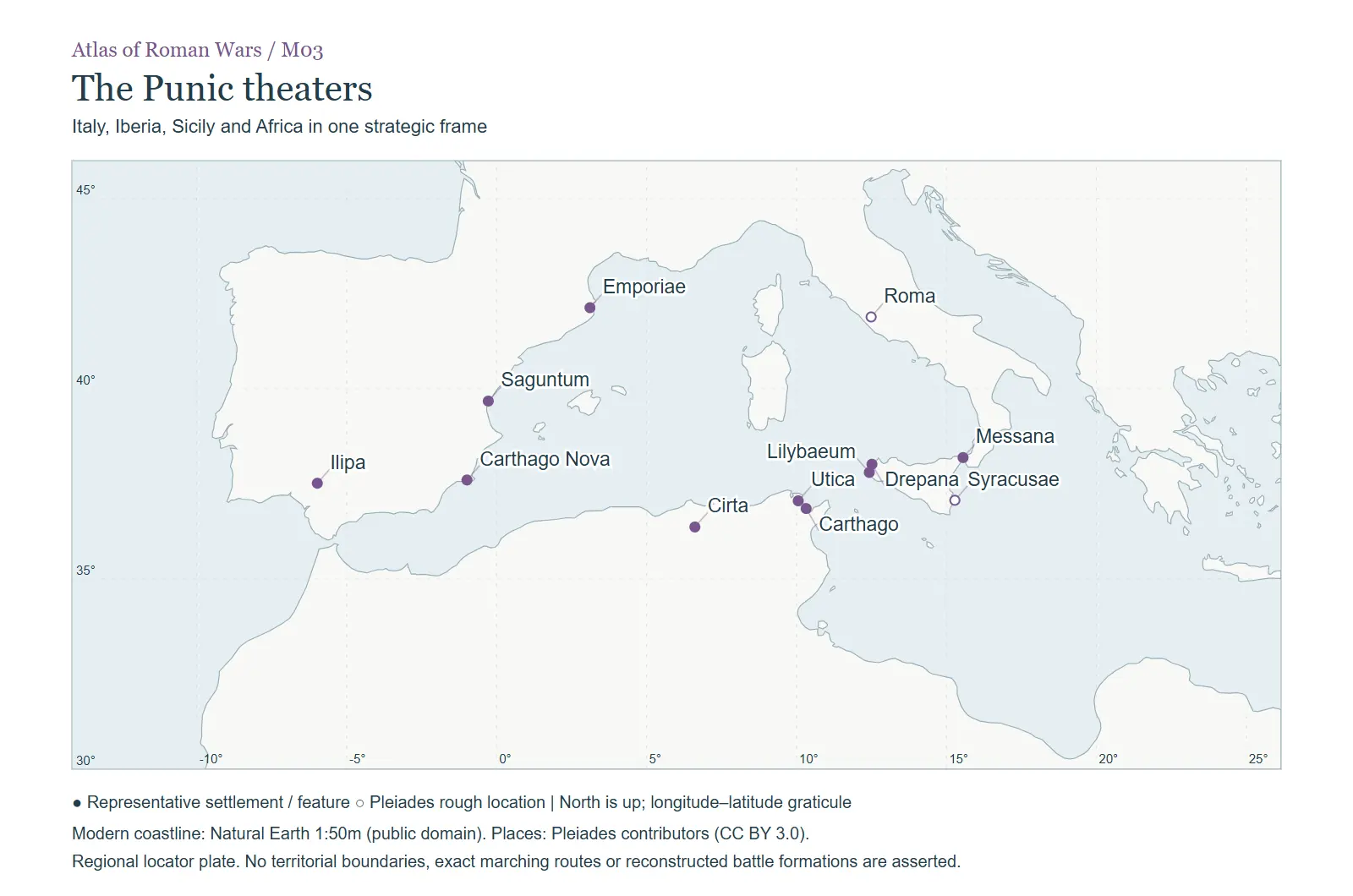 Italy, Iberia, Sicily and Africa in one strategic frame. In The regional atlas
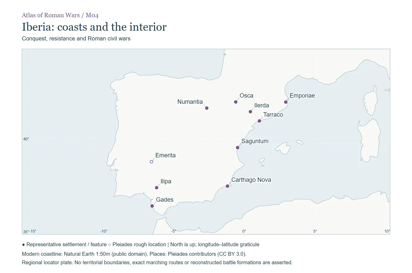 Conquest, resistance and Roman civil wars. In The regional atlas
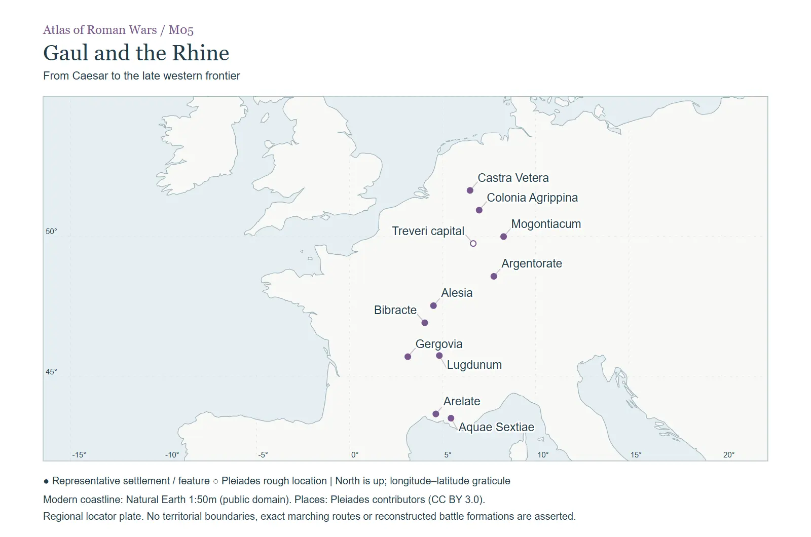 From Caesar to the late western frontier. In The regional atlas
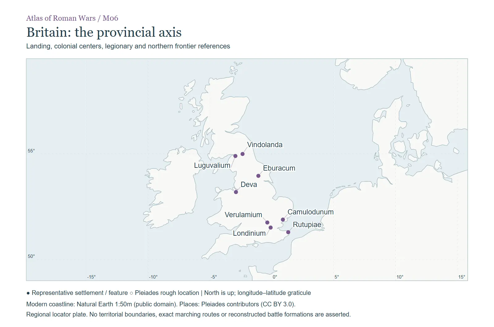 Landing, colonial centers, legionary and northern frontier references. In The regional atlas
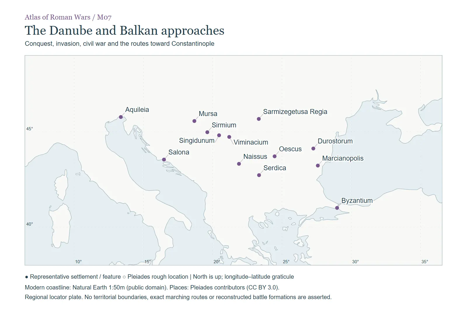 Conquest, invasion, civil war and the routes toward Constantinople. In The regional atlas
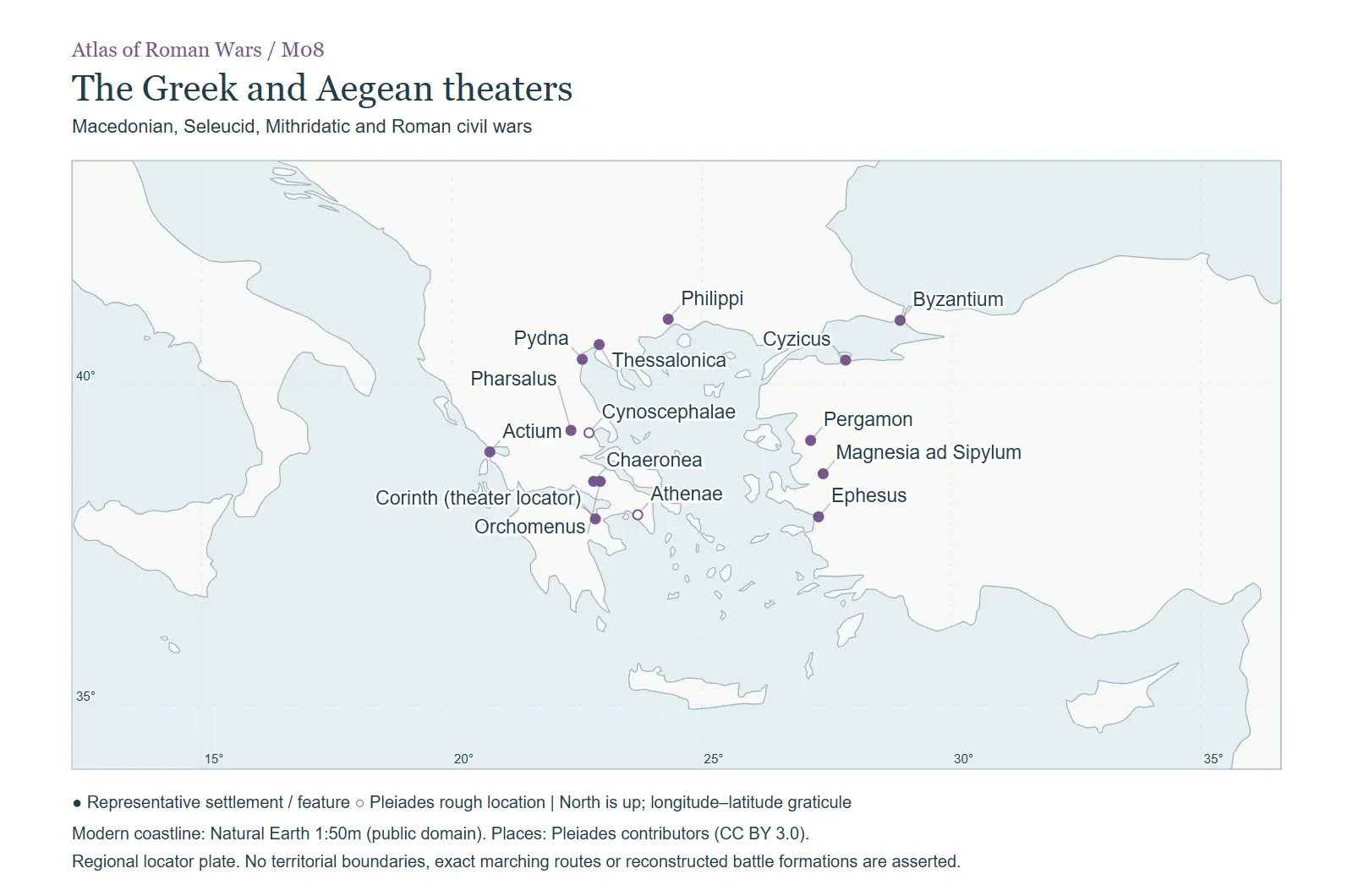 Macedonian, Seleucid, Mithridatic and Roman civil wars. In The regional atlas
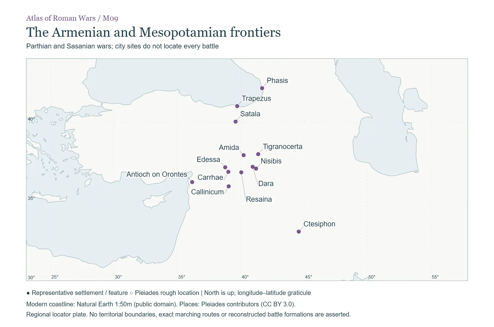 Parthian and Sasanian wars; city sites do not locate every battle. In The regional atlas
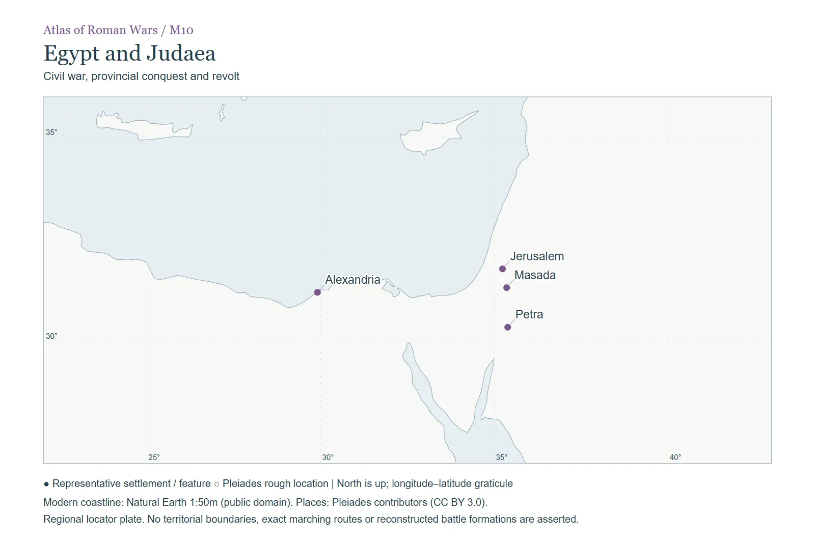 Civil war, provincial conquest and revolt. In The regional atlas
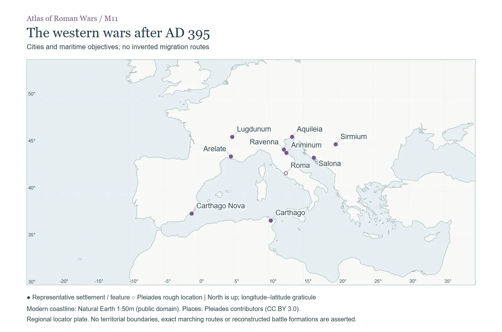 Cities and maritime objectives; no invented migration routes. In The regional atlas
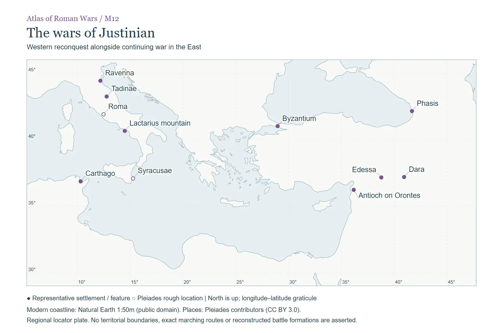 Western reconquest alongside continuing war in the East. In The regional atlas
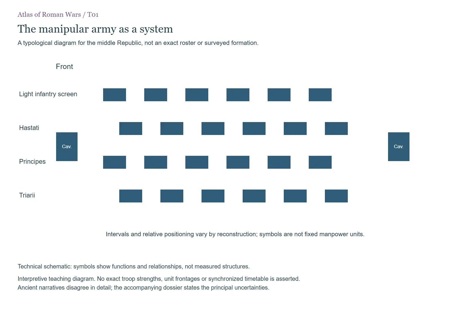 T01. A teaching diagram of differentiated infantry roles. The blocks are not fixed strengths and the spaces… In Armies, weapons and the conduct of campaigns
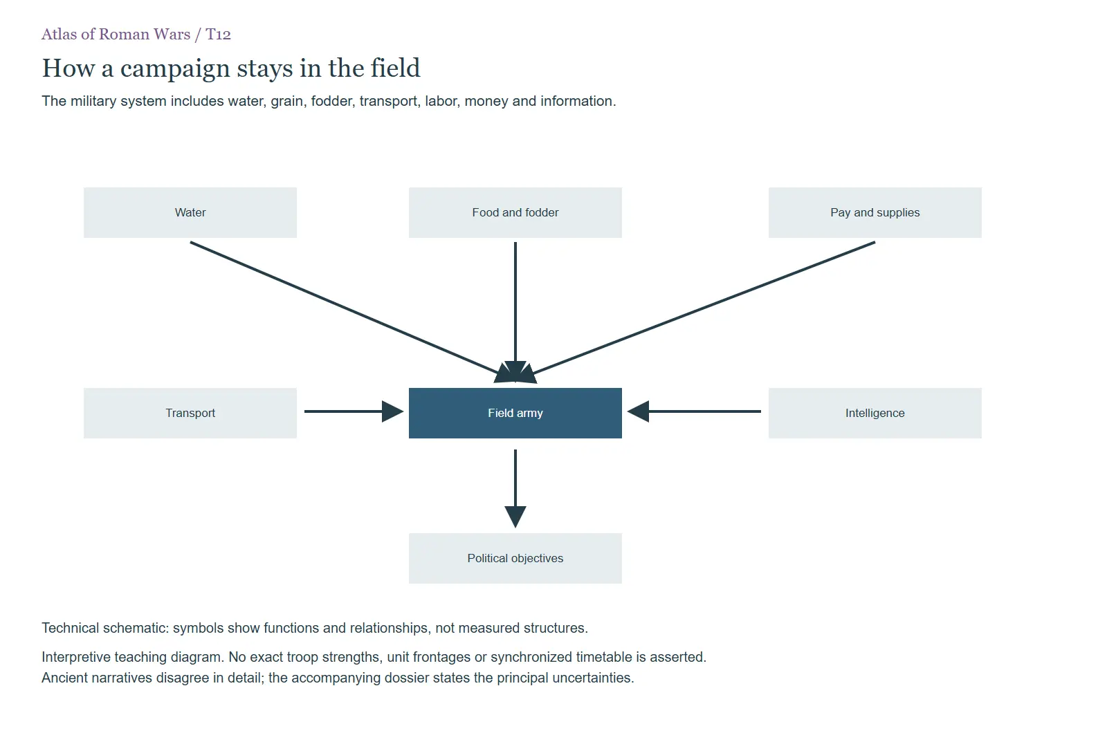 T12. The dependencies that connect a field army to resources and political objectives. In Armies, weapons and the conduct of campaigns
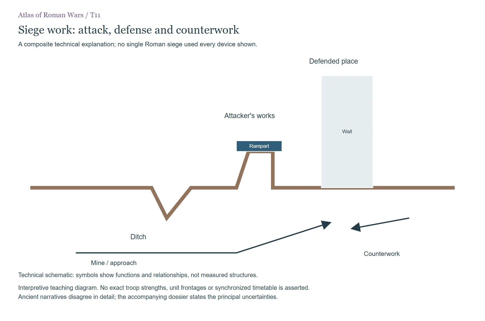 T11. Composite explanation of siege approaches, ditch, rampart, wall, mine and counterwork. It does not claim… In Armies, weapons and the conduct of campaigns
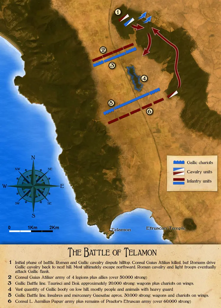 B10. Telamon: a conventional reconstruction. Modern schematic illustration; specific unit positions… In W011 Cisalpine Gallic and Ligurian wars
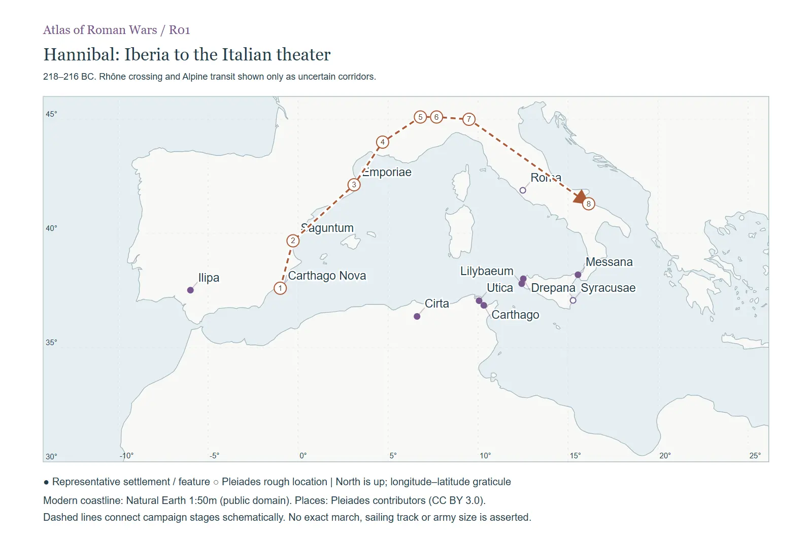 R01. 218–216 BC. Rhône crossing and Alpine transit shown only as uncertain corridors. In W015 The Second Punic War: the whole conflict
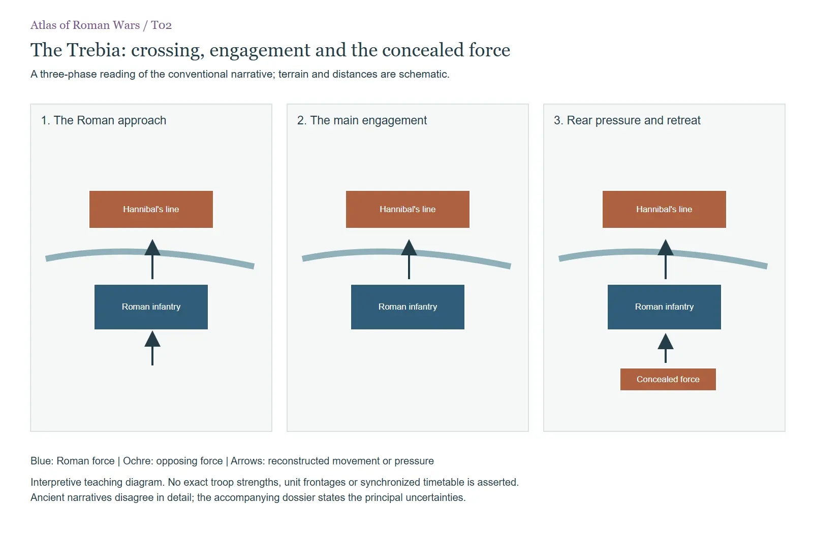 T02. A three-phase reading of the conventional narrative; terrain and distances are schematic. In W016 Hannibal in Italy
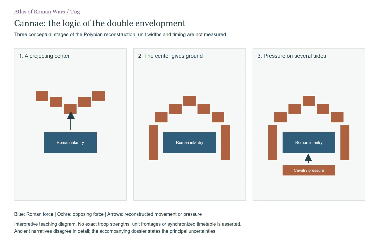 T03. Three conceptual stages of the Polybian reconstruction; unit widths and timing are not measured. In W016 Hannibal in Italy
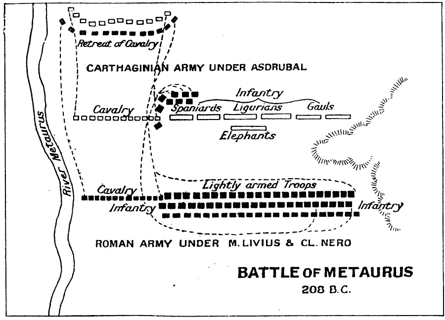 B06. The Metaurus interception and battle. Modern schematic illustration; specific unit positions, distances… In W016 Hannibal in Italy
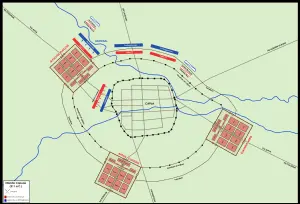 B08. Capua: siege and relief operations. Modern schematic illustration; specific unit positions, distances… In W016 Hannibal in Italy
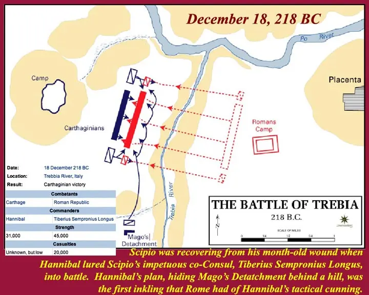 B09. Trebia: approach, battle and ambush. Modern schematic illustration; specific unit positions, distances… In W016 Hannibal in Italy
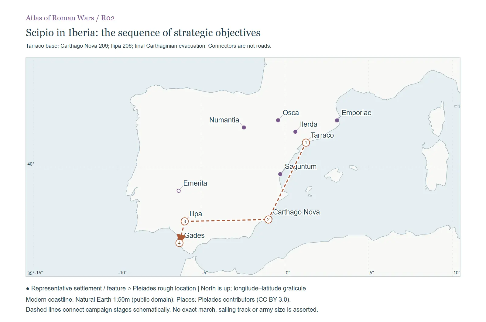 R02. Tarraco base; Carthago Nova 209; Ilipa 206; final Carthaginian evacuation. Connectors are not roads. In W017 The Iberian theater of the Hannibalic War
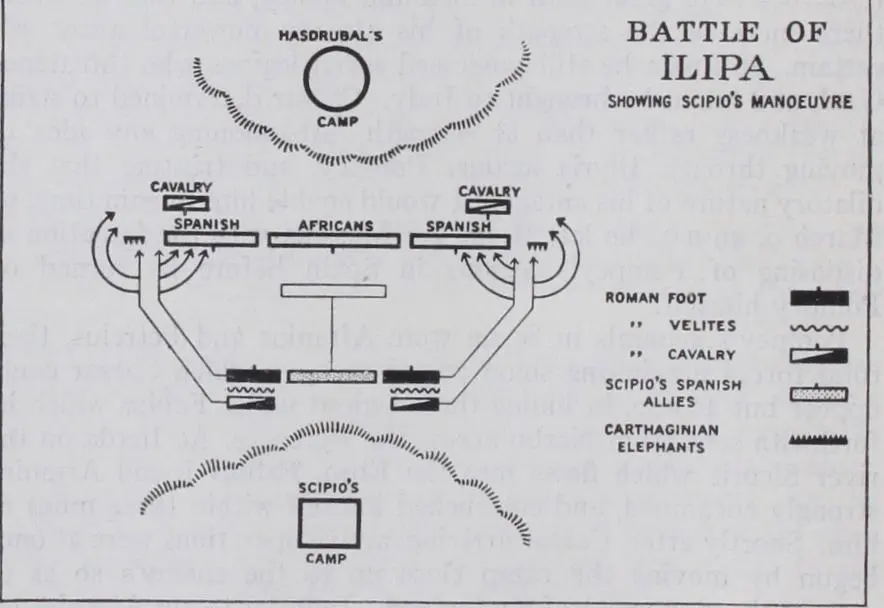 B05. Ilipa: a conventional tactical reconstruction. Modern schematic illustration; specific unit positions… In W017 The Iberian theater of the Hannibalic War
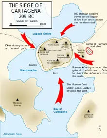 B07. Carthago Nova: the lagoon approach and siege. Modern schematic illustration; specific unit positions… In W017 The Iberian theater of the Hannibalic War
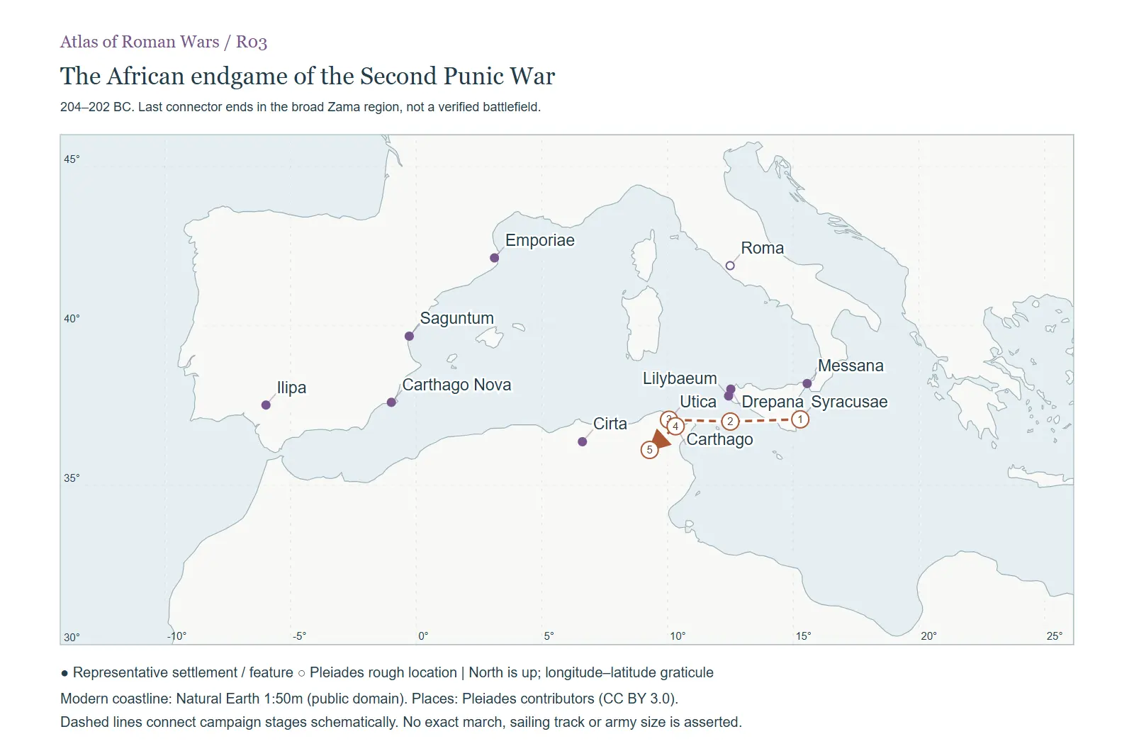 R03. 204–202 BC. Last connector ends in the broad Zama region, not a verified battlefield. In W018 Scipio in Africa and the battle of Zama
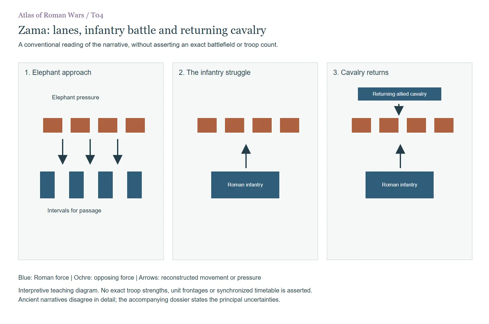 T04. A conventional reading of the narrative, without asserting an exact battlefield or troop count. In W018 Scipio in Africa and the battle of Zama
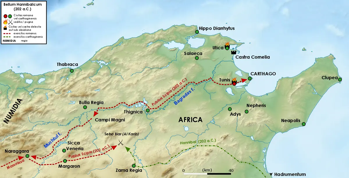 B04. The African campaign and the traditional Zama setting. Modern schematic illustration; specific unit… In W018 Scipio in Africa and the battle of Zama
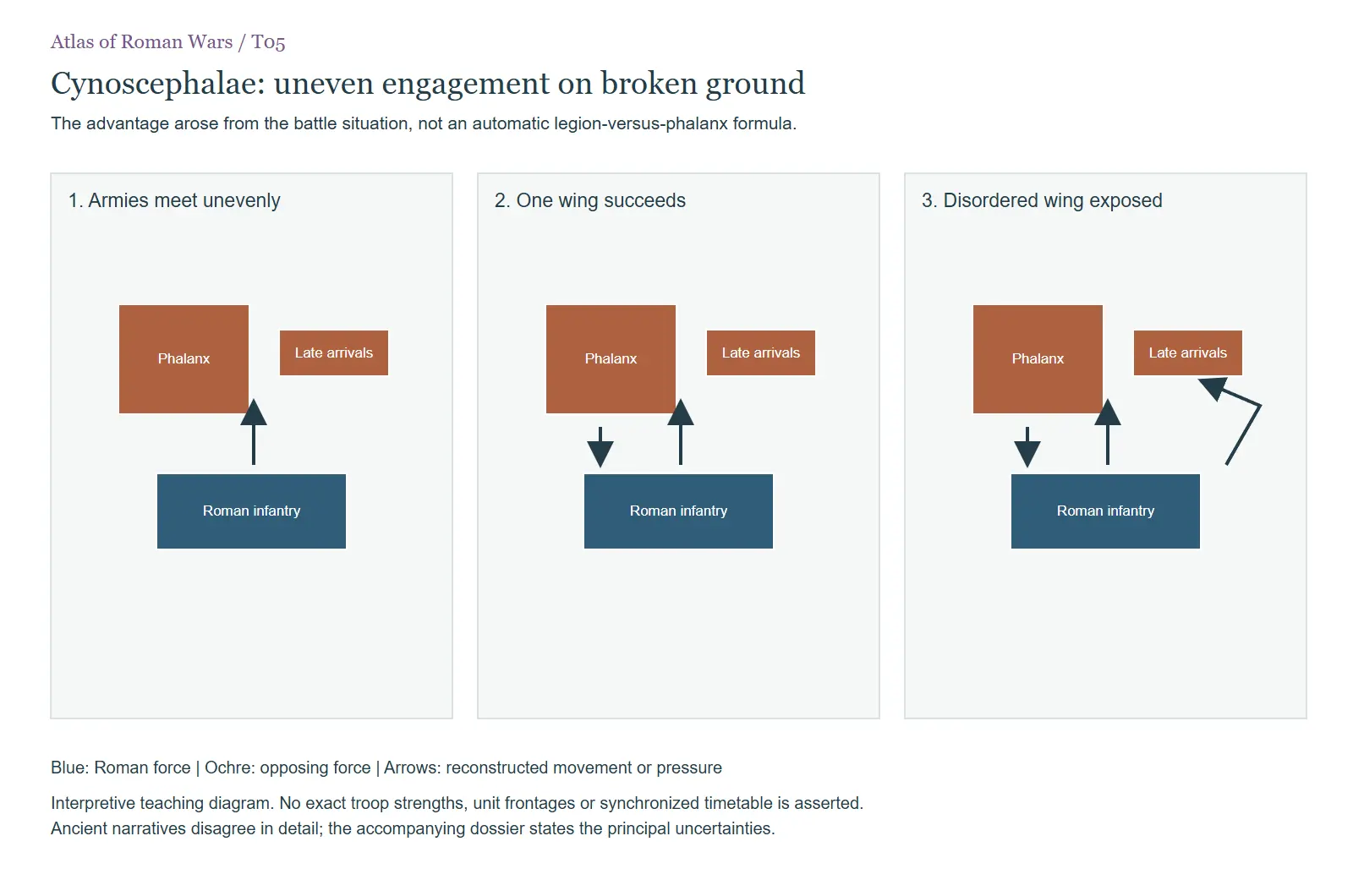 T05. The advantage arose from the battle situation, not an automatic legion-versus-phalanx formula. In W020 The Second Macedonian War
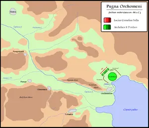 B24. Orchomenus: conventional reconstruction; normally dated 86 BC. Modern schematic illustration; specific… In W034 The First Mithridatic War
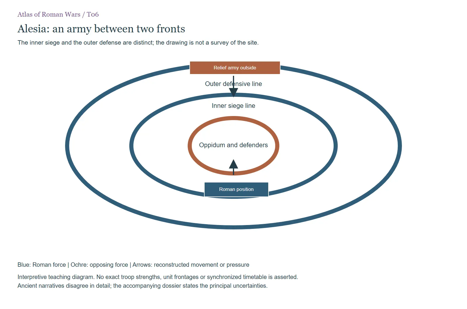 T06. The inner siege and the outer defense are distinct; the drawing is not a survey of the site. In W040 Caesar's Gallic wars
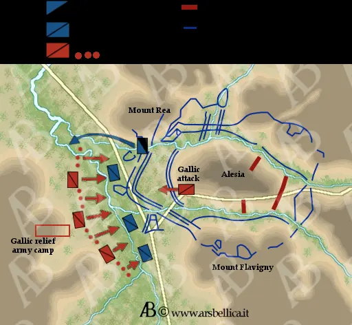 B16. Alesia: modern siege reconstruction. Modern schematic illustration; specific unit positions, distances… In W040 Caesar's Gallic wars
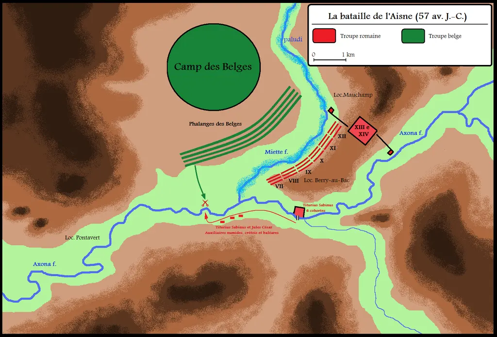 B17. The Axona: alternative modern reconstruction. Modern schematic illustration; specific unit positions… In W040 Caesar's Gallic wars
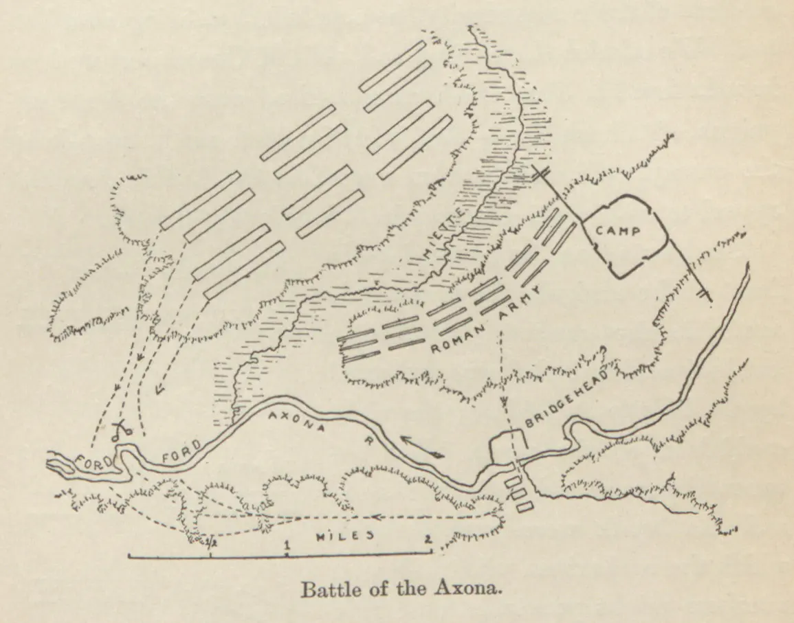 B18. The Axona: alternative modern reconstruction. Modern schematic illustration; specific unit positions… In W040 Caesar's Gallic wars
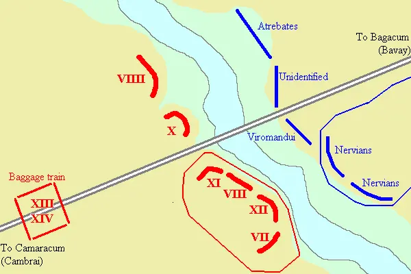 B19. The Sabis: conventional battle reconstruction. Modern schematic illustration; specific unit positions… In W040 Caesar's Gallic wars
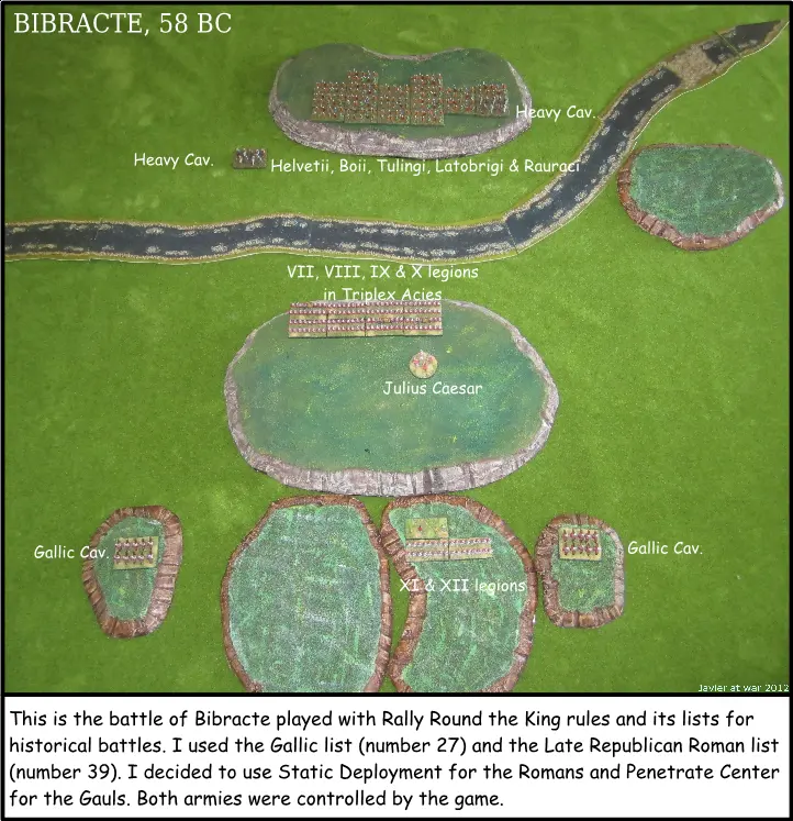 B21. Bibracte: conventional battle reconstruction. Modern schematic illustration; specific unit positions… In W040 Caesar's Gallic wars
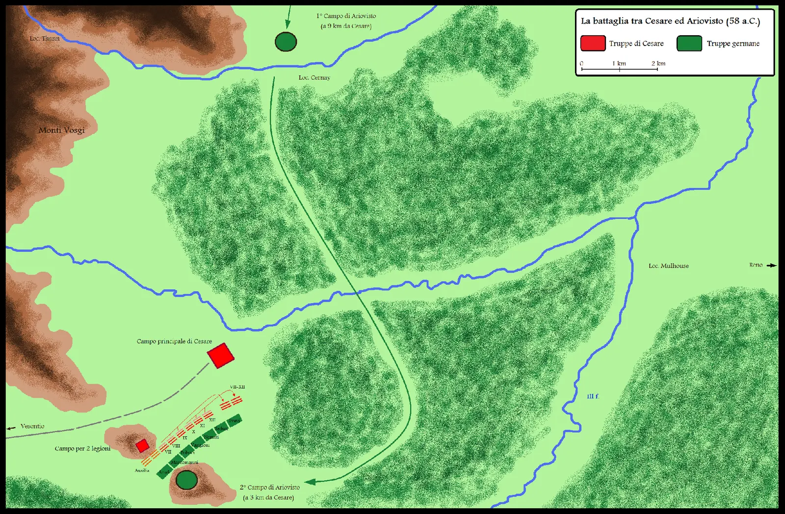 B22. The Ariovistus campaign: conventional reconstruction. Modern schematic illustration; specific unit… In W040 Caesar's Gallic wars
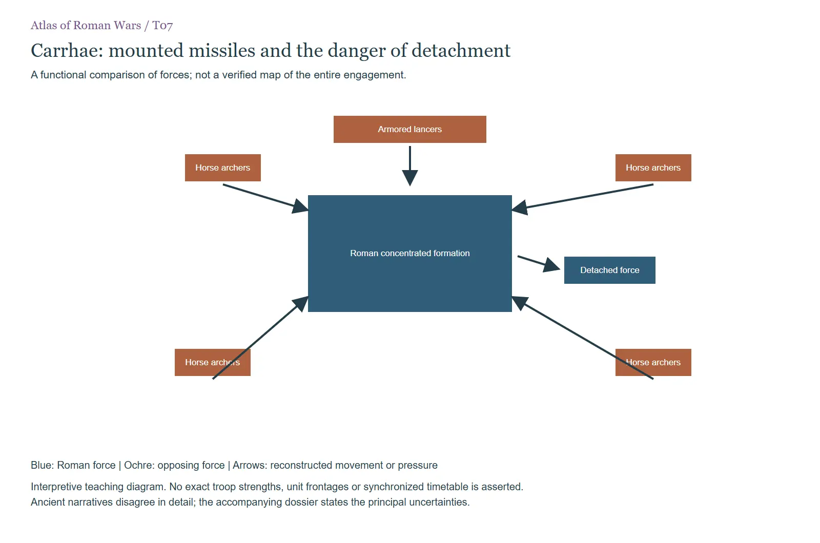 T07. A functional comparison of forces; not a verified map of the entire engagement. In W041 Crassus and the Parthian disaster at Carrhae
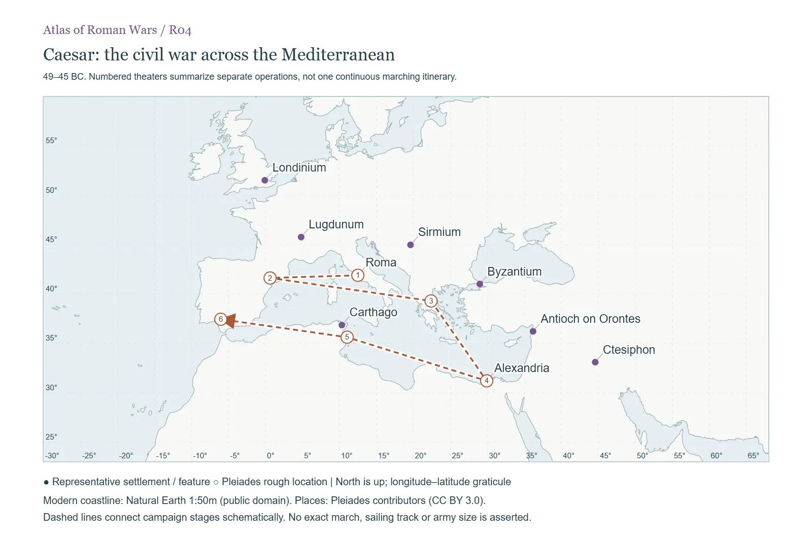 R04. 49–45 BC. Numbered theaters summarize separate operations, not one continuous marching itinerary. In W042 Caesar's civil war and the wars of the Caesarian corpus
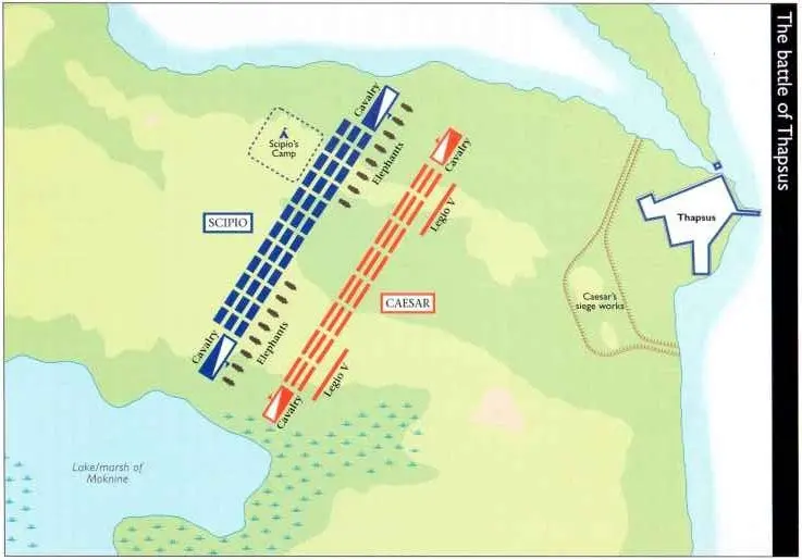 B13. Thapsus: a conventional tactical reconstruction. Modern schematic illustration; specific unit positions… In W042 Caesar's civil war and the wars of the Caesarian corpus
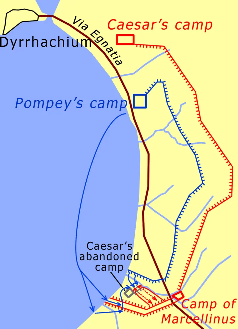 B14. Dyrrhachium: camps, lines and coastal constraints. Modern schematic illustration; specific unit… In W042 Caesar's civil war and the wars of the Caesarian corpus
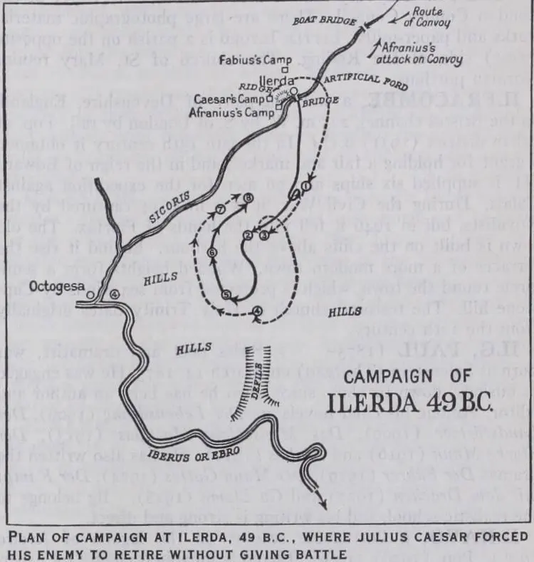 B15. Ilerda: operations around the river crossings. Modern schematic illustration; specific unit positions… In W042 Caesar's civil war and the wars of the Caesarian corpus
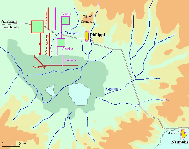 B11. Philippi: the two opposing army positions. Modern schematic illustration; specific unit positions… In W043 The wars after Caesar: Mutina, Philippi and Perusia
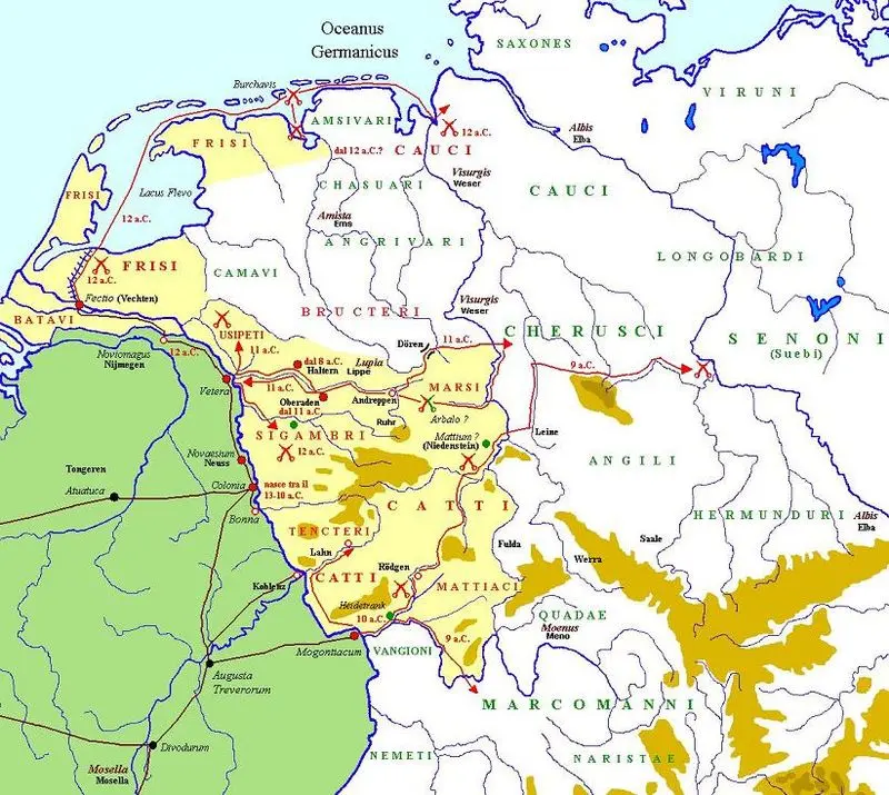 B01. Drusus and the German theater. Modern schematic illustration; specific unit positions, distances and… In W046 Augustus' western, Alpine and Danubian conquests
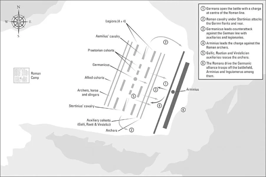 B02. The Angrivarian Wall: modern tactical reconstruction. Modern schematic illustration; specific unit… In W049 Varus' defeat and Germanicus' campaigns
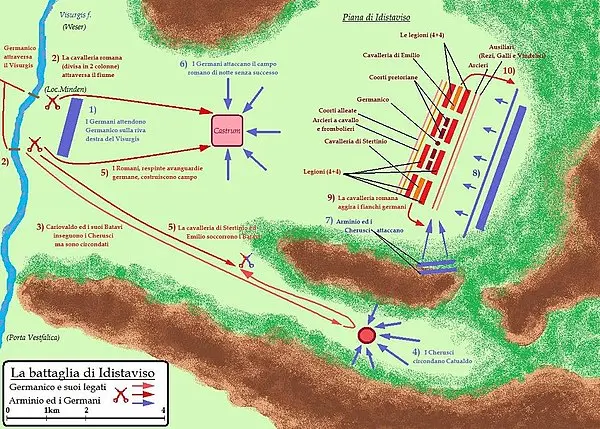 B03. Idistaviso: modern tactical reconstruction. Modern schematic illustration; specific unit positions… In W049 Varus' defeat and Germanicus' campaigns
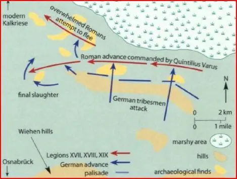 B25. Kalkriese and interpretations of the Varus disaster. Modern schematic illustration; specific unit… In W049 Varus' defeat and Germanicus' campaigns
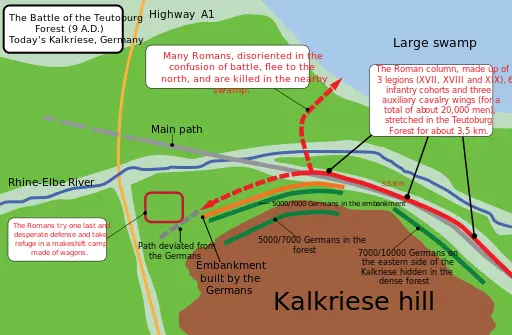 B26. Kalkriese and interpretations of the Varus disaster. Modern schematic illustration; specific unit… In W049 Varus' defeat and Germanicus' campaigns
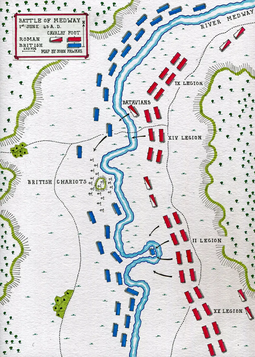 B12. The conventional Medway battle reconstruction. Modern schematic illustration; specific unit positions… In W051 The conquest of Britain and Agricola's northern campaigns
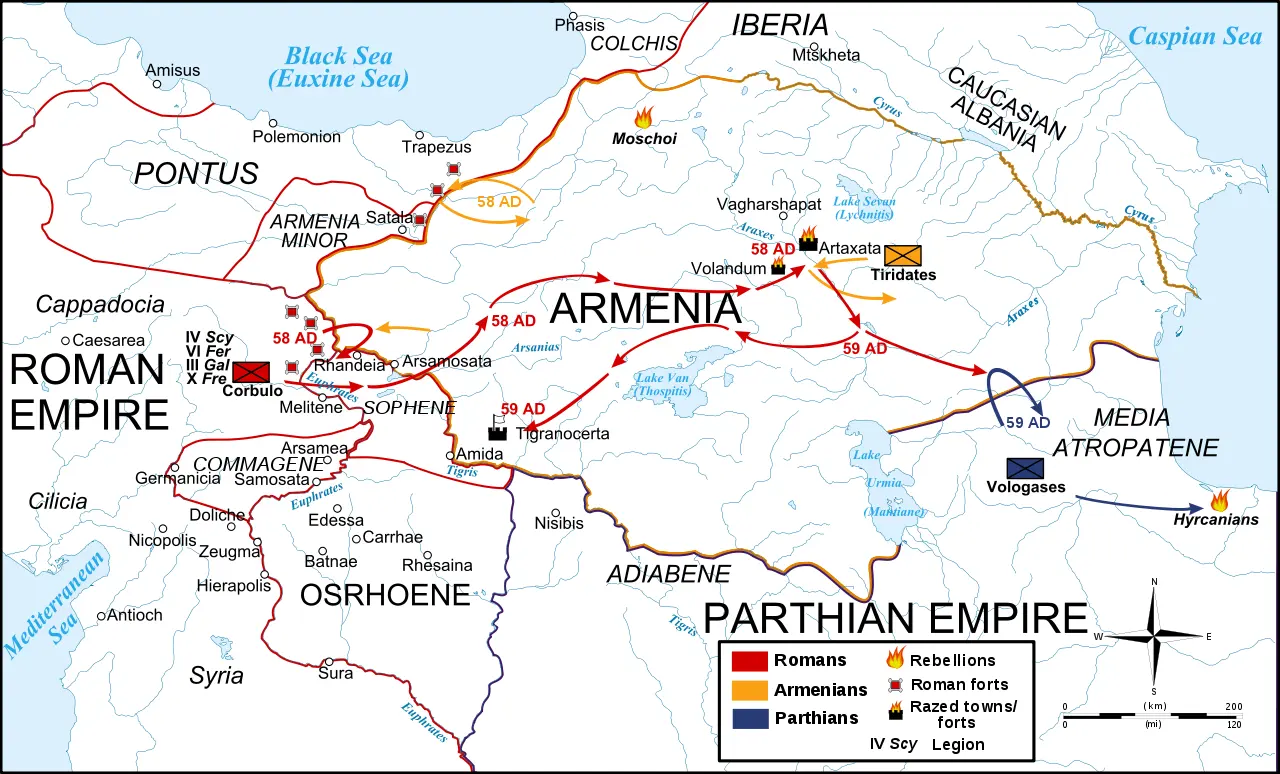 B20. Corbulo and the Armenian theater. Modern schematic illustration; specific unit positions, distances and… In W053 Corbulo, Armenia and the Parthian settlement
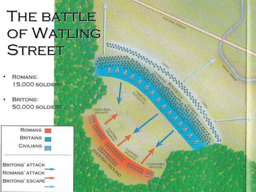 B23. Boudica: conceptual deployment only; the final battlefield is unlocated. Modern schematic illustration… In W052 Boudica's revolt
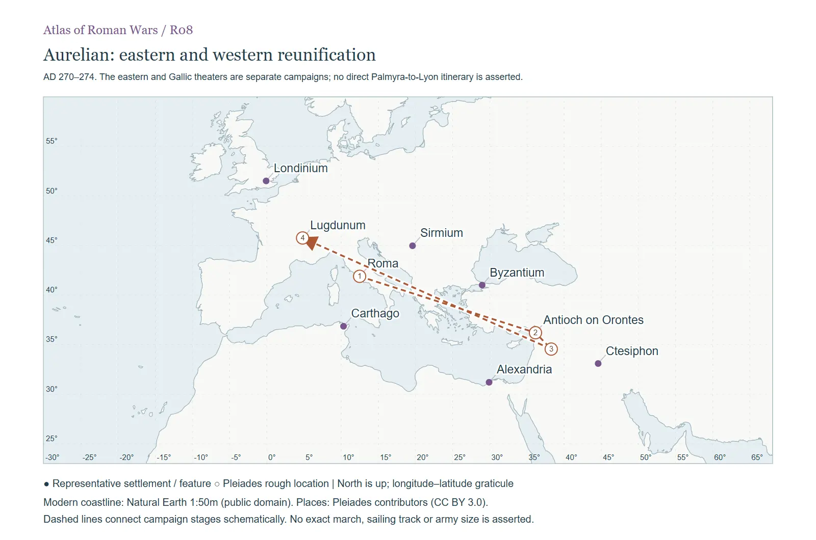 R08. AD 270–274. The eastern and Gallic theaters are separate campaigns; no direct Palmyra-to-Lyon itinerary… In W067 Aurelian's reunification wars
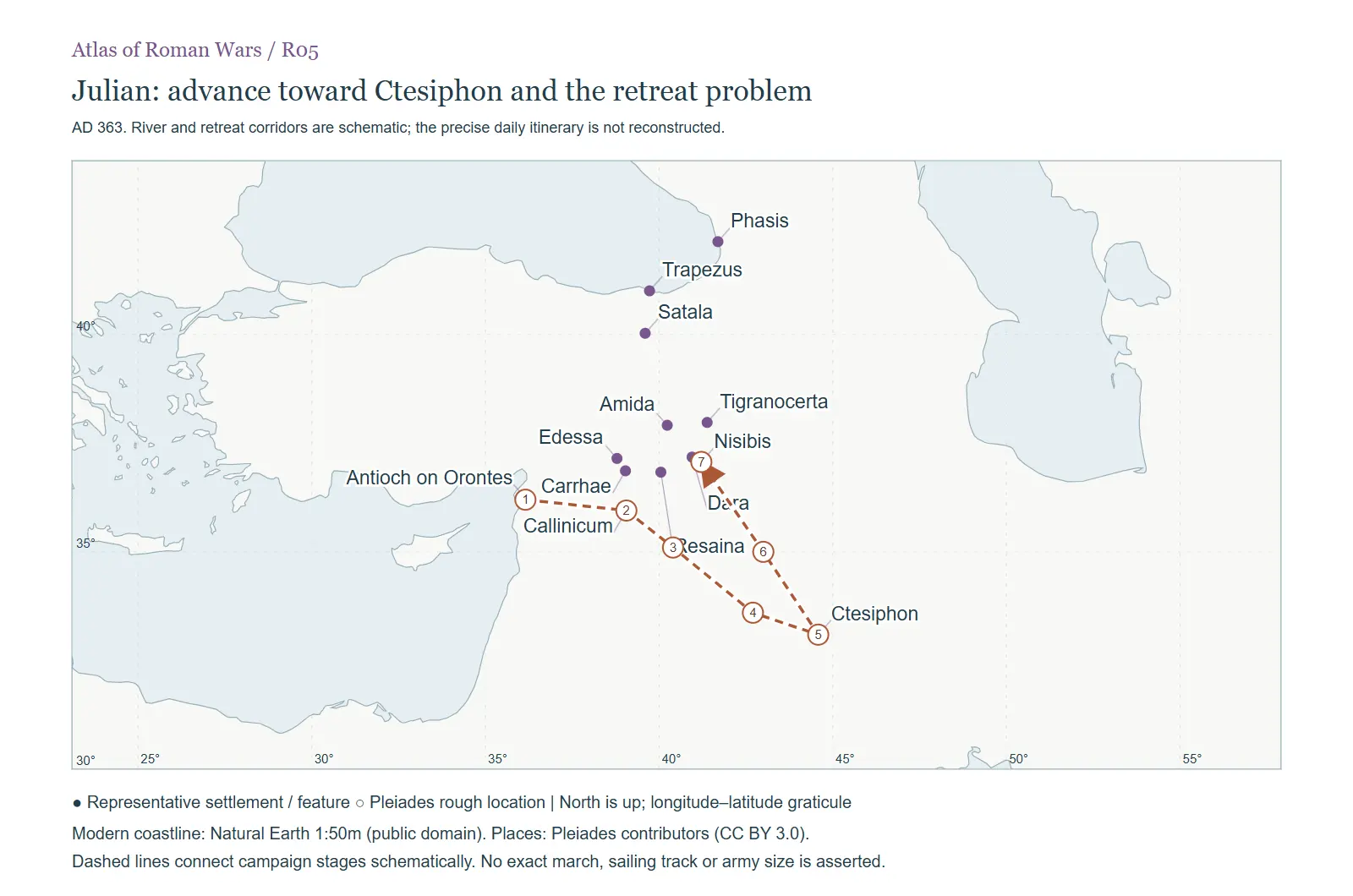 R05. AD 363. River and retreat corridors are schematic; the precise daily itinerary is not reconstructed. In W073 Julian's Persian expedition
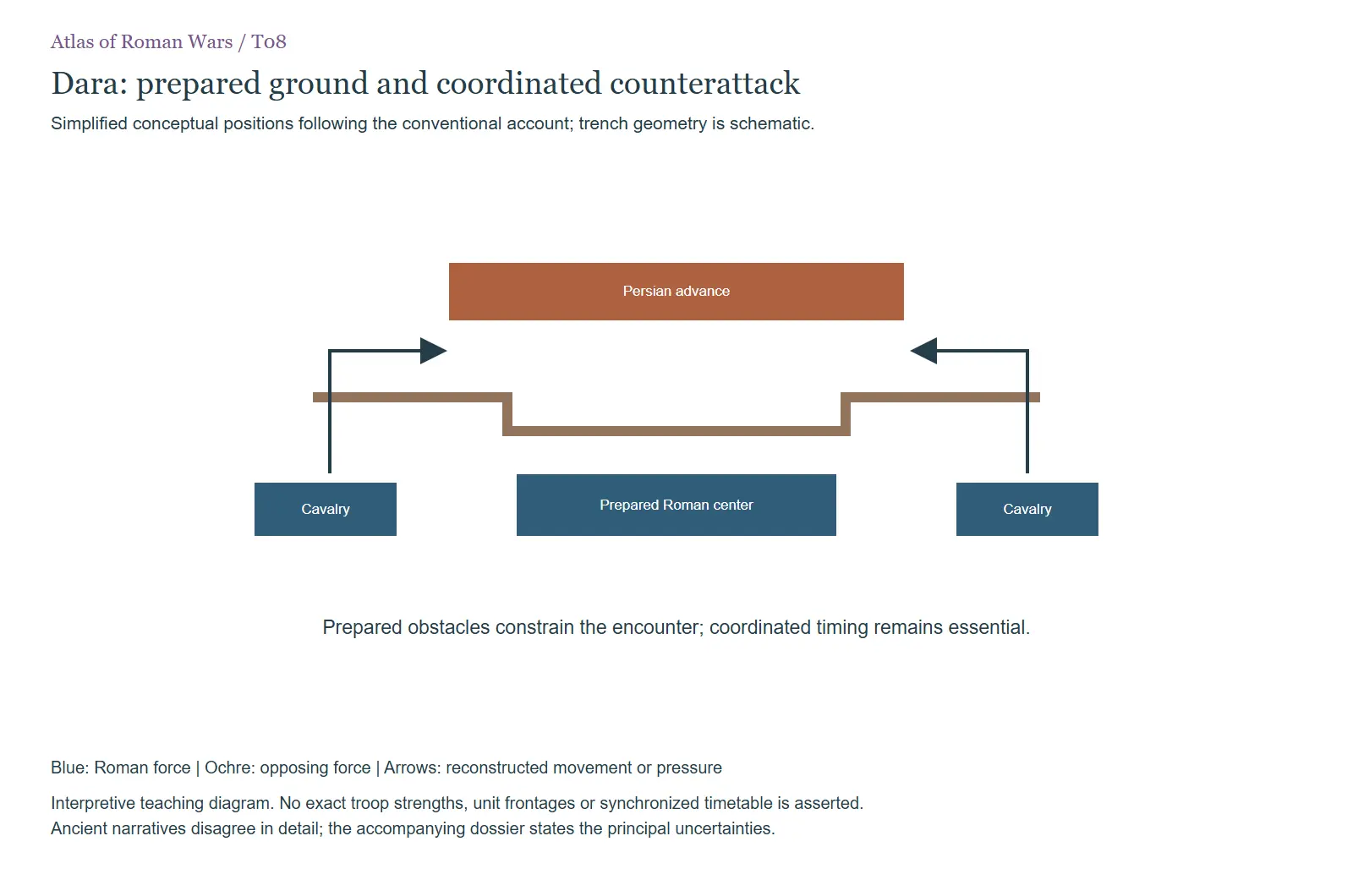 T08. Simplified conceptual positions following the conventional account; trench geometry is schematic. In W087 The Iberian war: Dara and Callinicum
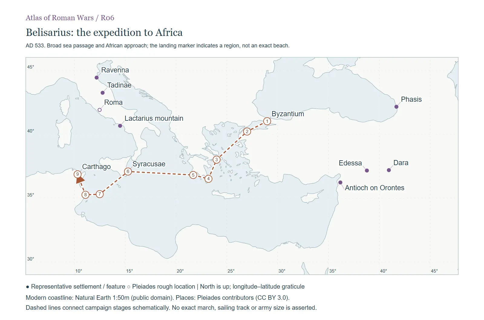 R06. AD 533. Broad sea passage and African approach; the landing marker indicates a region, not an exact… In W090 The Vandalic war
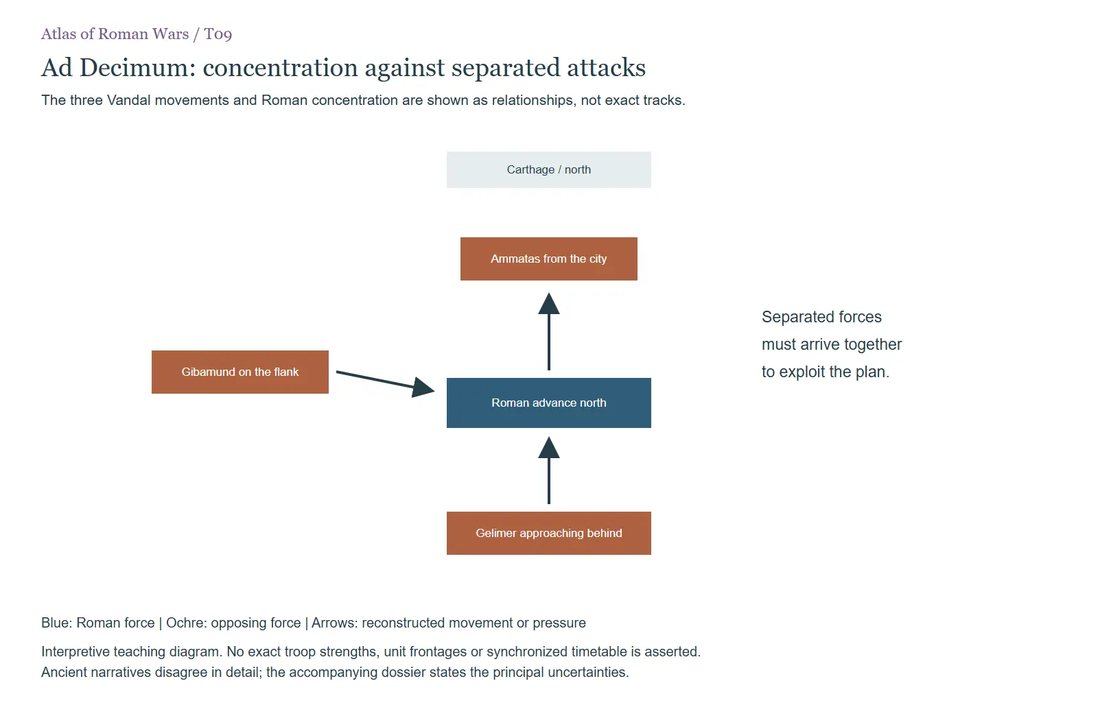 T09. The three Vandal movements and Roman concentration are shown as relationships, not exact tracks. In W090 The Vandalic war
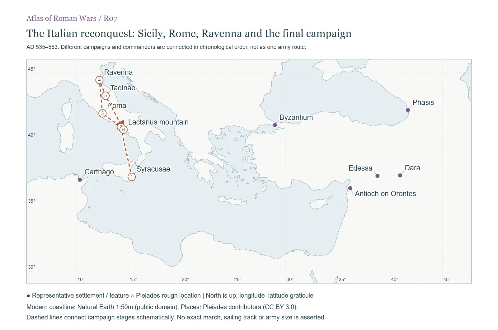 R07. AD 535–553. Different campaigns and commanders are connected in chronological order, not as one army… In W091 The Gothic war for Italy
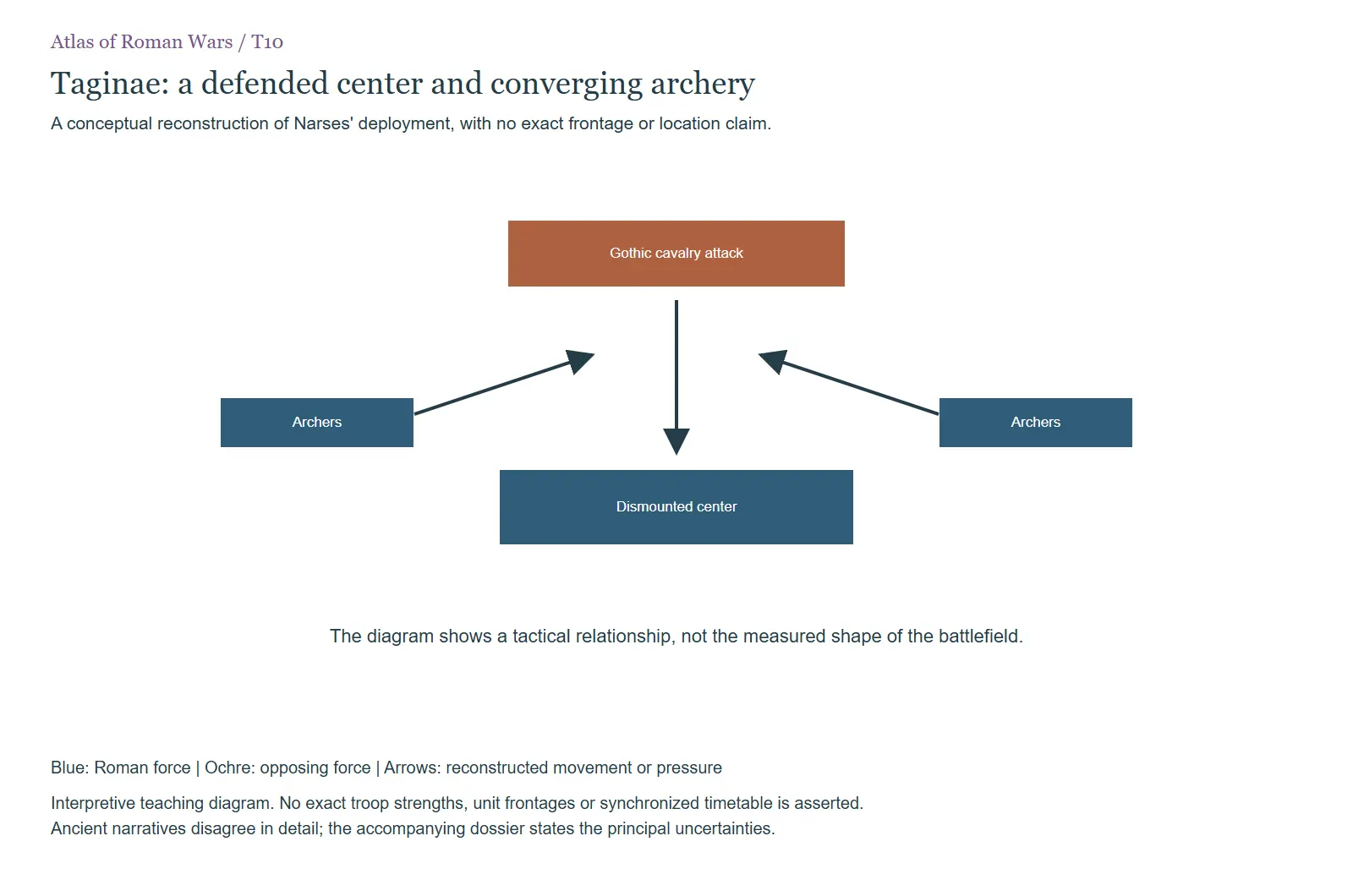 T10. A conceptual reconstruction of Narses' deployment, with no exact frontage or location claim. In W091 The Gothic war for Italy
Legions From the legions compendium
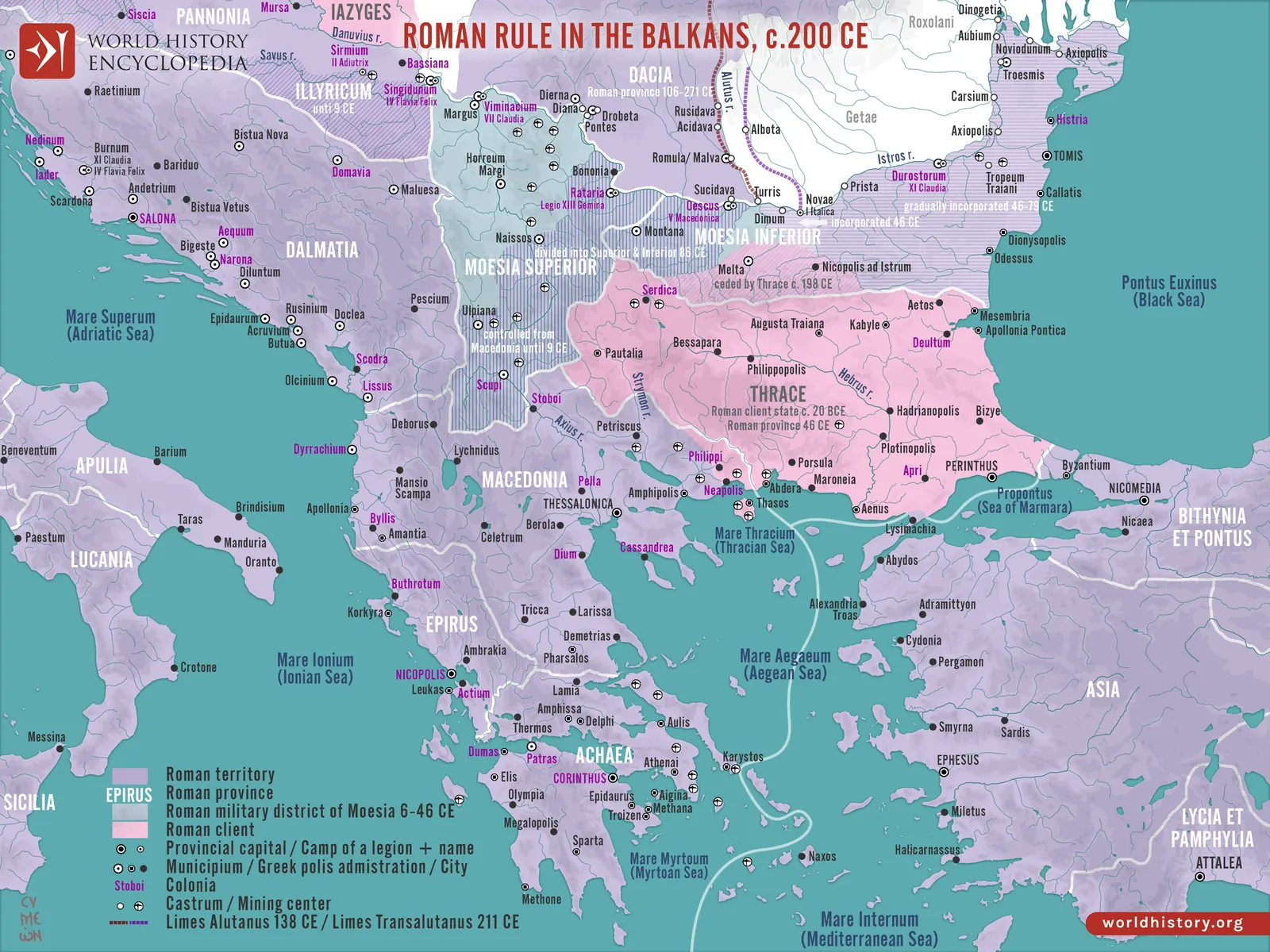 Roman military geography in the Balkans around 200 CE. The map provides regional context for the Danubian… In 01 Legio I Adiutrix
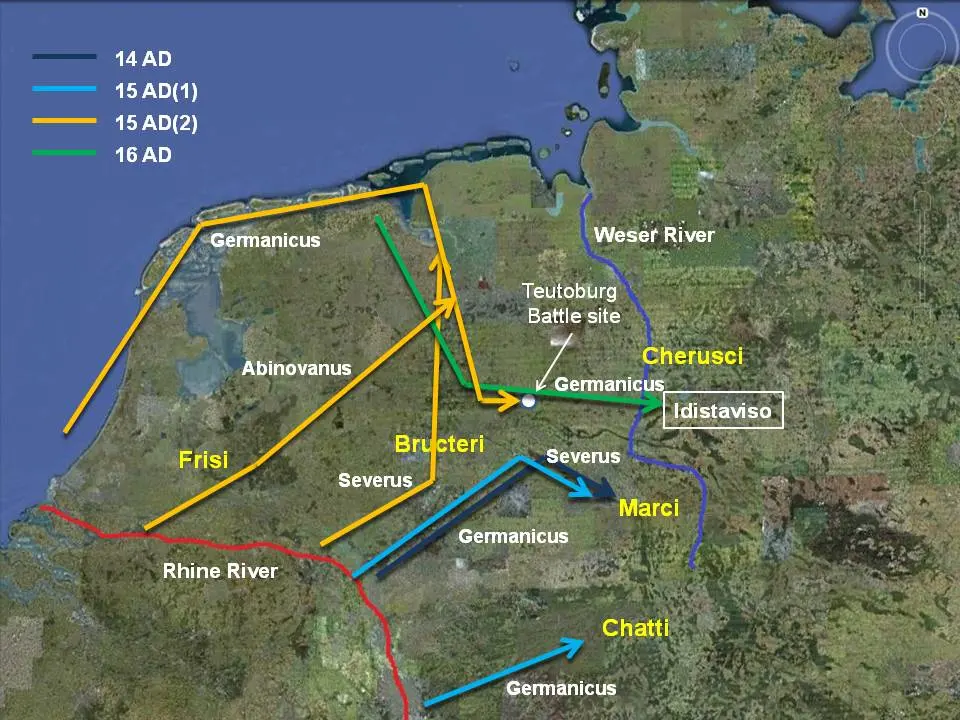 A schematic reconstruction of Germanicus’ campaigns, 14–16. Routes are explanatory reconstructions of army… In 02 Legio I Germanica
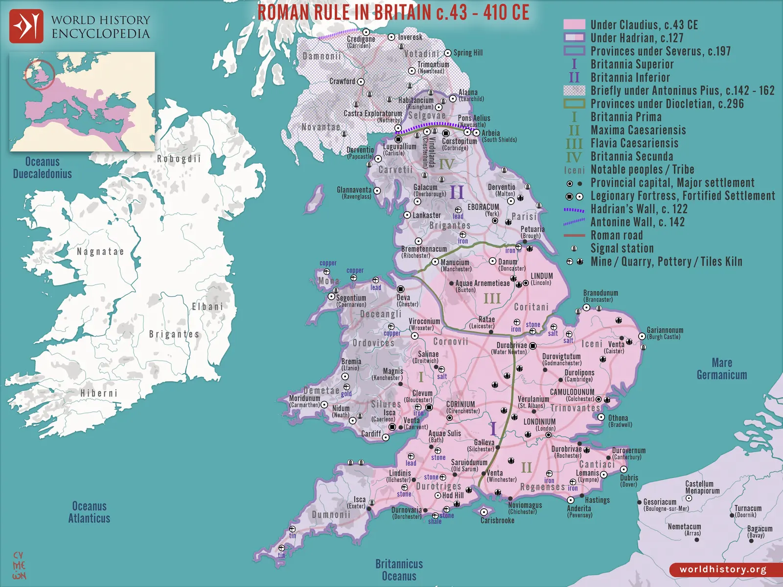 Roman Britain across several phases of conquest, frontier construction, and later administration. Read the… In 08 Legio II Augusta
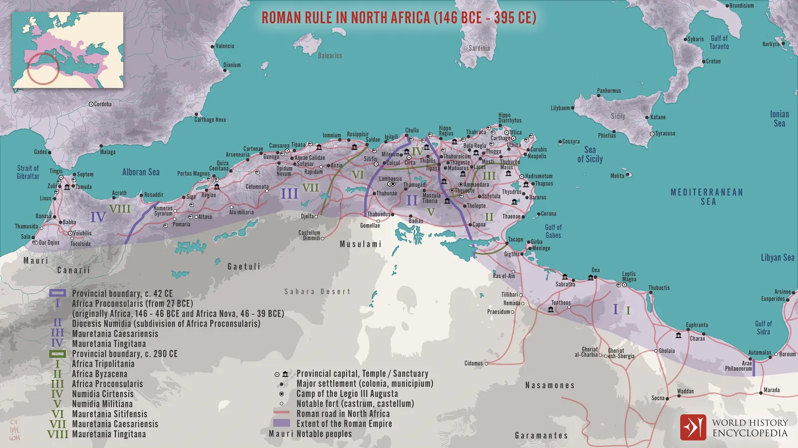 North African provinces, cities, and routes over several historical phases. III Augusta’s headquarters… In 12 Legio III Augusta
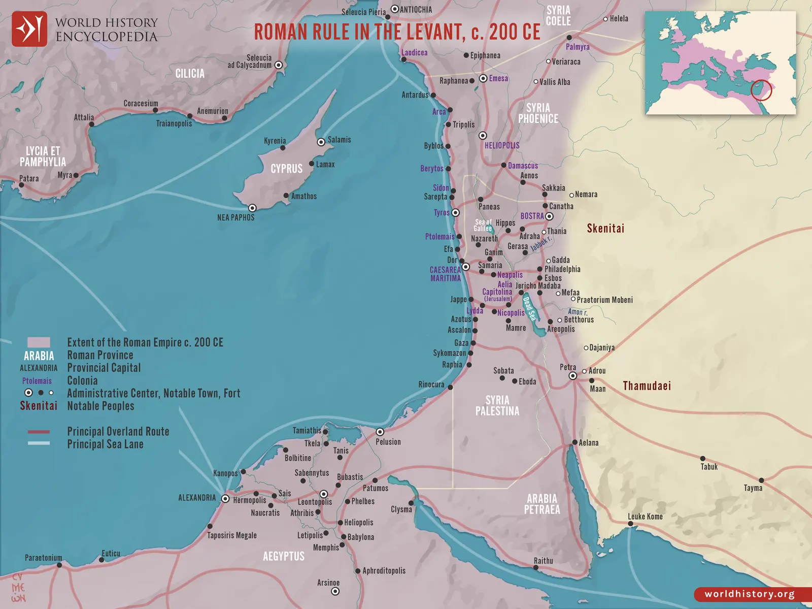 The Levant around 200 CE: cities, roads, and provincial geography. The map’s Severan-era setting should not… In 15 Legio III Gallica
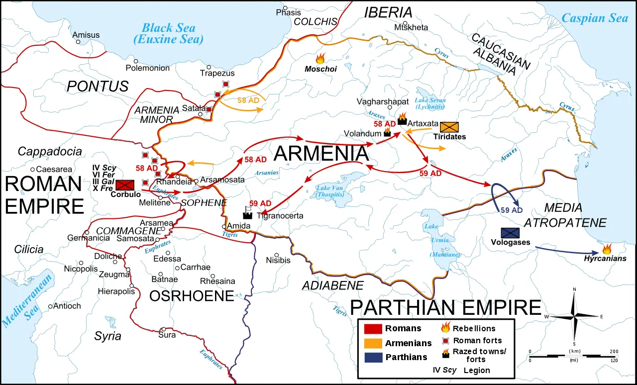 A reconstruction of the Armenian campaigns of 58–59. The wider Armenian war also included Paetus’ later and… In 20 Legio IV Scythica
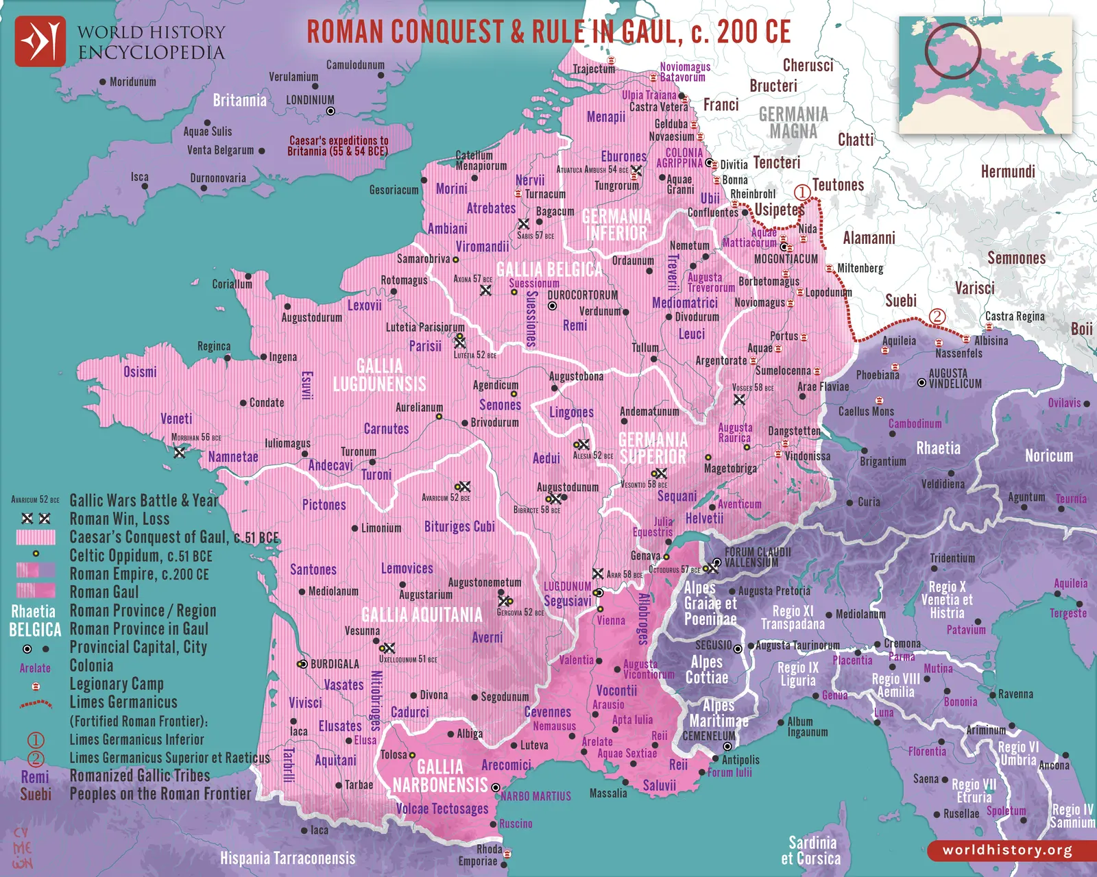 Gaul and its communications around 200 CE, with earlier conquest context. The Eighth’s Caesarian service and… In 27 Legio VIII Augusta
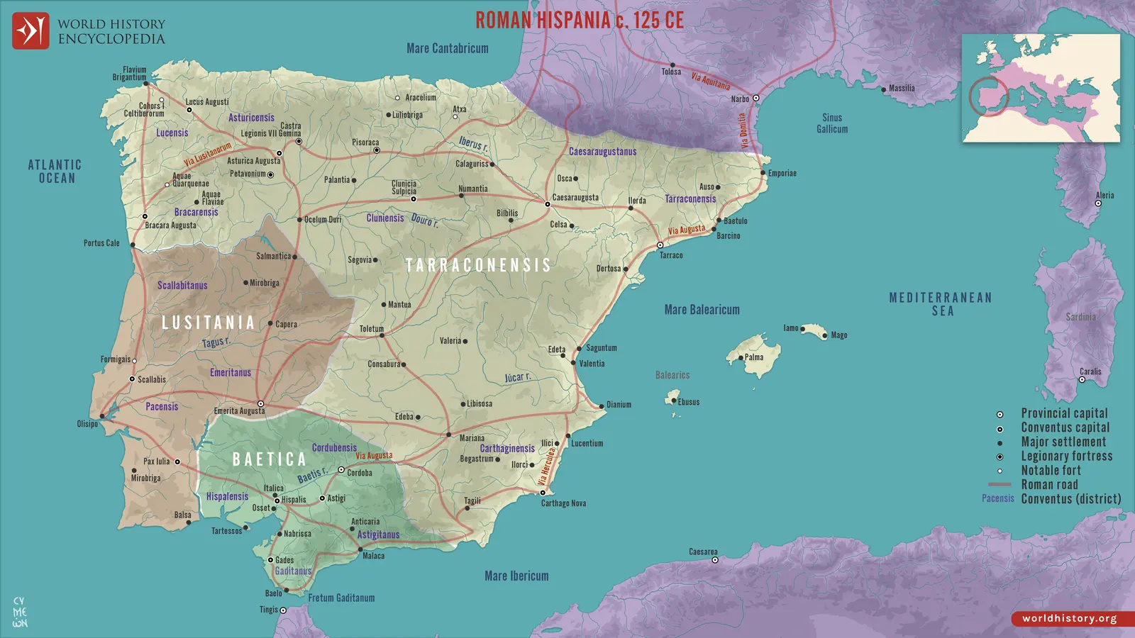 Roman Hispania around 125 CE, showing the provincial and communications landscape associated with several… In 28 Legio IX Hispana
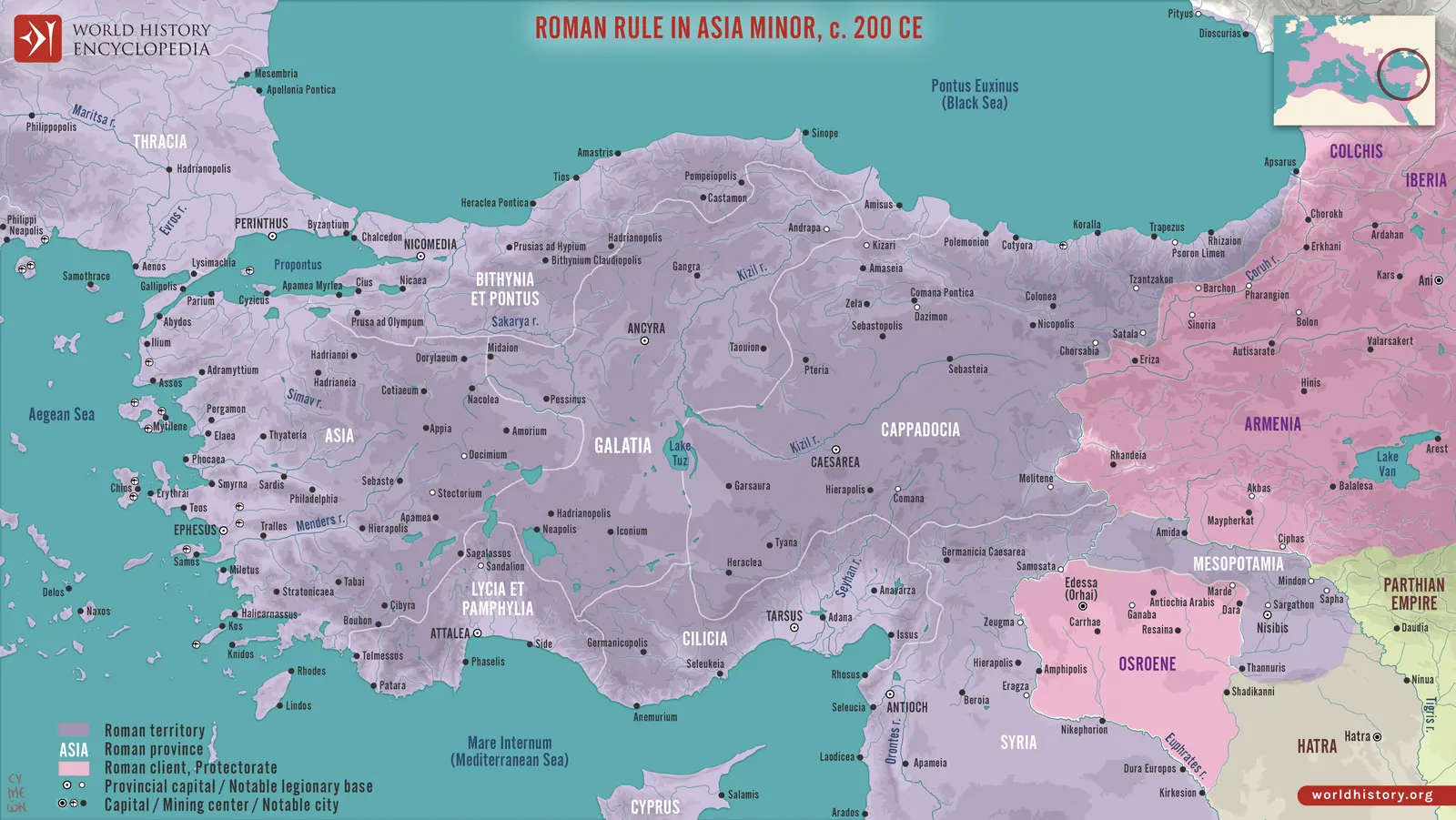 Asia Minor around 200 CE, including the Cappadocian and Armenian approaches. Satala and Melitene belong to a… In 35 Legio XV Apollinaris
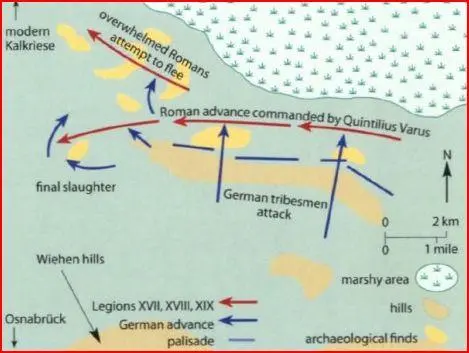 A schematic reconstruction of fighting in the Varian disaster’s landscape. The broad event and the detailed… In 39 Legio XVII
Provinces From the provinces compendium
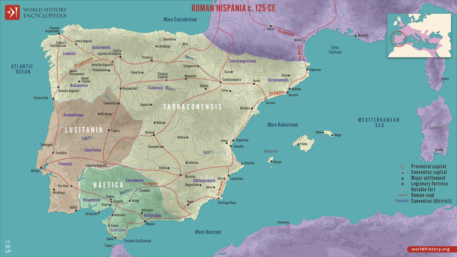 Hispania around 125 CE: the principal imperial provinces, cities, roads, and judicial districts. In Provinces
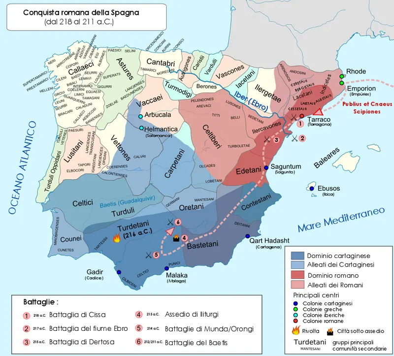 The opening Iberian theatre, 218–211 BCE. Roman footholds on the northeastern coast confronted Carthaginian… In RP-04 Hispania Citerior and Hispania Ulterior
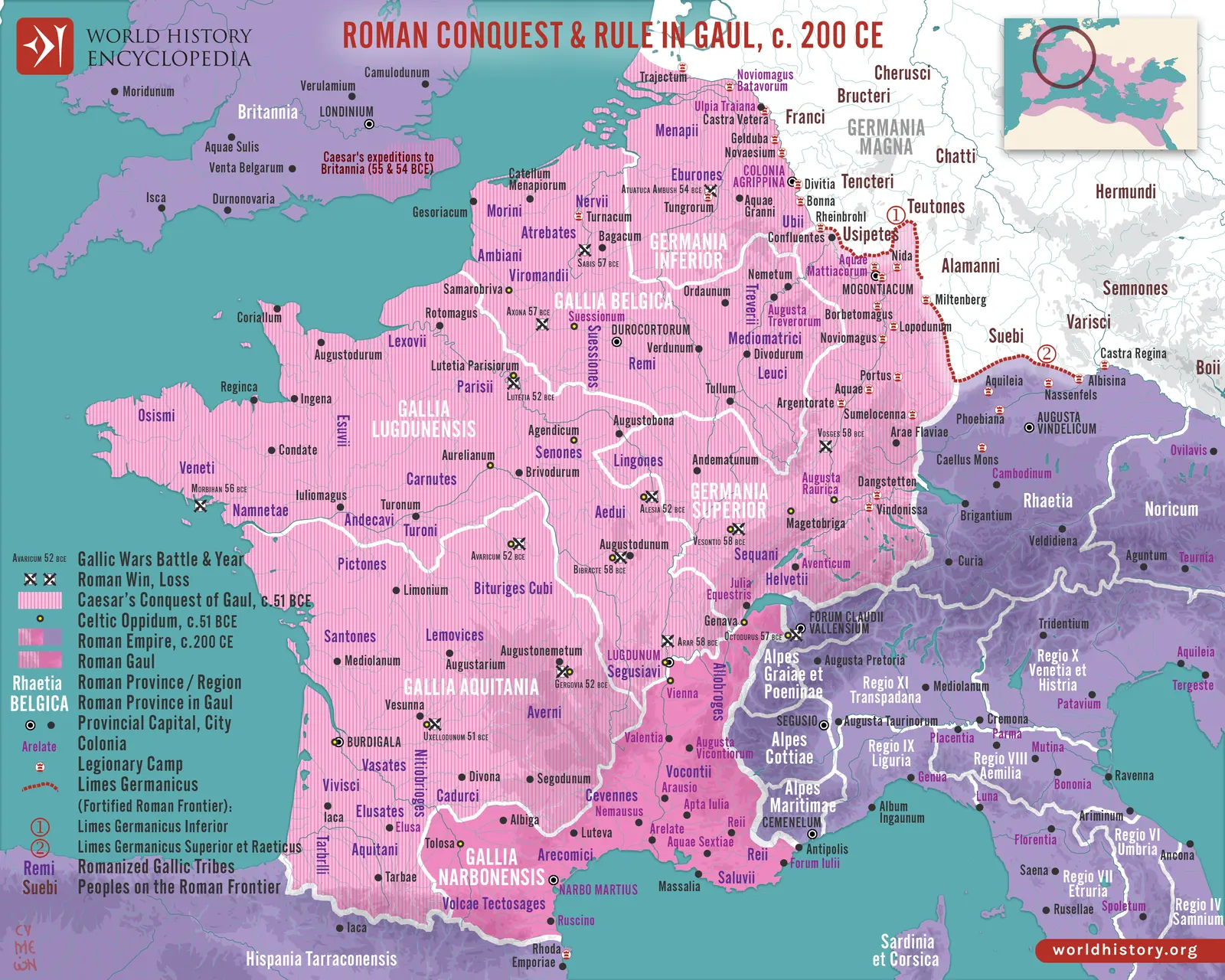 Imperial Gaul and the Rhine around 200 CE, with earlier campaigns superimposed. The different layers… In Provinces
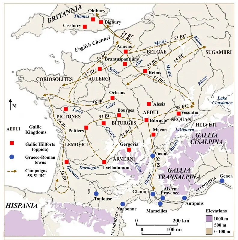 The Gallic conquest, 58–51 BCE. Campaigns crossed river systems and the territories of existing communities… In Provinces
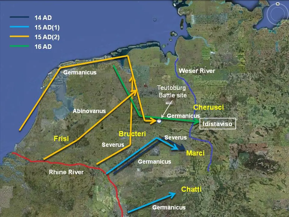 Germanicus’s campaigns, 14–16 CE. The Rhine, North Sea approaches, and inland river corridors explain how… In RP-14 The Augustan Germania beyond the Rhine
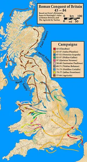 Britain’s successive campaigns, 43–84 CE. The routes distinguish the initial invasion from later operations… In RP-15 Britannia
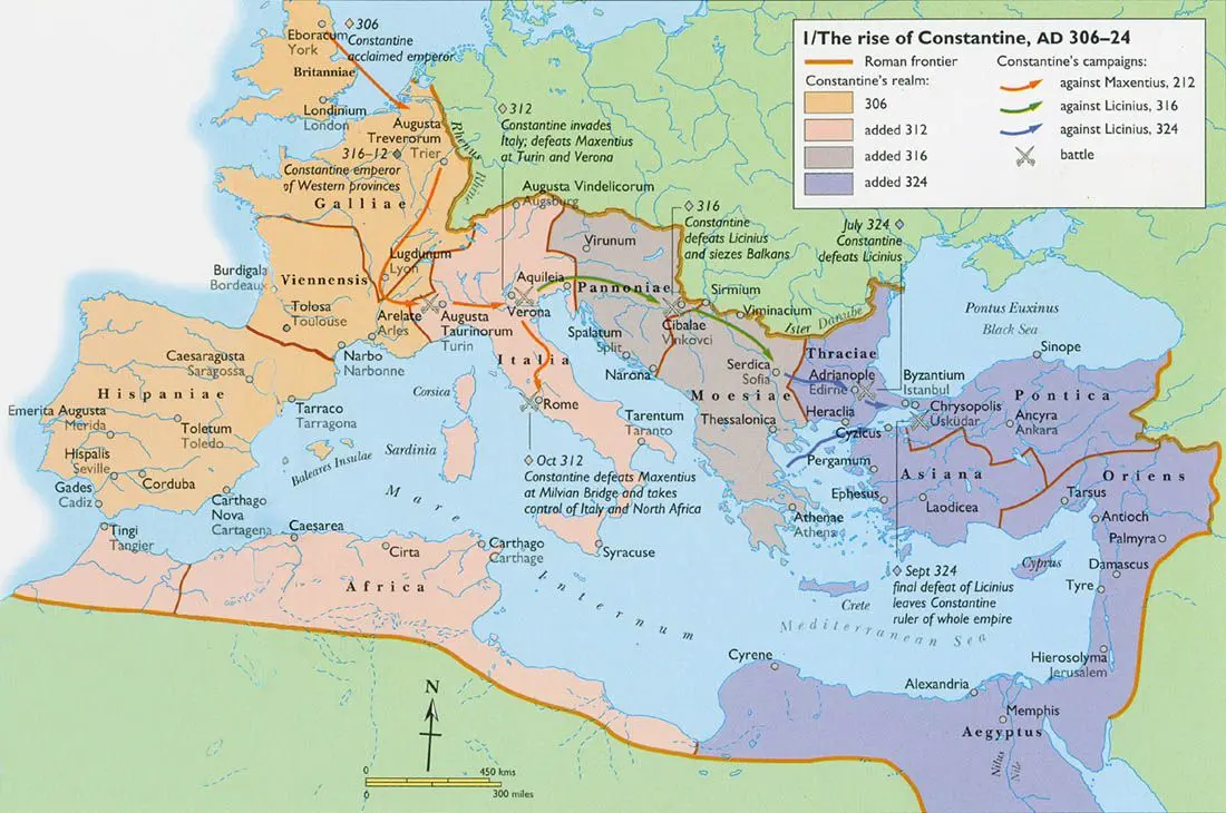 Constantine’s rise, 306–324 CE. The Danubian corridor and Sirmium linked western and eastern imperial power.… In RP-22 Pannonia: Superior, Inferior, and their successors
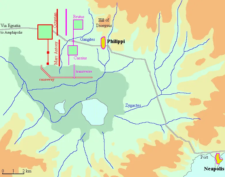 Philippi, 42 BCE: civil war within a provincial landscape. The Via Egnatia, marshland, hill positions, and… In RP-26 Macedonia
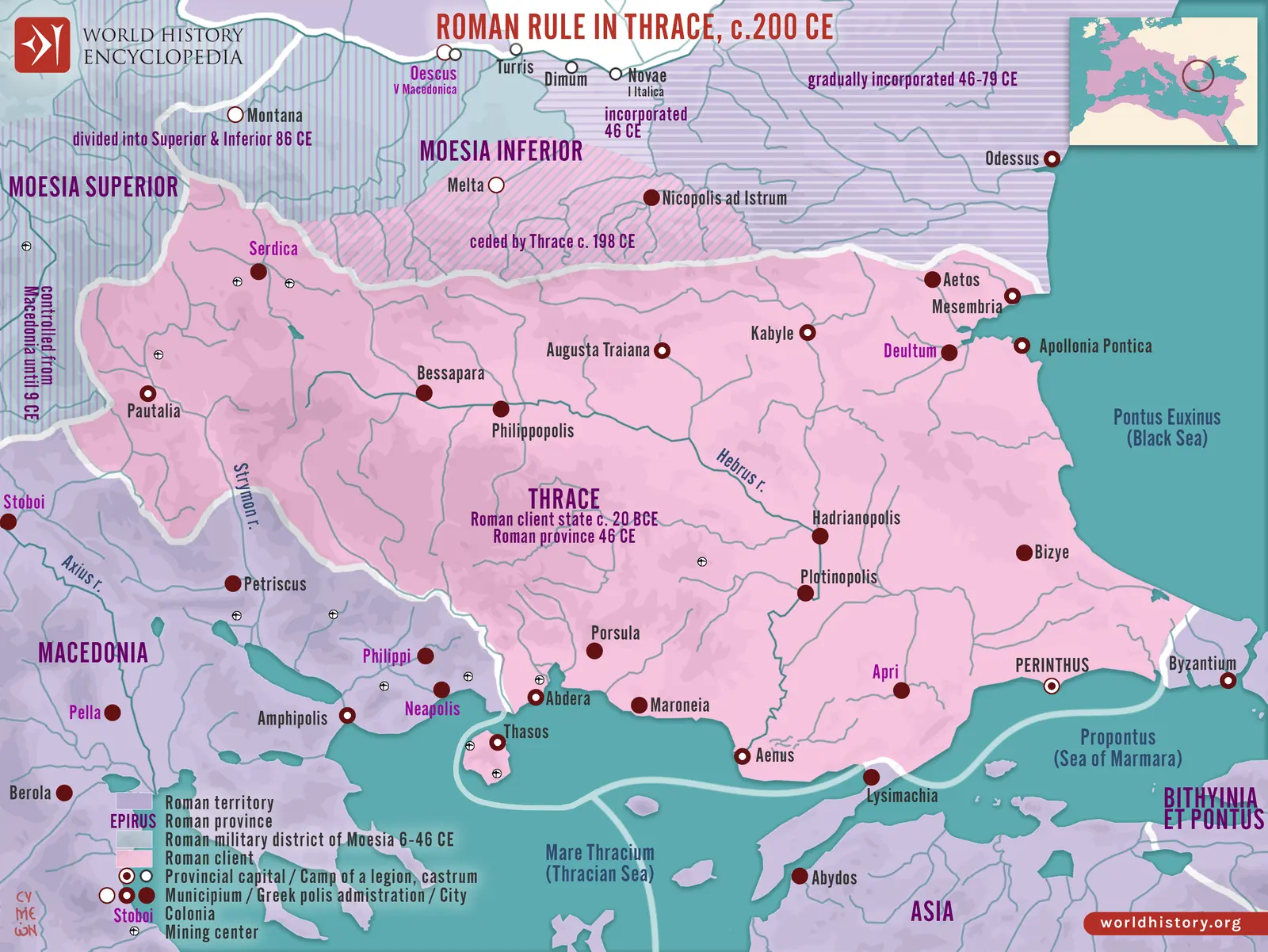 Thrace and its neighbours around 200 CE. The Hebrus valley, mountain barriers, Aegean coast, and approaches… In RP-29 Thracia
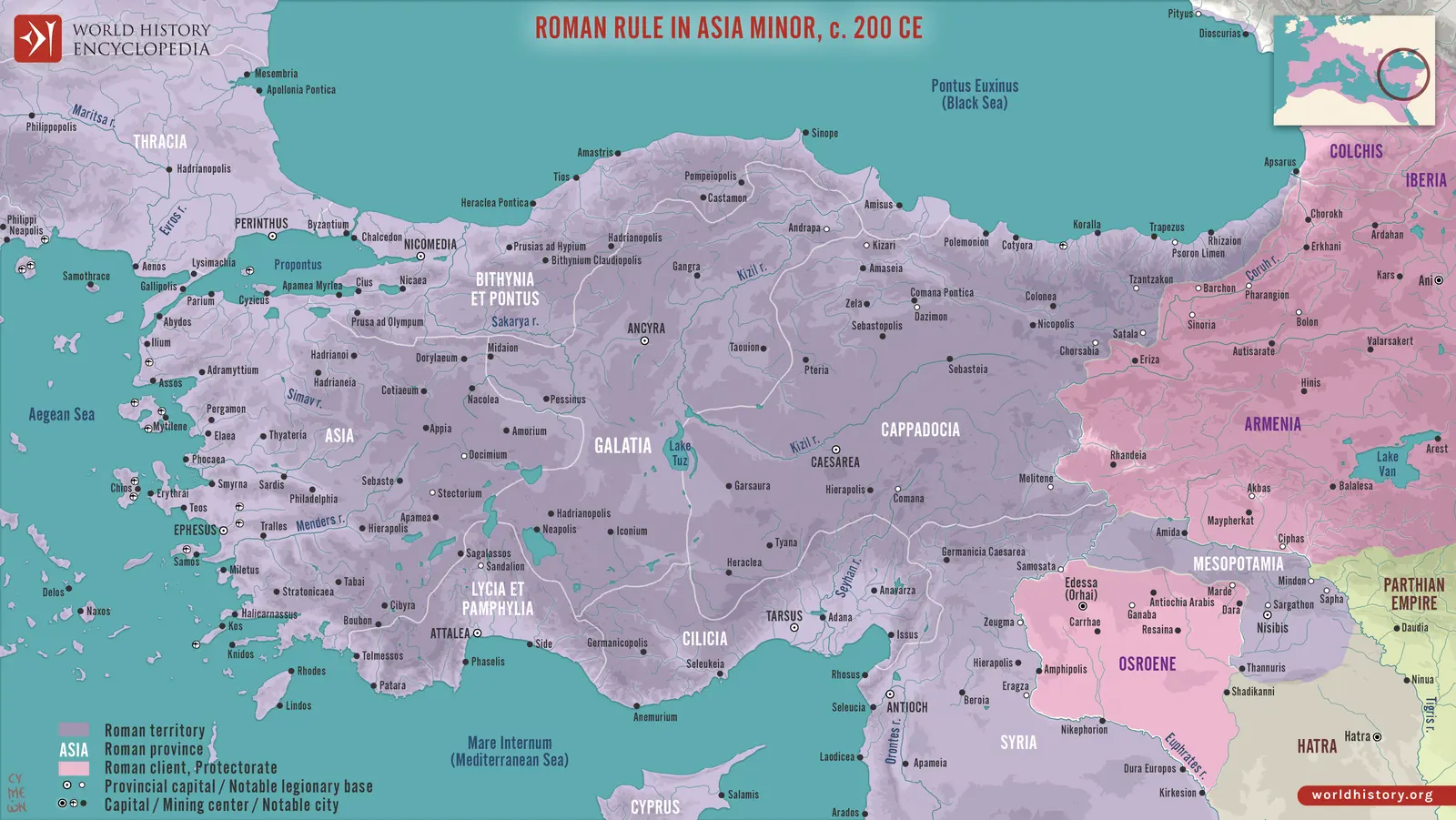 Anatolian cities, routes, and provincial regions around 200 CE. Eastern client and provincial relationships… In Provinces
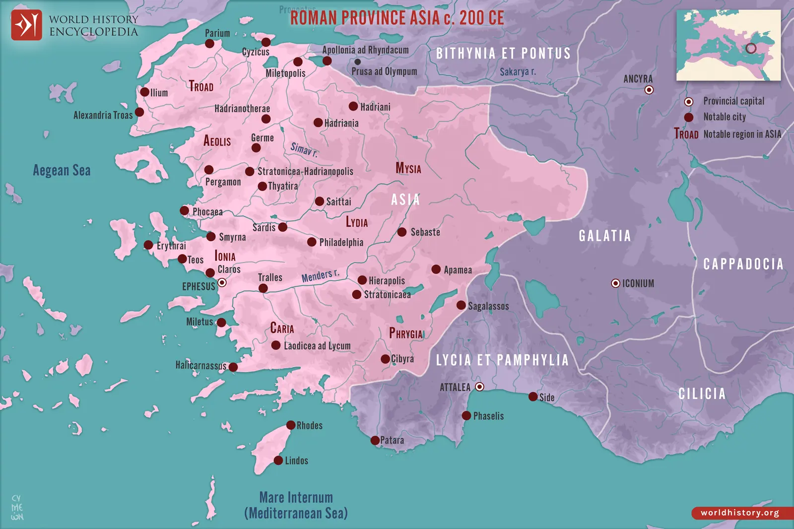 Asia around 200 CE. Ephesus, Smyrna, Pergamum, Sardis, and the inland cities belonged to a dense civic… In RP-30 Asia
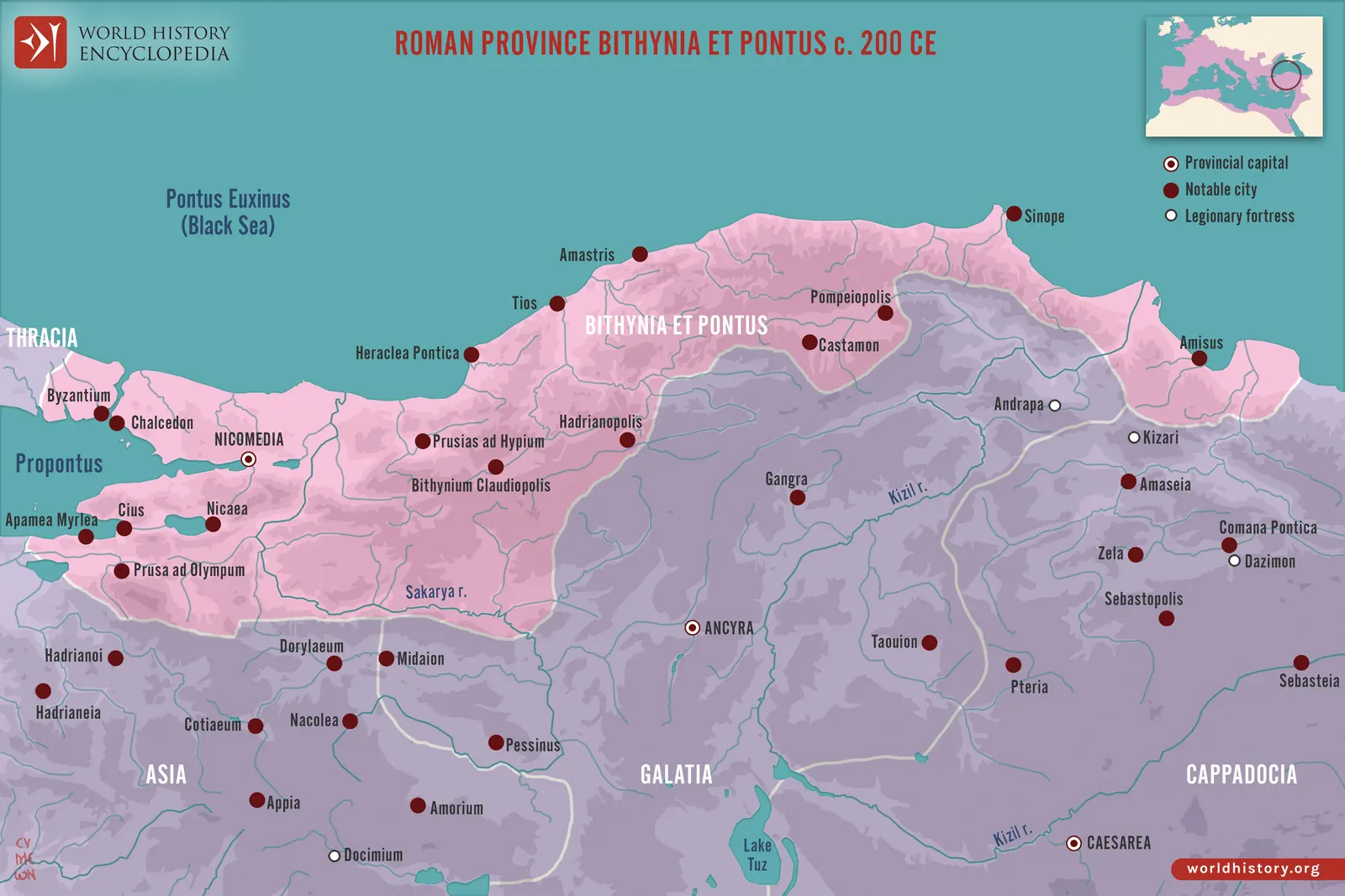 Bithynia et Pontus around 200 CE. The long Black Sea frontage joined western Bithynian cities with eastern… In RP-31 Bithynia et Pontus
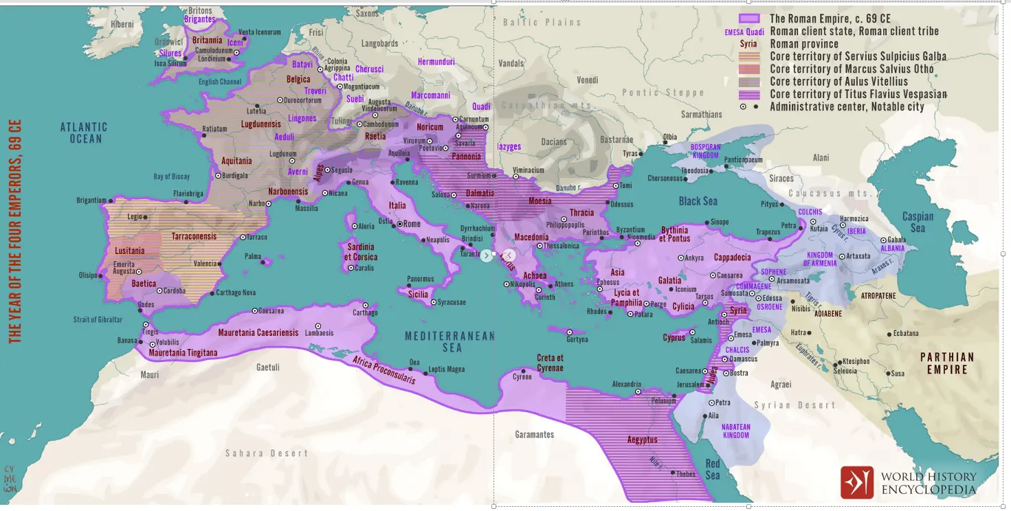 The provincial power bases of 69 CE. Spain, the Rhine armies, Italy, and the eastern commands supplied… In RP-38 Syria, Syria Coele, and Syria Phoenice
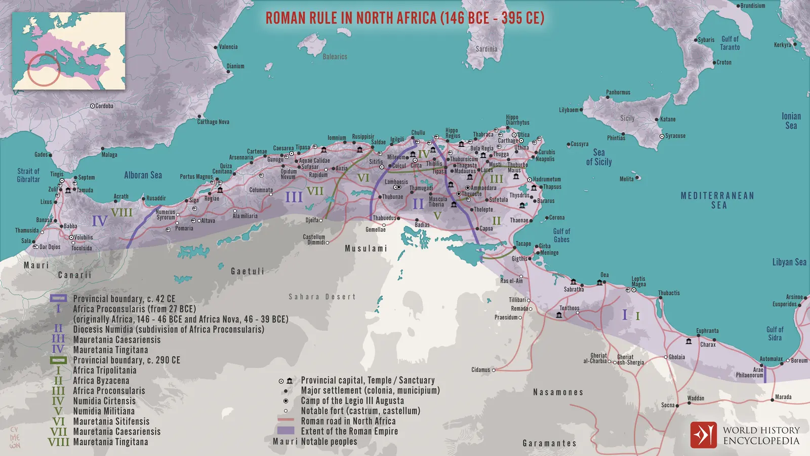 North African cities, roads, and successive provincial divisions. The plate combines early and late… In Provinces
 The empire around 400 CE. The broad colours represent prefectural groupings, while regional names, major… In Provinces
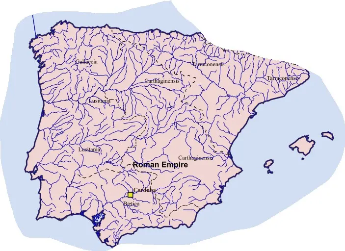 Late Roman Iberia: rivers and provincial subdivision. Gallaecia and Carthaginiensis distinguish this… In Provinces
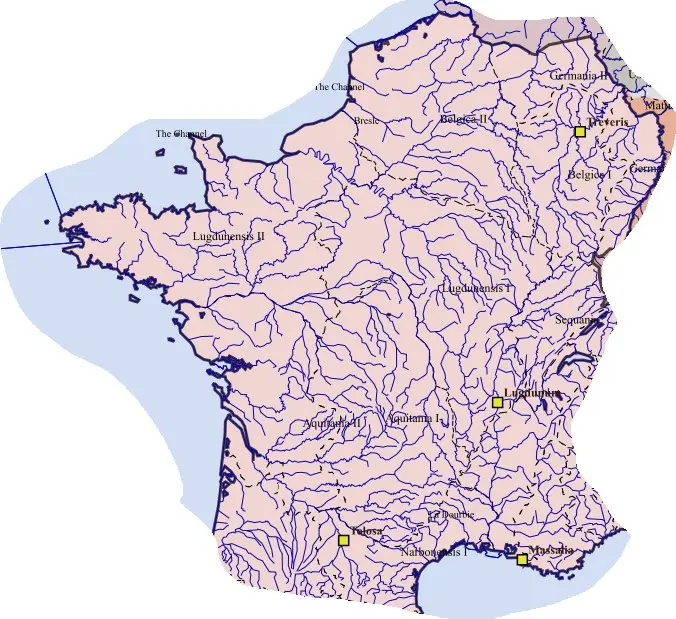 Gaul during an earlier stage of late imperial subdivision. The Rhône–Saône, Loire, Seine, Garonne, and Rhine… In LW-11 Germania Secunda
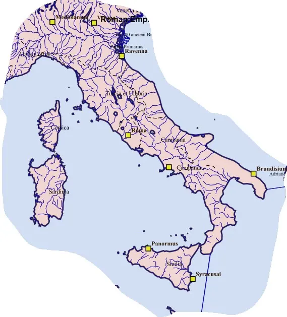 Peninsular Italy and the central Mediterranean islands. The Apennines divide river basins and coastal… In LW-36 Raetia Secunda
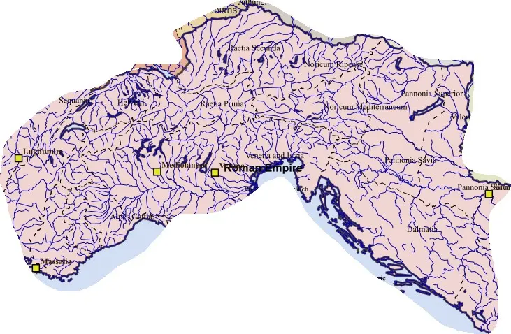 From the Alpine passes to the Pannonian plain. Northern Italy, Raetia, Noricum, Dalmatia, and the Pannonian… In LW-46 Corsica
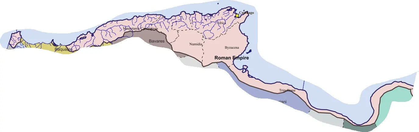 The central African coast and its hinterlands. Carthage, Numidia, Byzacena, and Tripolitania occupy… In LW-53 Noricum Mediterraneum
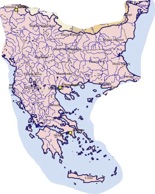 The later Balkan provincial landscape. Dacia south of the Danube, the two Epiri, Thessaly, Macedonia, Achaia… In Provinces
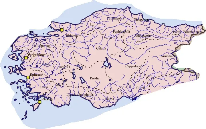 Anatolia in an early late-imperial administrative layer. Hellespontus, Lydia, Caria, and the divided Phrygias… In LE-18 Scythia Minor
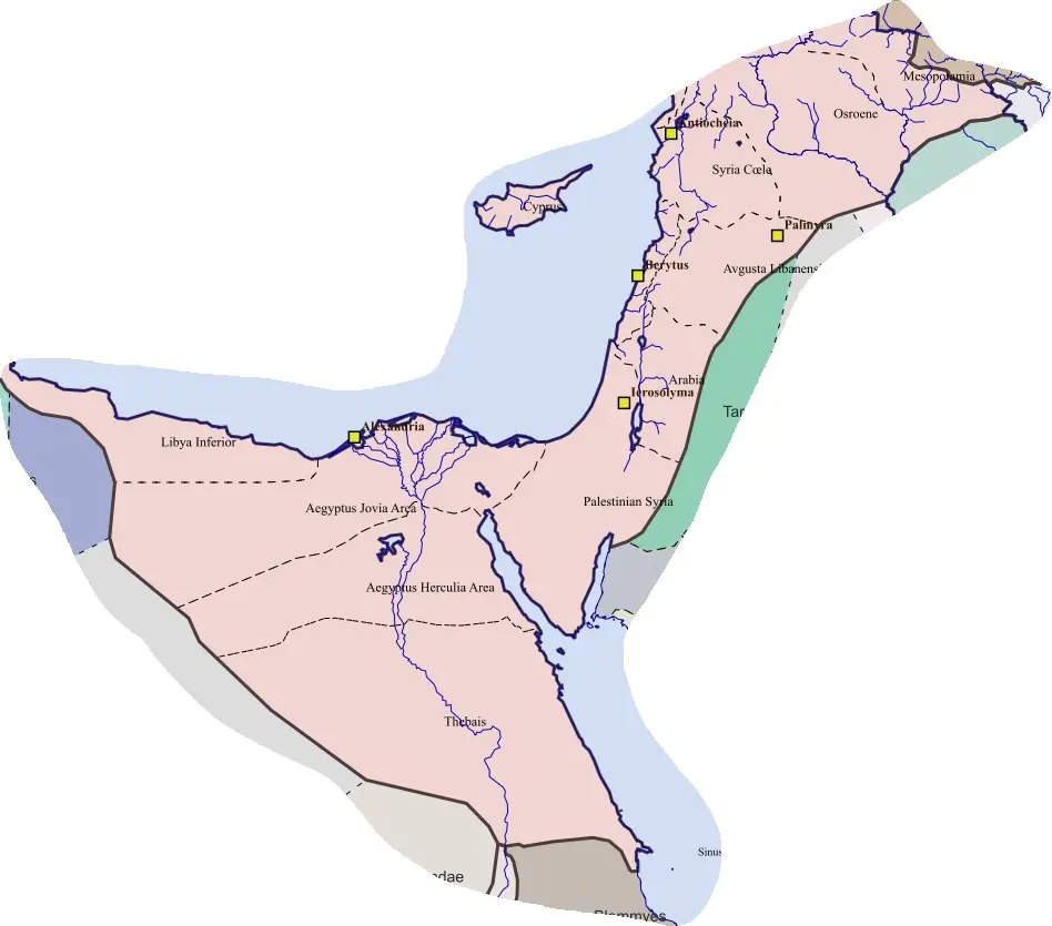 The Nile country and its eastern Mediterranean connections. The Delta, long Nile corridor, Libyan approaches… In LE-55 Cyprus
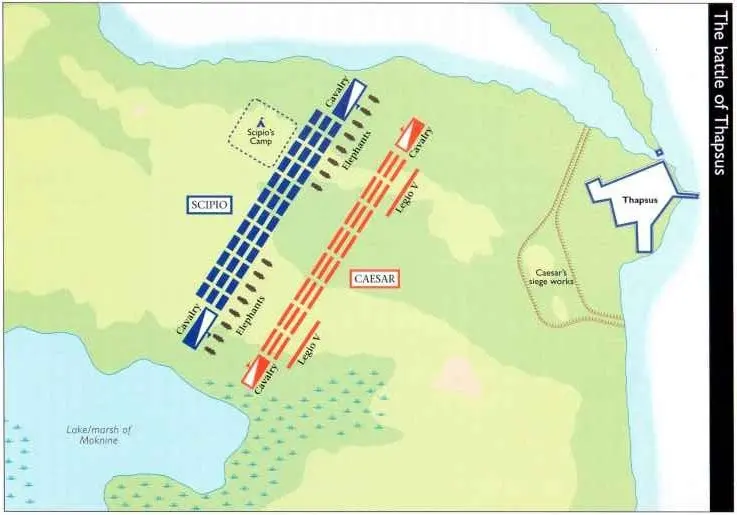 Thapsus, 46 BCE. The coastal and marshland setting constrained the armies in Caesar’s African campaign. The… In AH-04 Africa Nova
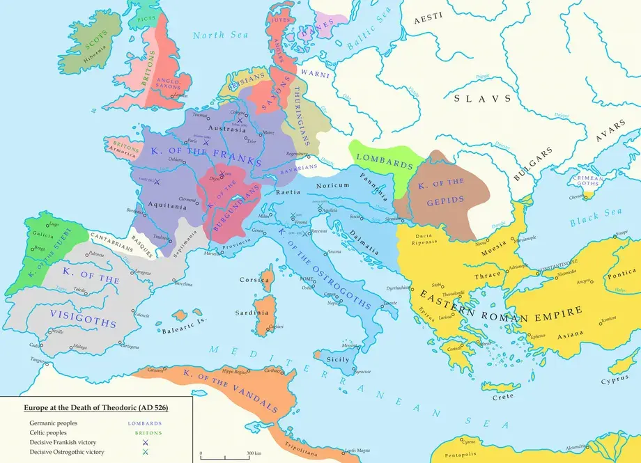 The Mediterranean political setting around 526 CE. Ostrogothic Italy, Vandal Africa, Visigothic Iberia, and… In AH-21 Thebais Superior
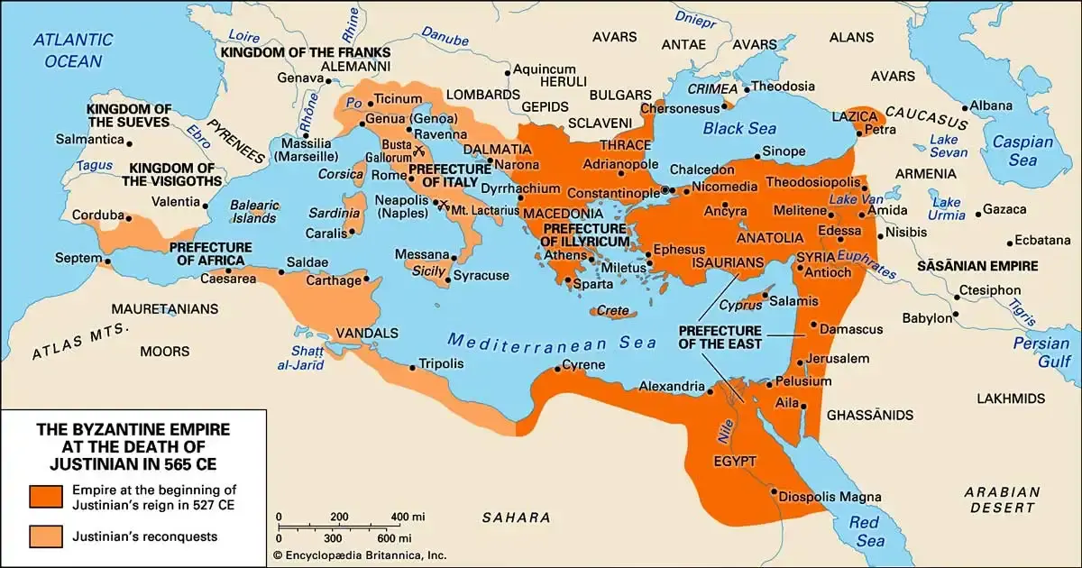 Justinian’s empire in 565 CE, compared with its extent in 527. The recovered African coast, Italy, islands… In AH-23 The restored African provincial system
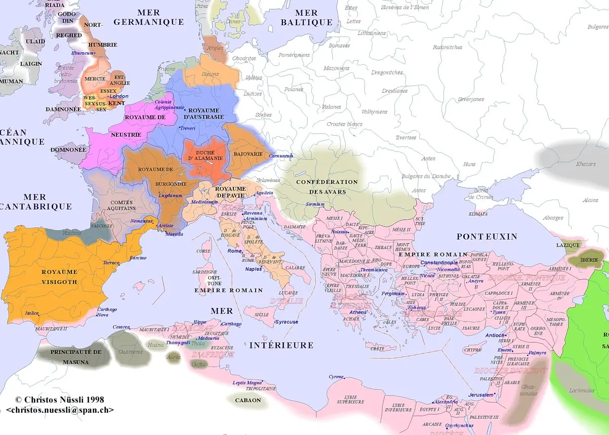 The Mediterranean world around 600 CE. Lombard expansion had fragmented the restored Italian system, while… In AH-24 The restored Italian provinces